
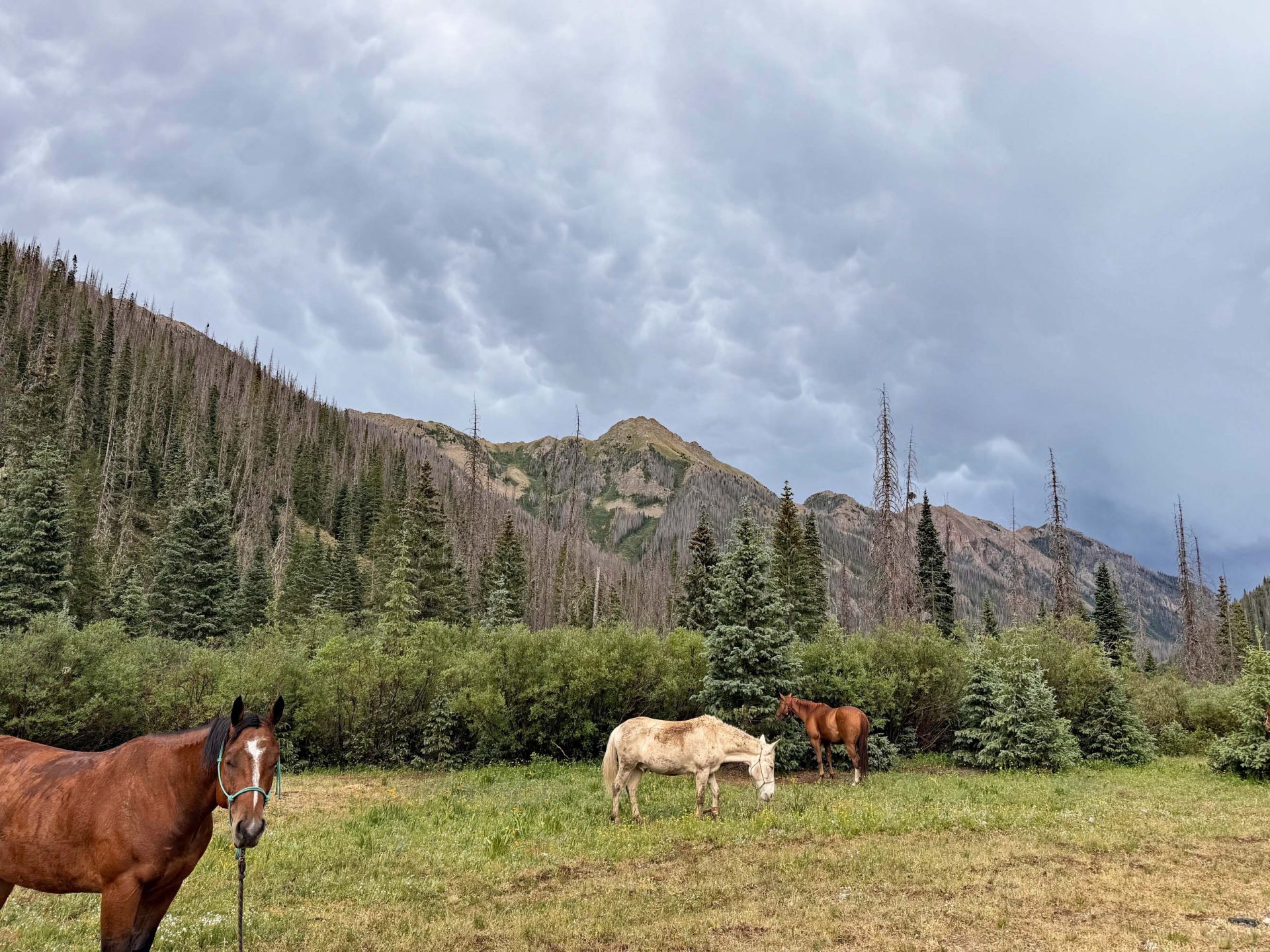
Thunderstorms deep in the wilderness Friday night. Photo credit to roaming weather reporter, Shawn. (select title of post to see picture)
Sunday – 28 Jun 2026 – 6:00pm
Red Flag Warning is out for today from Noon to 10pm.
The past…
Stevens Field Observations & Lobo Overlook
Saturday: High: 81, Low: 44, Peak wind: 40mph, Afternoon humidity: 9-16%. Wolf Creek, Lobo Overlook gust to 64mph.
Sunday: High: 81, Low: 44, Peak wind: 38mph, Afternoon humidity: 9-17%. Wolf Creek, Lobo Overlook gust to 53mph.
| Average High | Record High / Year | Average Low | Record Low / Year |
| 83 | 94 / 1990 | 39 | 22 / 1948 |
Precipitation summary… A prefrontal trough moved through Friday afternoon and a cold front moved through about 2am early Saturday morning.
We had a number of thunderstorms with moderate rainshowers at times, small hail, and gusty winds moving through the area Friday afternoon and a few isolated ones around 2am.
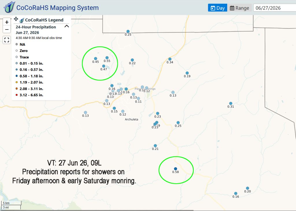
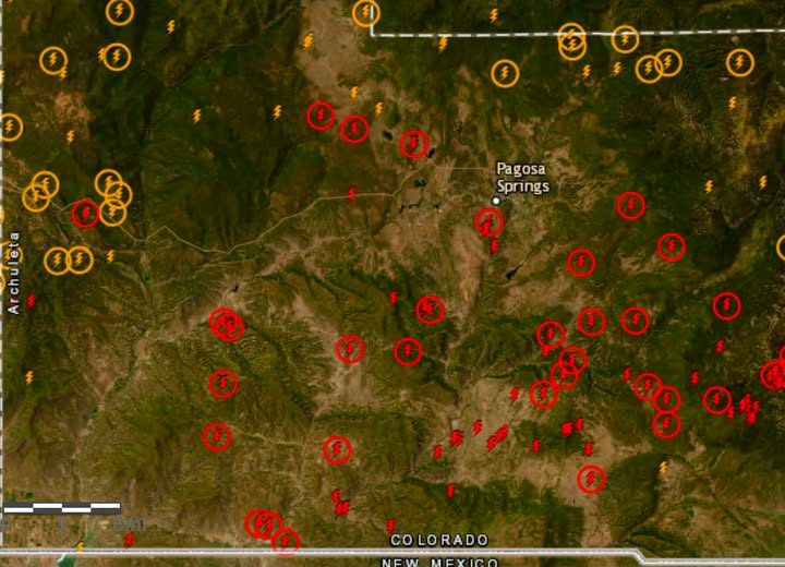
Current satellite and radar…
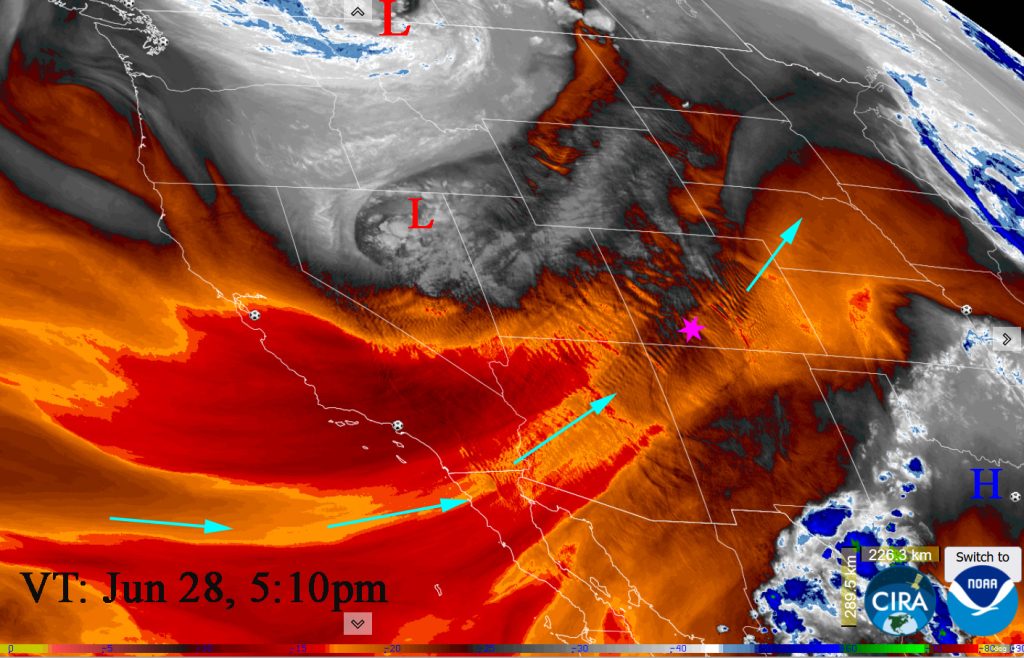
The main area of Low pressure is in northern Montana with a secondary Low over northeast Nevada. Ridge and area of High pressure are over the southeast causing a squeeze play over Colorado. We have a 70mph jet over our heads at ~ 10,000 feet above ground level. In addition the winds are in phase – coming out of the same direction from about 30,000 feet down to the surface. Geek moment – You can SEE the undulations in the jet – the ripples! We feel that when from time to time the winds bounce down to the surface.
Radar: There is nothing on radar in our area at this time.
Forecast highlights…
*** Sunday: Very Strong afternoon gusts! Gusts to 50mph in the high country!***
***Red Flag Warning for gusty winds, low relative humidity and dry fuels, which is in effect Sunday, today, from Noon to 10pm.***
*** Monday through Friday: Breezy, Wind Gust to 25mph ***
*** See Fire/Smoke Report at the bottom of this post***
Sunday… Squeeze play… As the area low-pressure system exits into Canada, it is deepening while the area of high pressure to the southeast builds resulting in a tightening gradient and strong, dry flow out of the southwest.
Clear to Partly Cloudy. Dry air moved in behind the Saturday morning front. Humidity in the mid teens and wind gusting 30-40mph will lead to CRITICAL FIRE CONDITIONS.
***RED FLAG WARNING Noon to 10PM!!! It has been issued for low humidities, gusty winds, and dry fuels. Fires will catch and spread quickly. ***
Temps… Highs: Mid 70s to Lo-80s. Lows: Low 40s to upper 40s.
Winds… Very Strong afternoon gusts! Winds on Sunday till late evening will gust to 40mph! Note: Gusts to 50mph in the high country.
Monday through Friday (Jun 29 – Jul 3)… We’ll be clear to partly cloudy. Increasing Clouds on Friday. We’ll still be under the squeeze play though the gradient will be looser. High pressure will be to our southeast and the long-wave trough will be set up over the Great Basin. Upper-level flow will be out of the southwest though it will be dry. It will remain sunny, dry, and warm with gusty afternoon winds.
Temps… Highs Monday through Wednesday will be Lo 70s to lo 80s. Thursday and Friday will be warmer: mid 70s to mid 80s. Lows will be near 40 to the upper 40s.
Winds… Breezy with afternoon gusts to 25mph.
Saturday (Jul 4)… Partly to Mostly Cloudy. Polar Front Jet will be weakening and moving north. The Subtropical Ridge over the southeast will be the dominant feature. We’ll be under weak southwest flow. Though we will still be dry and warm. Monsoon will be trying to set up but won’t be here yet.
Temps… Highs Upper 70s to upper 80s. Lows will be mid 40s to the upper 40s.
Winds… Breezy with afternoon gusts to 20mph.
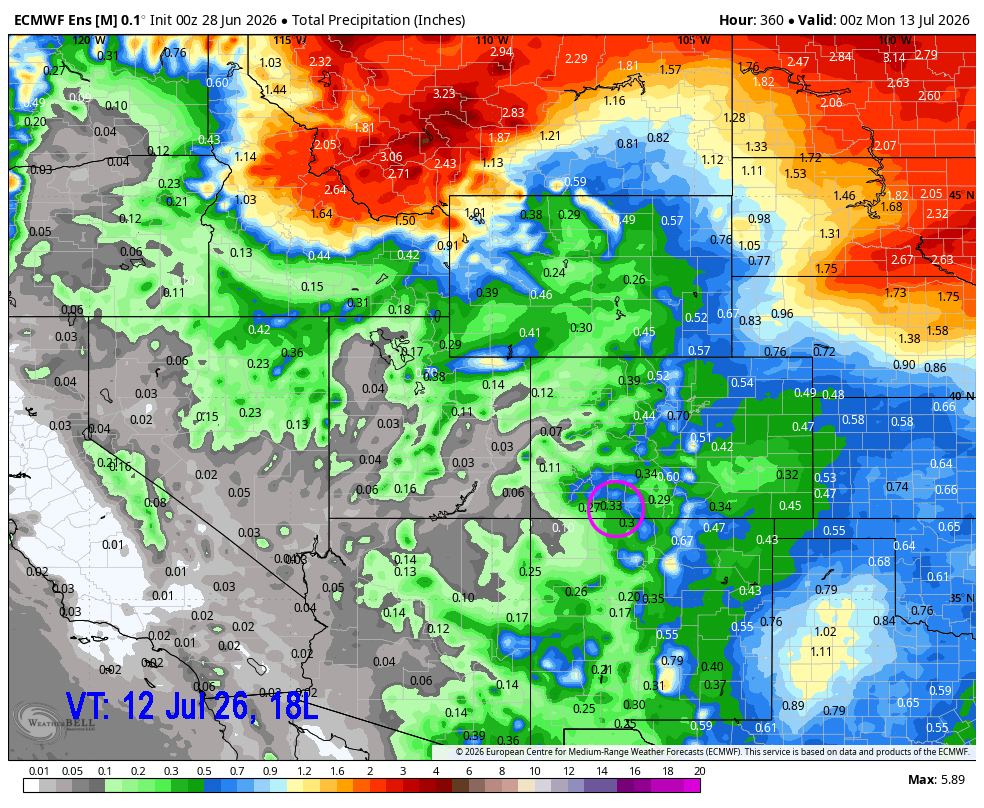
05 Jul to 13 Jul… The subtropical high will try to set up over eastern Colorado. Though the latest model indicates it may waiver to the west of us which is not ideal. We’ll be dry till the 6th of July and then see a slow increase of moisture and instability as the monsoon tries to set up. Those first few days will be primarily dry thunderstorms.
Fire and Smoke Update
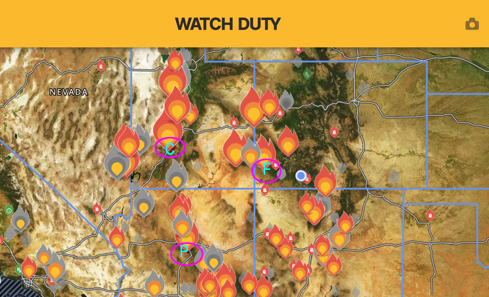
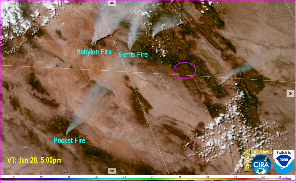
A number of fires are raging throughout the west. Thanks to our first responders, there are not any active fires being reported in Archuleta County at this time. The fires that could impact us with smoke over the next week are:
The Cottonwood Fire near Beaver Utah (impacted us early Wednesday this past week). Currently at 93,606 acres. May impact us again later in the week as we come under a more westerly flow.
The Pocket Fire near Sedona, Arizona. Currently at 6,000 acres. It is directly southwest of us so the smoke will move our direction.
Ferris Fire northeast of Dolores. It was first reported yesterday and has already burned 9,590 acres.
Babylon Fire near Blanding, Utah is at 16,000 acres.
- My next post will be Tuesday.
– Arleen


6 Responses
Where was the photo taken?
RB, it was taken about 12 miles northeast of Vallecito near Emerald Lake.
Are we seeing smoke clouds to the North east in the distance, looking from Jacks Pasture area ? Originally looked like afternoon cloud buildup today, but moving more quickly. Gold Mt. Fire ?
Lawrence, yes, that was the Gold Mountain Fire to the northwest, past Cimmarona. Amazingly, it is only about 60 miles from here even though it takes hours to drive there.
The barometric pressure dropped significantly Saturday night. Was hoping for rain …..
Beverly that is probably when the front went through. Rain was more sparse than in the afternoon. I didn’t get any but our CoCoRaHS observer in Loma Linda reported .19” at 11pm.
– Arleen