

Rocky Mountain penstemon is one of my favorites! – pic taken 6/14/2026
Sunday – 14 Jun 2026 – 4:00pm
The past…
Stevens Field Observations
Thursday: High: 83, Low: 40, Peak wind: 33mph, Afternoon humidity: 10-12%
Friday: High: 83, Low: 40, Peak wind: 30mph, Afternoon humidity: 11-13%
Saturday: High: 81, Low: 41, Peak wind: 25mph, Afternoon humidity: 14-16%
| Average High | Record High / Year | Average Low | Record Low / Year |
| 78 | 90 / 1947 | 35 | 23 / 1951 |
Precipitation summary… A couple of folks reported 0.01” and 0.02” of rain, but most of the county has remained dry.
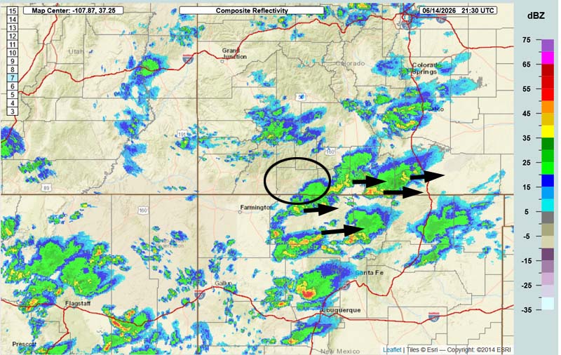
Current satellite and radar…

Forecast highlights…
*** Spotty afternoon showers and thunderstorms Sunday and Monday. Precip amounts will be light and spotty. ***
*** Chance for “dry lightning” Sunday and Monday. Keep an eye out for new fires. ***
*** Breezy afternoons, mostly dry, and warm for much of the next two weeks. FIRE DANGER WILL REMAIN HIGH. ***
Rest of Sunday through Monday… A little influx of moisture and instability will help kick up a few isolated afternoon and evening showers and thunderstorms. Precip amounts will be light and spotty.
Tuesday and Wednesday… A ridge will build to our west. Upper-level flow out of the northwest will be stable, drier, and warm.
Thursday through next Sunday… Weak moisture and weak instability will lead to an isolated shower or thunderstorm each afternoon, but I think most of us will stay dry.
Temps…
Sunday night lows will be in the low to high 40s.
Monday highs will be in the high 70s to the mid 80s and lows will be in the high 30s to the high 40s.
Tuesday highs will be near 80 to the high 80s and lows will be near 40 to the high 40s.
Wednesday and Thursday highs will be in the low to high 80s and lows will be near 40 to the high 40s.
Friday, Saturday, and next Sunday highs will be near 80 to the high 80s and lows will be near 40 to the high 40s.
Winds…
Monday afternoon gusts will be around 20mph, but isolated higher gusts are possible near showers or thunderstorms.
Tuesday and Wednesday, each afternoon gusts will be around 25mph.
Thursday afternoon gusts will be around 20mph.
Friday afternoon gusts will be around 25mph.
Saturday and next Sunday, each afternoon gusts will be around 30mph.
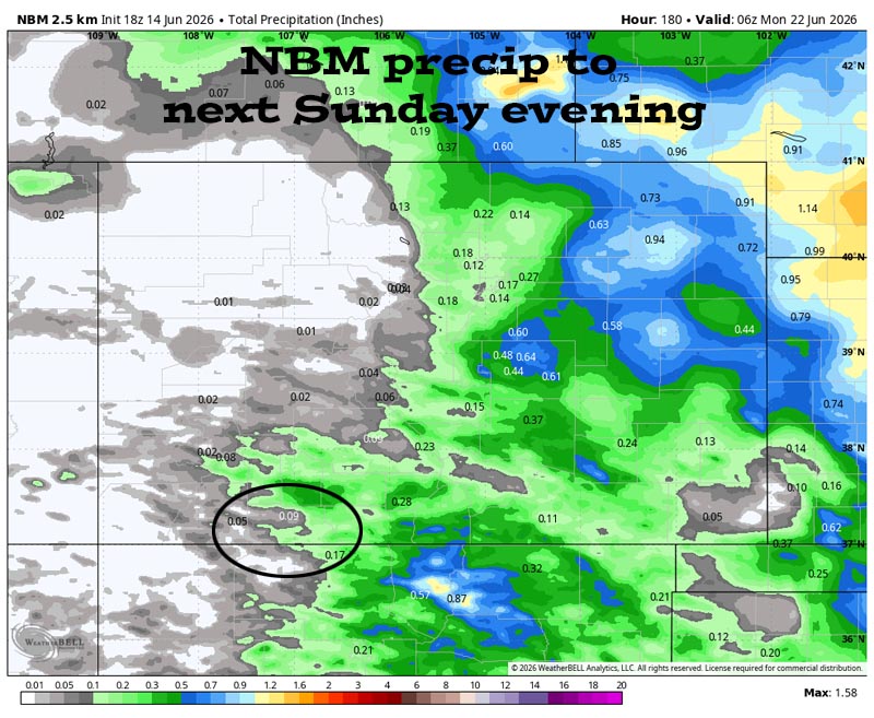
21 Jun to 29 Jun… The subtropical high will try to set up to our south. We will have weak moisture and weak instability that will kick up an isolated afternoon shower or thunderstorm each day, but I expect most of us to stay dry and warm.
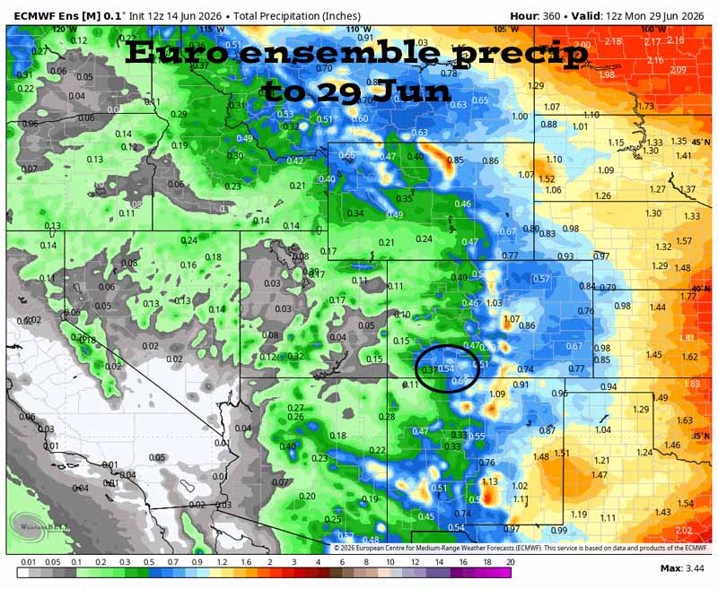

Our best chance for precip is today and then the chance decreases tomorrow. It’s dry Tuesday through Thursday morning. Then there’s a slight chance for a spotty shower or thunderstorm Thursday, Friday, and Saturday afternoons, but I’m skeptical. It’s dry next Sunday and Monday and then the models hint it will get more active, but they aren’t reliable.
The next post will be Tuesday afternoon.
– Shawn


