

RED FLAG WARNINGS Thursday and Friday
Thursday – 11 Jun 2026 – 3:00pm
The past…
Stevens Field Observations
Tuesday: High: 82, Low: 45, Peak wind: 44mph, Afternoon humidity: 7-11%
Wednesday: High: 81, Low: 42, Peak wind: 33mph, Afternoon humidity: 9-12%
| Average High | Record High / Year | Average Low | Record Low / Year |
| 77 | 94 / 1946 | 35 | 18 / 1951 |
Precipitation summary… Much of the county got a little rain on Tuesday. Precip amounts were mostly in the 0.01” to 0.07” range.
Current satellite and radar…
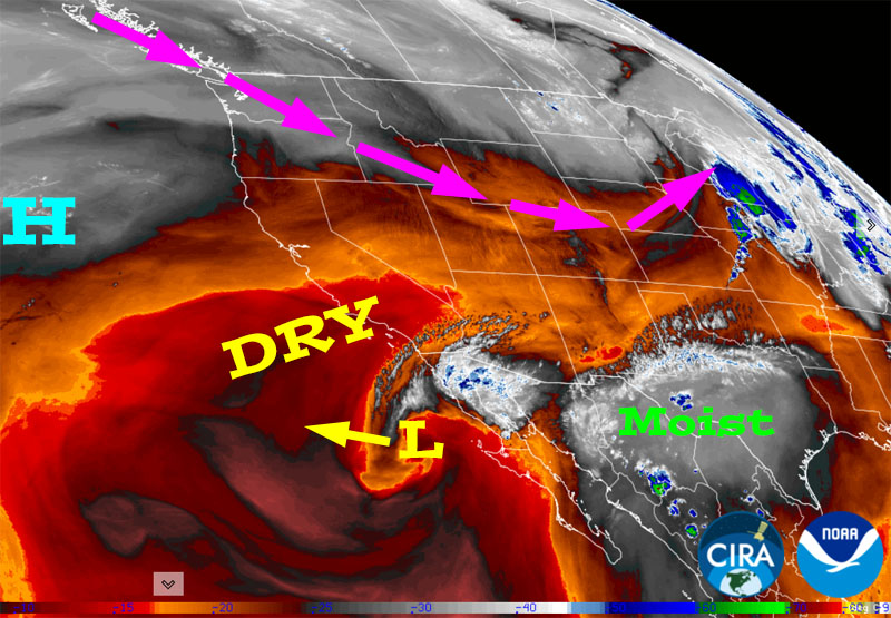
There is nothing on radar in our area Thursday afternoon.
Forecast highlights…
*** Low humidity, gusty winds, and drying fuels are leading to critical fire conditions. RED FLAG WARNINGS today and Friday. ***
*** Slight chance for a spotty afternoon shower or thunderstorm Saturday and Monday. Better chance on Sunday. Precip amounts will be light and spotty. ***
*** Chance for “dry lightning” Saturday, Sunday, and Monday. Keep an eye out for new fires. ***
*** Breezy afternoons, mostly dry, and warm for much of the next two weeks. FIRE DANGER WILL REMAIN HIGH. ***
Rest of Thursday through Friday… The ridge will be to our south while the trough remains to the north. Upper-level flow out of the west will keep our afternoon winds breezy and keep us dry and warm.
Saturday, Sunday, and Monday… A little influx of moisture and instability will help kick up a few isolated afternoon showers and thunderstorms. The best chance for rain is on Sunday. Precip amounts will be light and spotty.
Tuesday, Wednesday, and next Thursday… A ridge will build to our west. Upper-level flow out of the northwest will be stable, drier, and warm.
*** Temps will be 5-10 degrees above average, afternoon humidity will be in the low teens, and afternoon winds will gust to around 25mph. FIRE DANGER WILL REMAIN HIGH. ***
Temps…
Thursday night lows will be in the high 30s to the high 40s.
Friday and Saturday highs will be in the high 70s to high 80s and lows will be in the low to high 40s.
Sunday highs will be in the mid 70s to the low 80s and lows will be in the low to high 40s.
Monday highs will be in the high 70s to the mid 80s and lows will be in the high 30 to the high 40s.
Tuesday, Wednesday, and next Thursday highs will be in the low to high 80s and lows will be near 40 to the high 40s.
Winds…
Thursday and Friday, each afternoon gusts will be 25-30mph.
Saturday and Sunday afternoon gusts will be 20-25mph.
Monday through next Thursday, each afternoon gusts will be around 25mph.

Most of this is from scattered showers and thunderstorms Sunday afternoon into Sunday evening.
18 Jun to 26 Jun… The subtropical high will try to set up to our south. That puts us on the dry, stable side of the high. I expect us to be mostly dry and warm.


It’s dry through Saturday morning and then there’s a slight chance for a few isolated showers and thunderstorms later Saturday afternoon. There’s a better chance for scattered showers and thunderstorms Sunday afternoon into Sunday night. Monday there’s just a slight chance. It’s dry Tuesday, Wednesday, and next Thursday. Next Friday and Saturday there’s a slight chance for a few spotty showers or thunderstorms. Then it’s mostly dry through the rest of the period.
The next post will be either Saturday or Sunday afternoon. We are spending time with family.
– Shawn


