
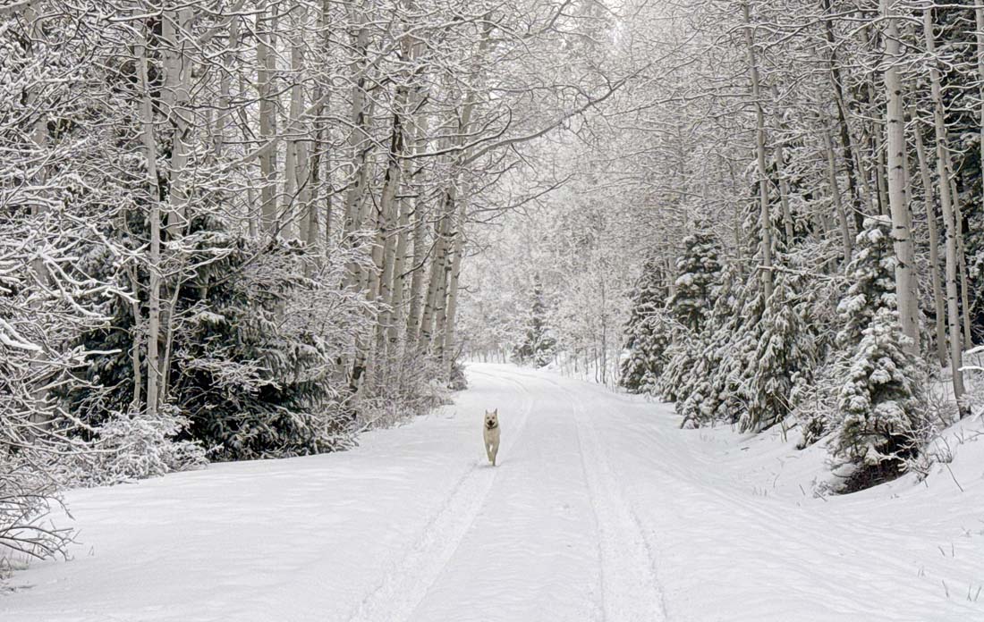
Just a couple of inches of fresh snow can make our forest magical. Tommy loves it too! – Pic taken 2/14/2026
Saturday – 14 Feb 2026 – 5:30pm
The past…
Stevens Field Observations
Thursday: High: 51, Low: 28, Peak wind: 21mph
Friday: High: 45, Low: 27, Peak wind: 20mph
| Average High | Record High / Year | Average Low | Record Low / Year |
| 42 | 59 / 1981 | 8 | -22 / 1948 |
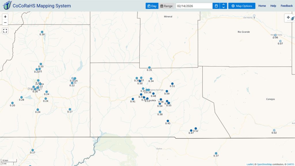
Precipitation summary… Wolf Creek reported 8” of snow Saturday morning and then the sun came out. It looked glorious up there!
Moisture was pretty good in the Pagosa area, and the snow level dropped lower than I expected. Thanks to everyone for your reports and pictures!

Current satellite and radar…

There is nothing on radar in the region Saturday afternoon.
Forecast highlights…
*** Potential storm train next week with multiple waves of snow possible. ***
*** The best chance for snow is early Tuesday morning into Wednesday evening. Snow will come in waves and be blown around by winds 35-40mph near Pagosa and 50-60mph up at Wolf Creek. Expect white-out conditions on Wolf Creek Pass and crappy travel conditions throughout our area. ***
*** A weaker round of snow is possible Wednesday night into Friday morning. ***
Forecast details…
Saturday night through Monday afternoon… A transient ridge will move through. Skies will be variably cloudy and we’ll stay dry.
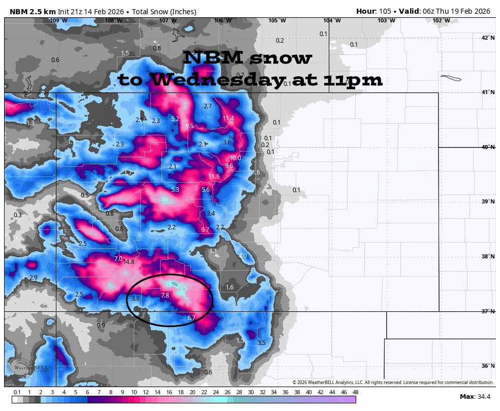
Monday night through Wednesday evening… The jet stream, storm energy, moisture, and orographic lift are trying to line up for two decent rounds of snow.
Timing… The first scattered snowshowers will start over the mountains Monday evening. Precip will ramp up after midnight and then fall heaviest early Tuesday morning into early Tuesday afternoon. There will be a lull with hit and miss snowshowers late Tuesday afternoon into early Wednesday morning. Then snow will ramp again around sunrise Wednesday into Wednesday evening.
Snow levels… Monday at sunset: around 8,500ft. Midnight Monday: around 8,000ft. Sunrise Tuesday: around 7,000ft and then below 7,000ft for the rest of this period.
Snow totals Monday night through Wednesday evening…
Wolf Creek area: 18-24”
Pagosa area above 7,600ft: 5-10”
Pagosa area below 7,600ft: 3-6”
*** I’ll continue to adjust the details as the data gets more reliable. ***
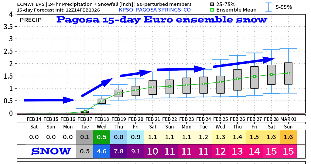
Wednesday night through Friday morning… I’m not too sure about this period. A final, weak trough will try to move through.
Upper-level winds will turn more westerly, which doesn’t favor us. We’ll have scattered snowshowers for much of this period but unless the winds turn more southwesterly, I expect low snow totals.
Snow amounts…
Wolf Creek area: 3-6”
Pagosa area: 1-3”
Chromo and Chama areas: 2-4”
Friday afternoon through next weekend… A ridge will build over the region. We should see lots of sun and a warming trend.
Temps…
Saturday night lows will be in the high teens to mid 20s.
Sunday and Monday highs will be in the high 40s to mid 50s. Sunday night lows will be in the high teens to mid 20s. Monday night lows will be in the mid 20s to low 30s.
Tuesday and Wednesday highs will be in the mid 30s to low 40s. Tuesday night lows will be near 20 to the mid 20s. Wednesday night lows will be in the low to high teens.
Thursday and Friday highs will be near 30 to the high 30s and lows will be in the high single digits to the mid teens.
Next Saturday highs will be in the mid 30s to low 40s and lows will be in the mid single digits to the mid teens.
Winds…
Sunday afternoon gusts will be 10-15mph near Pagosa and 25-30mph in the high country.
Monday afternoon gusts will be 20-25mph near Pagosa and 35-40mph in the high country.
Monday night into Tuesday afternoon wind gusts will be 30-40mph in the Pagosa area and 50-60mph in the mountains. *** Expect white-out conditions on Wolf Creek Pass. ***
Wednesday afternoon gusts will be 25-35mph in the Pagosa area and 45-55mph in the high country.
Thursday afternoon gusts will be 20-25mph in the Pagosa area and 35-40mph in the high country.
Friday and next Saturday, each afternoon, gusts will be 15-20mph in the Pagosa area and 30-35mph in the high country.
21 Feb to 1 Mar… I think we’ll be dry 21 Feb to 24 or 25 Feb and then a weak system could move through. I don’t see anything to get excited about for this period.

Keep an eye out on Facebook for quick updates. Otherwise, the next post will be on Monday.
– Shawn


