

Many of us woke up to a winter wonderland this morning! – Pic taken by Tiffany E. on 1/9/2026
Friday – 9 Jan 2026 – 1:30pm
The past…
Stevens Field Observations
Wednesday: High: 42, Low: 21, Peak Wind: 7mph
Thursday: High: 34, Low: 26, Peak Wind: 21mph
| Average High | Record High / Year | Average Low | Record Low / Year |
| 37 | 59 / 1956 | 1 | -21 / 1912 |
Precipitation summary… Wolf Creek reported another 3” of snow for a storm total of 8”.
The low tracked just to our south last night. This favored our friends in the Farmington, Aztec, Bloomfield, and Arboles areas. Much of Archuleta County was in my 1-3” range, but there was a surprise 4-6” bullseye along highway 160 through the middle part of the county.
Thanks so much for everyone’s snow reports and pictures!

The 4-6” bullseye along highway 160 through central Archuleta County was a surprise.

Current satellite and radar…
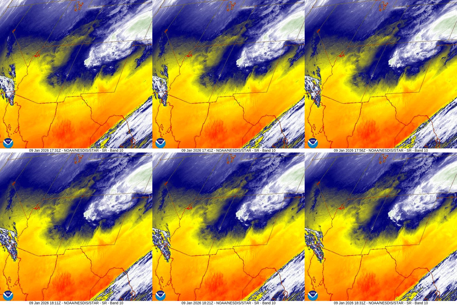
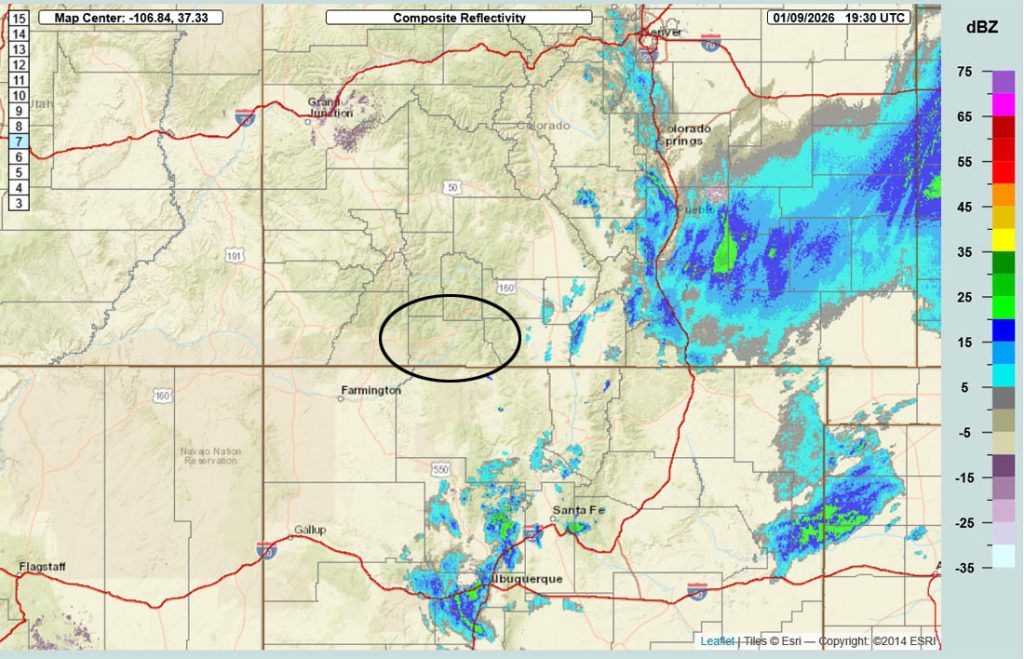
Snowshowers are persisting over parts of the I-25 corridor.
Forecast highlights…
*** And now we’ll have lots of blue sky and will be dry for a while. ***
Forecast details…
Rest of Friday… A few scattered snowshowers are possible along the eastern Divide and into the Chama area later this afternoon and into the evening. Those areas could get another 1” of snow, but the rest of the Pagosa area will stay dry.
Saturday and through next week… A Rex block will set up over much of the west US. We’ll have lots of sun, light winds, and gradual warming.
Temps…
Friday night lows will mostly be near zero to the low teens. The cold spots will drop below zero.
Saturday highs will be in the mid-30s to low 40s and lows will be in the low single digits to the low teens.
Sunday highs will be in the low to high 40s and lows will be in the high single digits to mid-teens.
Monday highs will be in the mid-40s to low 50s and lows will be in the low teens to low 20s.
Tuesday, Wednesday, and Thursday highs will be in the high 40s to mid-50s and lows will be in the mid-teens to mid-20s.
Next Friday highs will be in the low to high 40s and lows will be in the low teens to low 20s.
Winds…
Saturday through Thursday, each afternoon peak winds will be 5-10mph in the Pagosa area and 15-20mph in the high country.
Next Friday, afternoon gusts will be 10-15mph near Pagosa and 25-30mph in the high country.
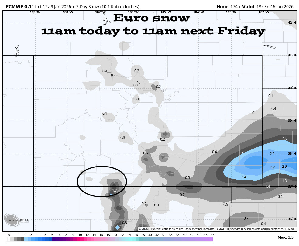
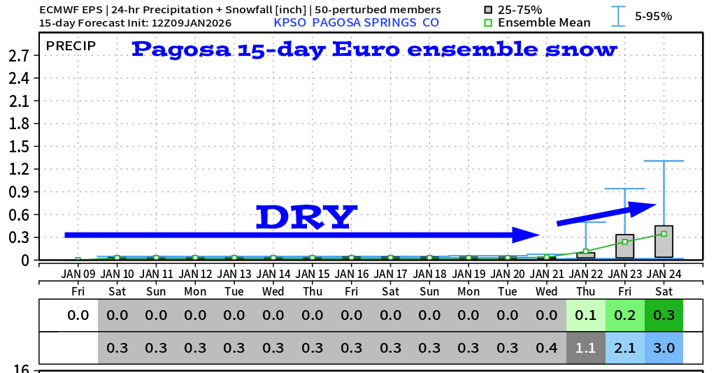
16 Jan to 24 Jan… Most of this period will be dry but there are signs that the weather pattern will get more active towards the last 2 or 3 days.

* Unfortunately I think the lower amounts are more likely. *

My thoughts… Forecast models are notorious for breaking down a blocking pattern too soon. That’s why every couple of days, the forecast models move everything farther out. None of these show a good, organized storm on the horizon.

The next post will be on Sunday.
– Shawn


