

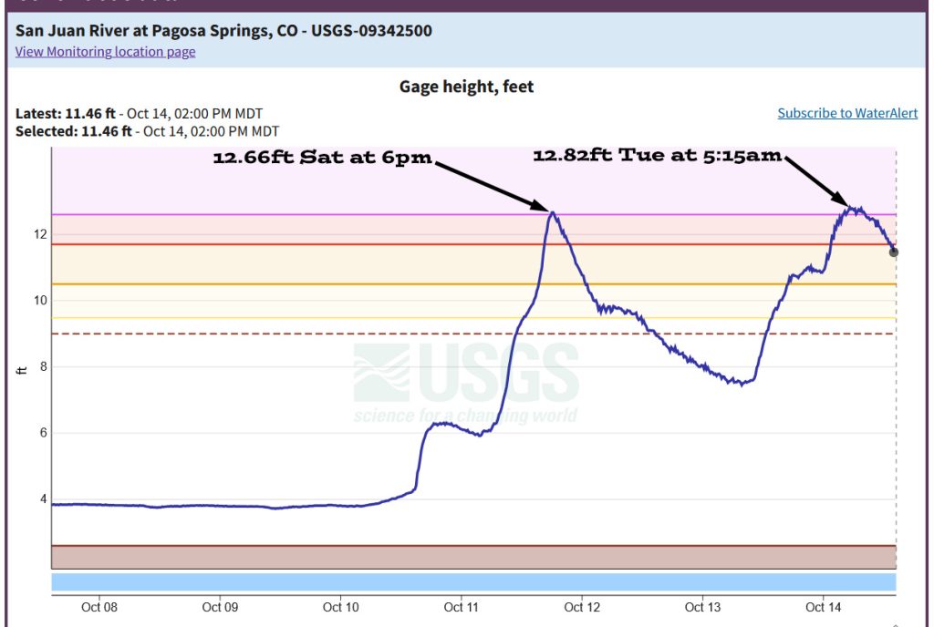
The San Juan River in Pagosa Springs hit major flood stage for the second time in two and a half days. – taken by Lisa Tedder on 10/14/2025
Tuesday – 14 Oct 2025 – 3:00pm
The past…
Stevens Field Observations
Monday: High: 57, Low: 36, Peak Wind: 20mph, 24hr precip: 1.81”
| Average High | Record High / Year | Average Low | Record Low / Year |
| 66 | 85 / 1940 | 26 | 13 / 1975 |
Precipitation summary and river levels…
Impressive rain totals again.
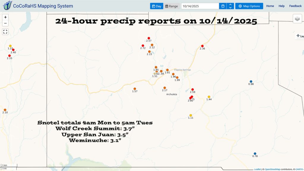
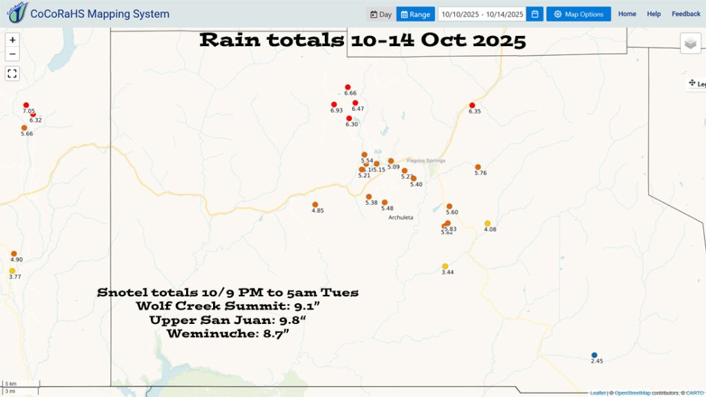
For perspective, October average precip for Pagosa Springs is 2.27” and 4.39” for Wolf Creek Pass.
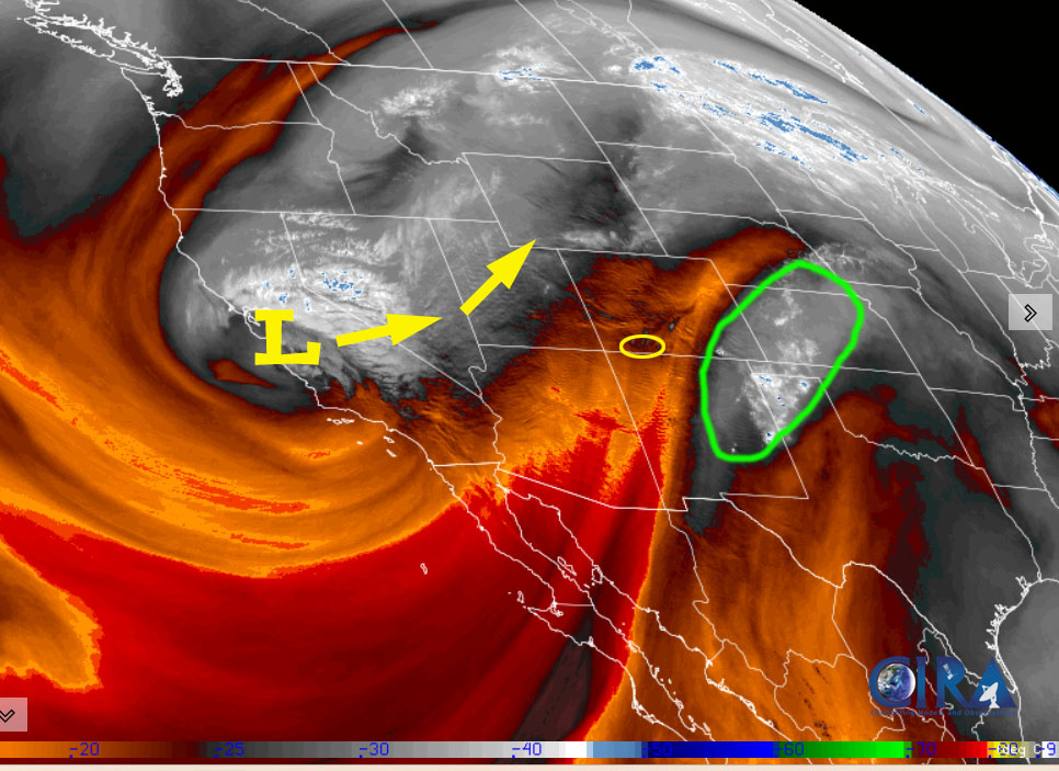
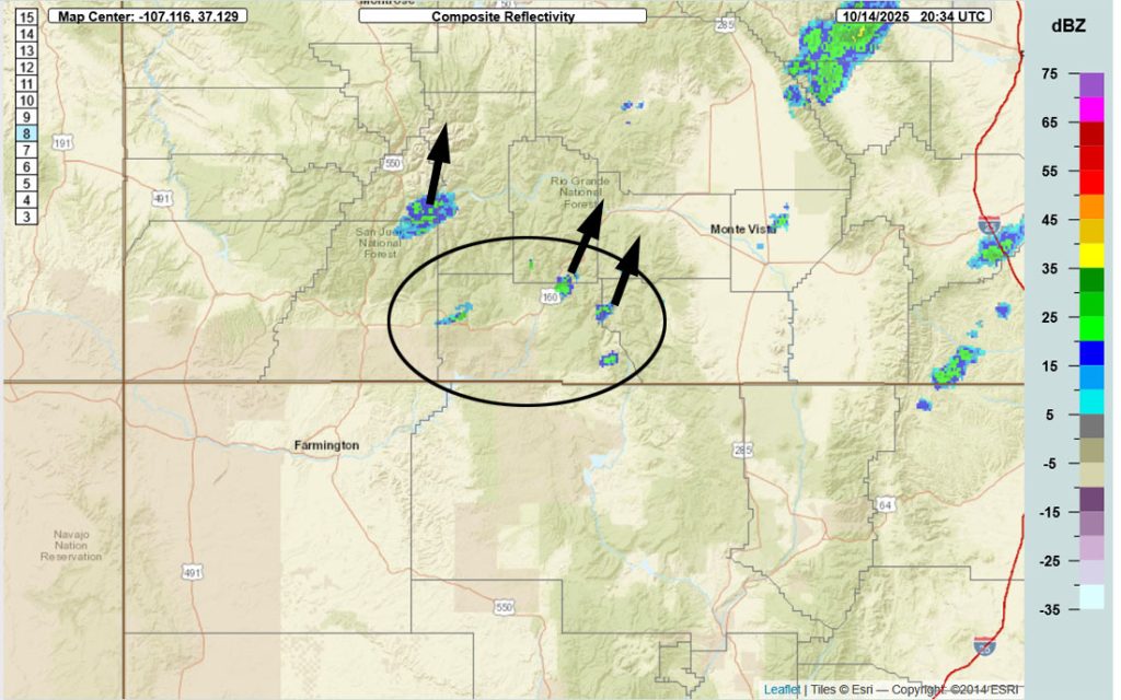
Current satellite and radar…
Forecast highlights…
*** FLOOD WARNING is out until late Tuesday evening for the SAN JUAN RIVER in Pagosa Springs. The river slowly drop through the day and is expected to be lower than flood stage this evening. ***
*** FLOOD WARNING is out until 3pm Wednesday for the PIEDRA RIVER and its tributaries. ***
*** FLOOD WATCH through late Tuesday night. This includes all rivers, creeks, and low-lying areas in the region. ***
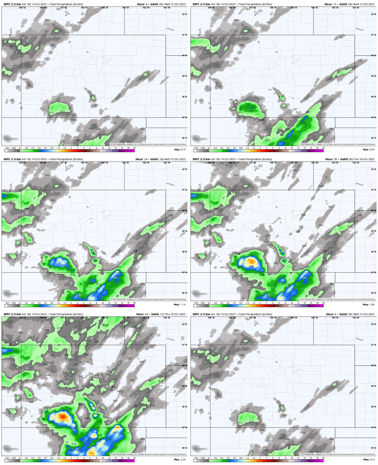
*** Rest of Tuesday through Thursday morning expect hit and miss showers and thunderstorms with brief periods of heavy rain, small hail, gusty winds, and lightning. ***
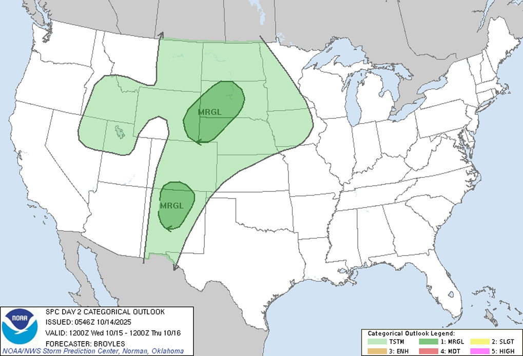
*** Late Wednesday morning into early Wednesday evening isolated SEVERE THUNDERSTORMS with damaging winds and hail are possible. ***
*** Wednesday night up to 1” of snow is possible on Wolf Creek Pass. Temps will drop below freezing and the pass could get slick. ***
*** Thursday afternoon through the weekend there will be lots of sun and dry weather. ***
*** Hard freeze Thursday, Friday, and Saturday nights. ***
Forecast details…
Rest of Tuesday to Thursday morning… A slow-moving low-pressure system will wobble to our west and push rounds of storm energy and moisture through our area. Upslope winds out of the southwest, precipitable water 150% to 200%, and moderate to high instability will fuel hit and miss showers and thunderstorms.
*** Storms will be fast-moving and cause brief periods of heavy rain, small hail, gusty winds, and lightning on small areas. Late Wednesday morning into early Wednesday evening isolated severe thunderstorms with damaging winds and hail are possible. ***
Thursday afternoon through the weekend… Ridging will build over the region and give us lots of sun, dry weather, and temps 5-10 degrees below average.
Temps…
Tuesday night lows will be in the high 30s to low 40s.
Wednesday highs will be in the high 50s to the mid-60s and lows will be in the low 30s to low 40s.
Thursday, Friday, and Saturday highs will be in the mid-50s to low 60s and *** lows will be in the low to high 20s. ***
Sunday and Monday highs will be near 60 to the high 60s and lows will be in the mid-20s to mid-30s.
Winds…
Tuesday afternoon gusts will be around 20mph.
Wednesday and Thursday afternoons gusts will be around 25mph.
Friday, Saturday, and Sunday afternoon gusts will be around 20mph.
As always, stronger isolated gusts are likely near a shower or thunderstorm.
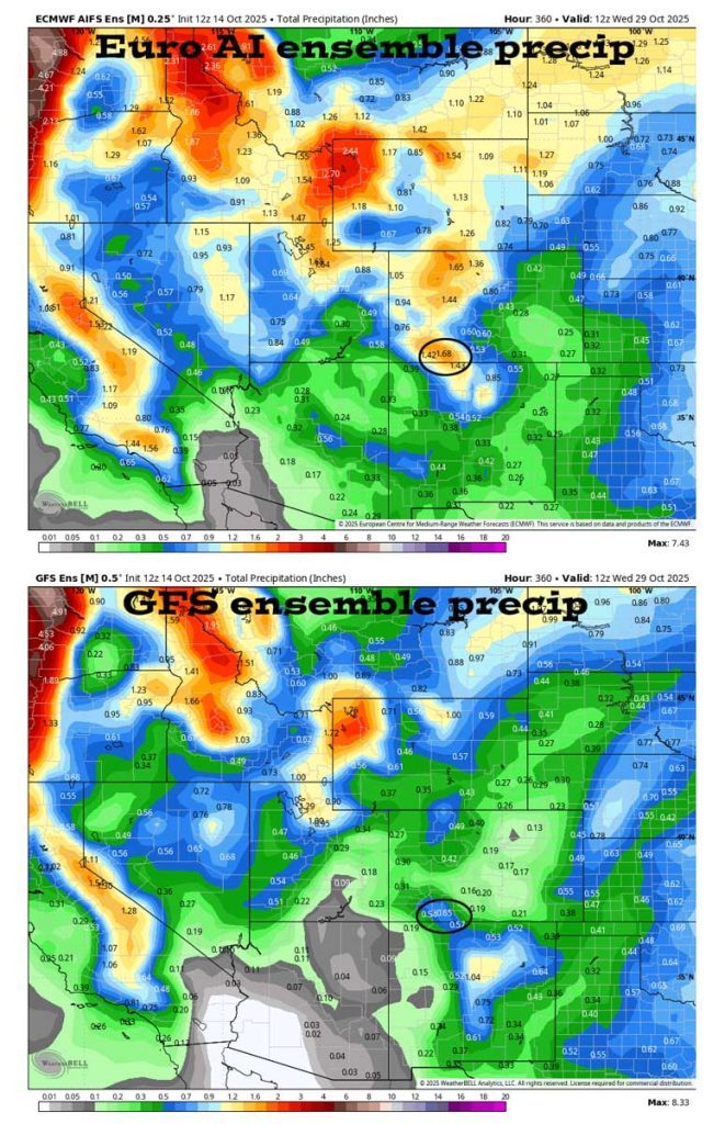
The 8-14 day period… The models show a weak system around 20-22 Oct but are otherwise mostly dry.
The next post will be tomorrow.
– Shawn


