
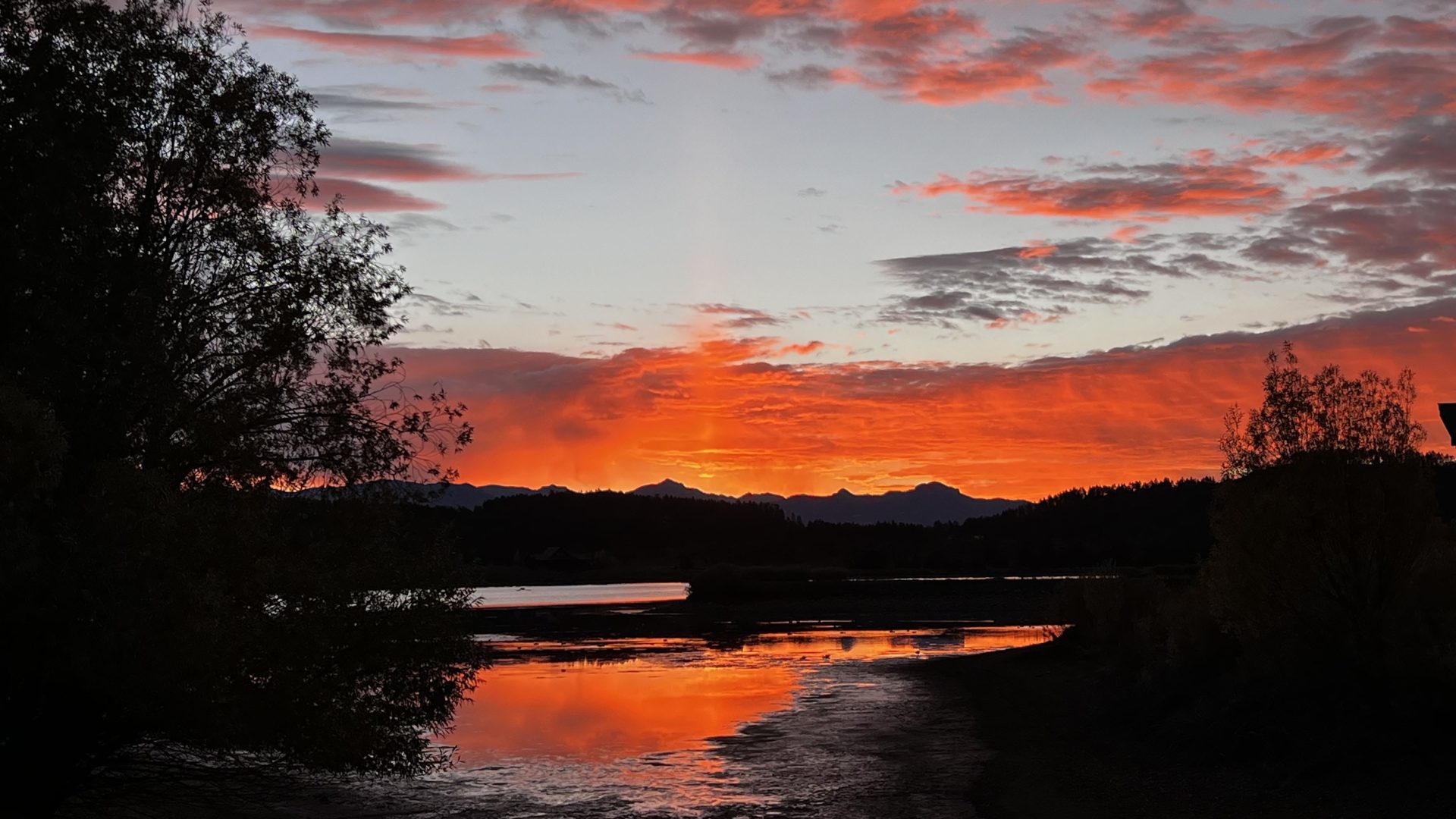
The calm before the storm. Red sky in morning, sailor’s warning! Picture taken Oct 9th, 2025 by Kathleen McFadden
Thursday – 9 Oct 2025 – 1:30pm
The tropical cyclone nursery is open for business off the Baja Peninsula and storms are forming one right after the other. With the long wave trough set up just off the west coast, those storms are tracking up and over the southwest United States. We’ll be impacted by the remnants of Hurricane Priscilla Friday and Saturday and by yet-to-form Tropical Storm Raymond Monday through Wednesday. Details below…
The past…
Stevens Field Observations
Wednesday: High: 71, Minimum relative humidity: 25%, Peak Wind: 20mph
Thursday Low: 47
| Average High | Record High / Year | Average Low | Record Low / Year |
| 67 | 84 / 1910 | 27 | 16 / 1945 |
Precipitation summary… There wasn’t any measurable precip yesterday.
Current satellite and radar…
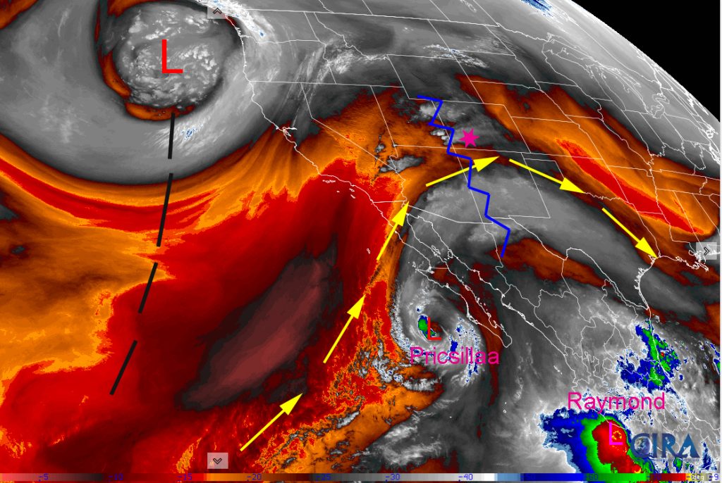
Water vapor satellite 12:00pm Thursday – The ridge is over our heads. Moisture and instability are slowly increasing from the south. Deep trough is off the coast of California giving us southwest flow.
The remnants of Priscilla off the Baja Pennisula will get wrapped up in the trough approaching from the west and impact us the most Friday night and Saturday. Farther south Raymond is just forming and will affect our area next week.
The area of low pressure off the coast of Washington is impressive! Very deep and wrapped up for this time of the year. The trough will stay in place giving the southwest a southwesterly fetch for the next two weeks!


Forecast highlights…
*** Thursday evening there will be spotty showers and thunderstorms. ***
*** Friday morning through Sunday morning Priscilla will visit. Expect lots of clouds, heavy rain showers, and a few embedded thunderstorms. ***
*** FLOOD WATCH Thursday evening through Saturday afternoon. ***
***Raymond visits Monday through Wednesday. ***
Forecast details…
Priscilla will visit. The question of the week is will Priscilla visit like a polite dinner guest, maybe staying for dessert, filling our rivers and reservoirs and then be on her way? Or will she get drunk, break dishes, flood low lying areas and cause road damage? Then invite over her cousin Raymond to join in on the fun?
Thursday evening… The upper-level ridge will be just to our west. We’ll have marginal stability and marginal moisture. There will be a few spotty showers and thunderstorms.
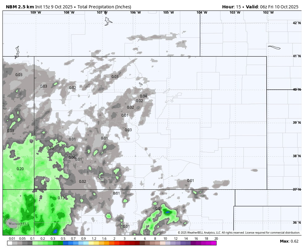
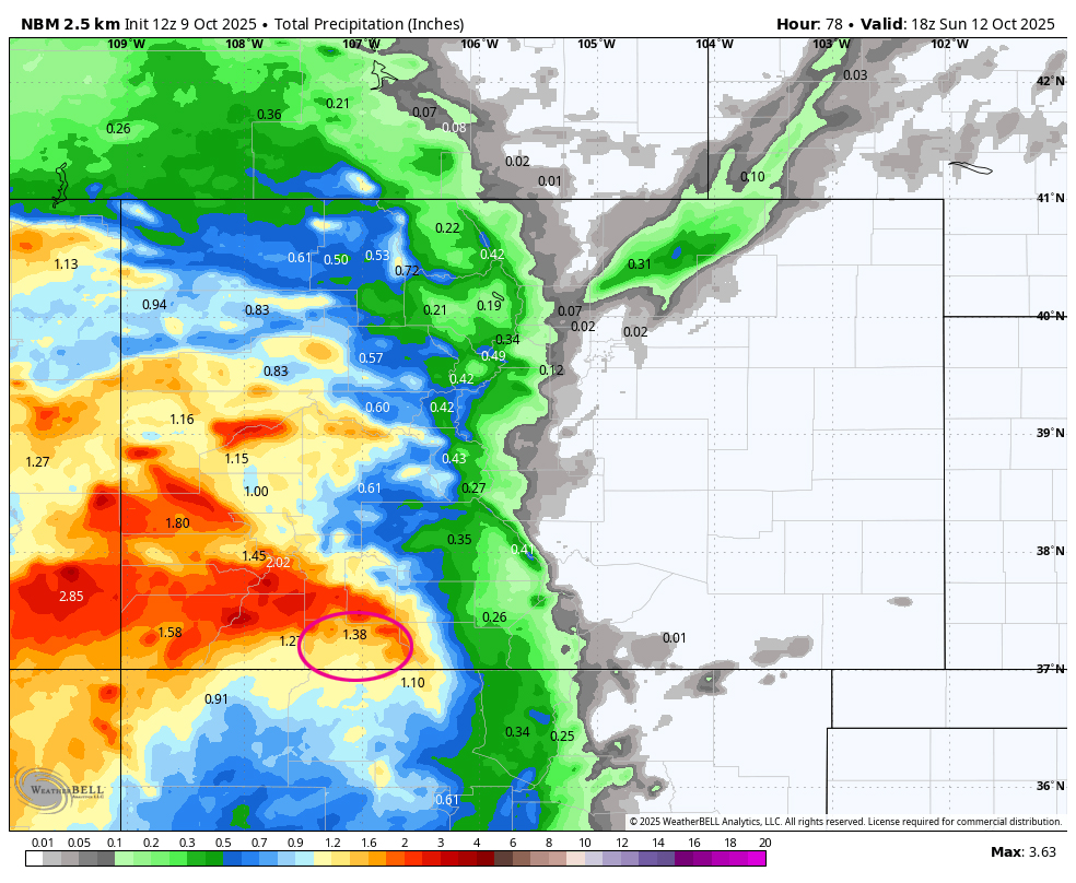
Friday through Sunday morning… Priscilla’s remnants will get entrained into the southwest flow ahead of a trough along the West Coast. The trough is expected to move through our area on Sunday with clearing behind it.
Friday into Saturday evening precipitable water, a measure of the potential amount of water vapor available for precip, is 250% to 300% of average. This could result in significant rainfall in our area. See forecast rainfall totals in the maps below.
Friday through Sunday morning will be more active with widespread showers and a few embedded thunderstorms. Storms will produce brief periods of heavy rain, small hail, lightning, and gusty winds. *** The heaviest rain will fall Friday night and Saturday. ***
Snow… A subtropical feed means relatively warm air and mostly rain. Snow levels are 13,000 to 14,000 feet and then drop down to 11,500 feet by Sunday morning. The lowest snow level for the week will be Sunday night at 10,700 feet when we are not expecting much in the way of precip.

Sunday afternoon through Monday morning… We’ll be between systems with partly to mostly cloudy skies and a few spotty showers, mostly over the mountains.
Monday afternoon into next Thursday morning: The remnants of yet-to-form Raymond will be transported into our area on the southwest flow along with rounds of storm energy and moisture through our area. Expect widespread showers and a few embedded thunderstorms. Storms will produce brief periods of heavy rain, small hail, lightning, and gusty winds.
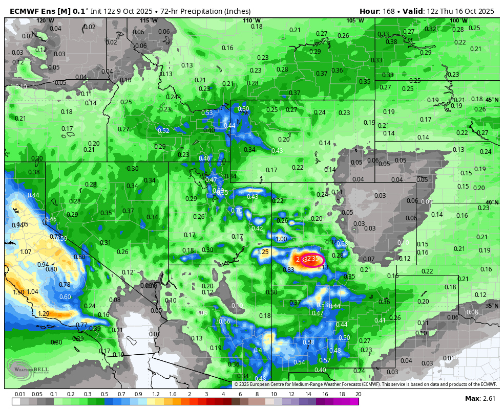
Thursday and Friday: scattered showers could persist. Confidence is shaky on the details. Stay tuned.
Temps…
Thursday highs will be in the upper-60s to low 70s and lows will be in the low to high 40s.
Friday highs will be near 60 to the high 60s and lows will be in the mid to high 40s.
Saturday and Sunday highs will be in the mid-50s to mid-60s. Saturday night lows will be near 40 to the mid-40s. Sunday night lows will be in the low to high 30s.
Monday and Tuesday highs will be in the upper-50s to mid-60s and lows will be in the high 30s to high 40s.
Winds…
Each afternoon gusts will be around 15mph. Expect higher gusts on Sunday as trough moves through, of 20-25mph.
As always, stronger isolated gusts are likely near a shower or thunderstorm.

The 8-14 day period… The models continue to flip-flop wildly for the 8-14 day period. One model run will show multiple low-pressure systems impacting us and then the next model run shows them missing us.
The good news is that the jet stream has slipped south and is active. We could see more precipitation the first half of October than we did all monsoon season.
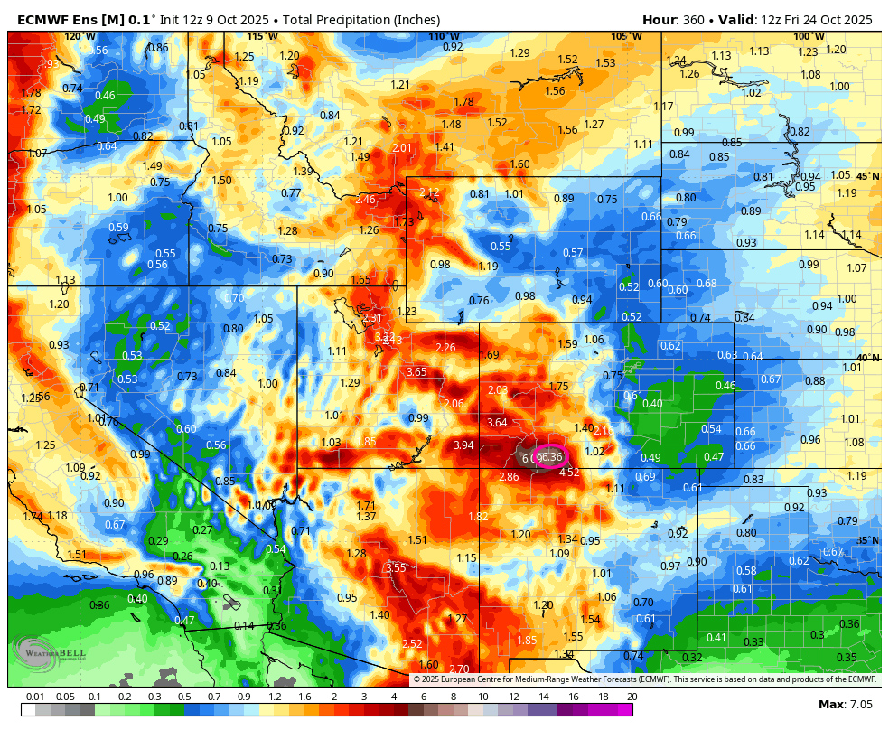

On the top, Euro ensemble precip to 23 Oct at 6am shows 6.36” in the Pagosa area! On the bottom, GFS ensemble precip shows 3.47”. That is a huge difference!
My next post will be tomorrow.
– Arleen


