
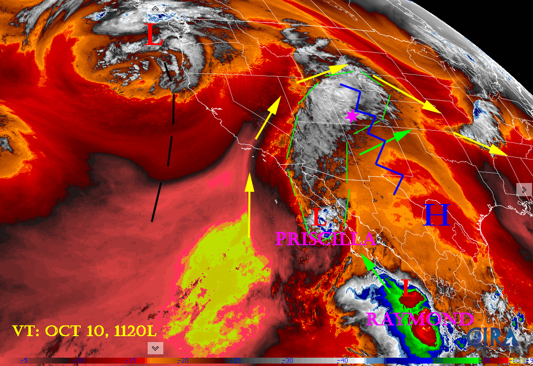
Water vapor satellite 11:20am, Friday. Remnants of Tropical Storm Priscilla are streaming into our area. Area of deep, low pressure off the Pacific Northwest coast and the ridge just to our east is creating an moisture ladder for Priscilla moisture to climb into the southwest. Cell movement will be out of the south-southwest but the system as a whole is moving to the east. Raymond will follow same path northeast.
Friday – 10 Oct 2025 – 12:30pm
The past…
Stevens Field Observations
Thursday: High: 74, Low: 47, Minimum relative humidity: 29%, Peak Wind: 10mph
| Average High | Record High / Year | Average Low | Record Low / Year |
| 68 | 79 / 1943 | 27 | 17 / 1982 |
Precipitation summary… Light rain showers and a few thunderstorms moved into Archuleta County around 8pm. Light rain spread out over most of the county around 2am moving from the south to the north. Areas in LaPlata County had areas of heavier rain than we did. This was just the first band of Priscilla’s moisture. And it fell in about 6 hours.
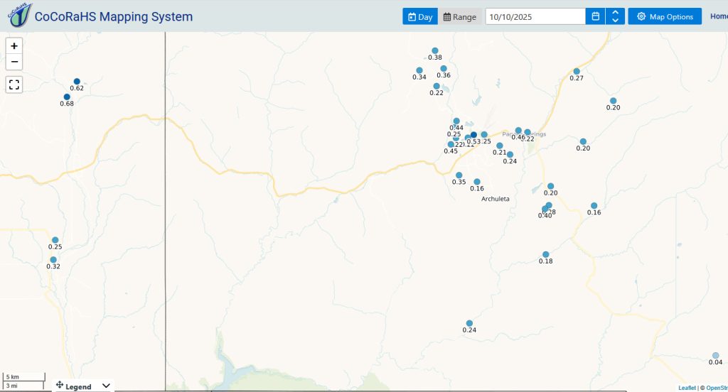
Current radar…
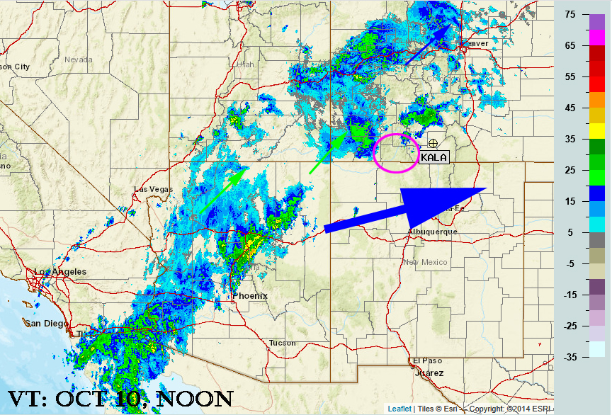
Radar at 11:00am Friday – Moisture is streaming out out of the southwest. Cell movement will be out of the south-southwest but the system as a whole is moving to the east. Areas of rain are stratiform, under deep Nimbo Stratus clouds. Not surprisingly, a lot of it is under the lowest radar beam. Though is looks like nothing is happening in Archuleta county, there is light rain across the area.

Tropical Storm Priscilla is being sponsored by the Springs Resort! Huge thanks to the team at The Springs Resort for being our Storm sponsor!
Forecast highlights…
*** Friday morning through Sunday morning Priscilla will visit. Expect lots of clouds, heavy rain showers, and a few embedded thunderstorms. ***
*** FLOOD WATCH through Saturday afternoon. Let us of any areas of flooding or damage in your area. ***
***Raymond visits Monday through Wednesday. ***
Forecast details…
Friday through Sunday morning… Priscilla’s remnants are entrained into the southwest flow ahead of a trough along the West Coast. The long-wave trough will remain anchored there but kick off a mesoscale trough that will move through our area Sunday and have clearing behind it.
So far Priscilla is being a polite guest, delivering much needed steady light to moderate rain across the area. We have had exactly 1.00″ of rain at our home, 7 miles northwest of Pagosa as of 1130am Friday morning.
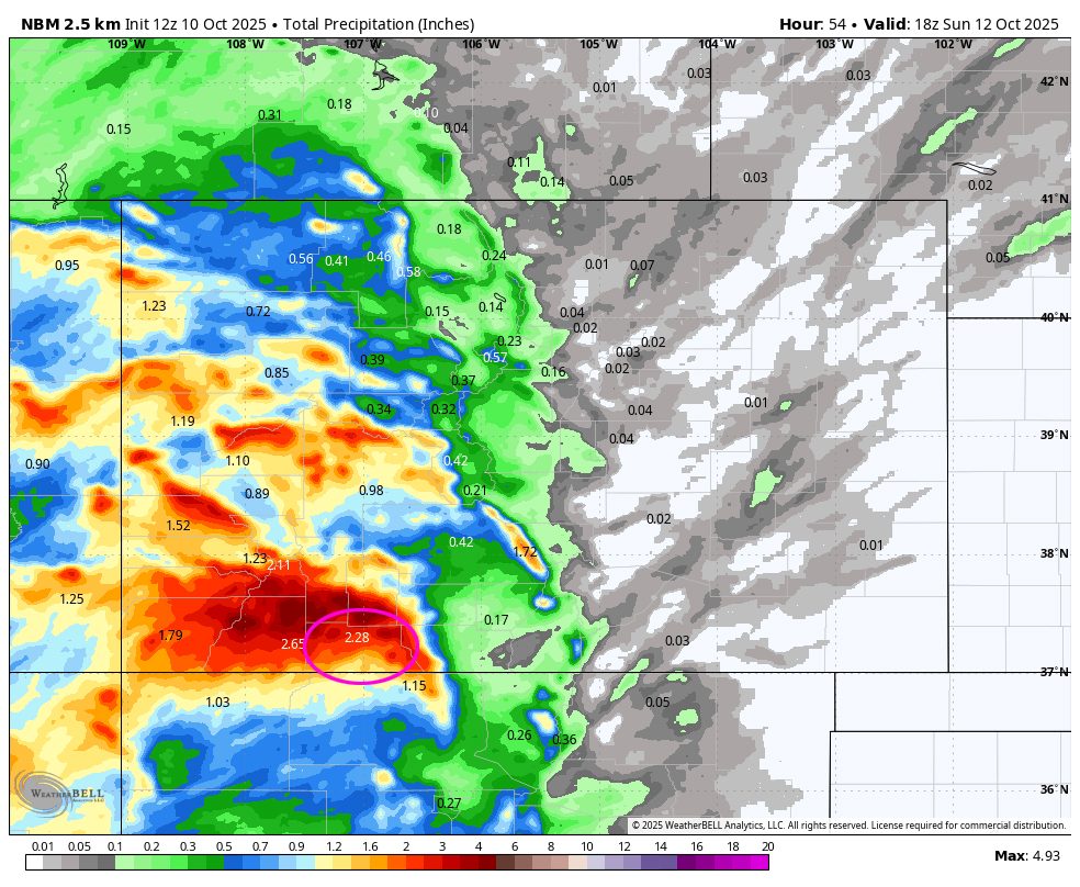
Friday into Saturday evening precipitable water, a measure of the potential amount of water vapor available for precip, is 250% to 300% of average. This could result in significant rainfall in our area. See forecast rainfall totals in the maps below.
Friday through Sunday morning expect widespread showers and a few embedded thunderstorms. Storms will produce brief periods of heavy rain, small hail, lightning, and gusty winds. *** The heaviest rain will fall Saturday during the day***
Snow… A subtropical feed means relatively warm air and mostly rain. Snow levels are 13,000 to 14,000 feet and then drop down to 11,500 feet by Sunday morning. The lowest snow level for the week will be Sunday night at 10,700 feet when we are not expecting much in the way of precip.
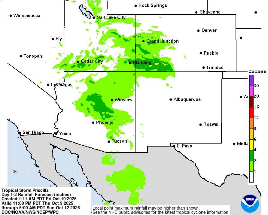

Sunday afternoon through Monday morning… We’ll be between systems with partly to mostly cloudy skies and a few spotty showers, mostly over the mountains.
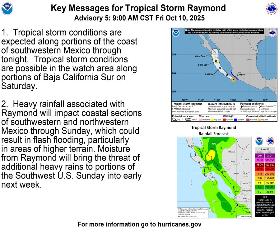
Monday afternoon into next Thursday morning: The remnants of Tropical Storm Raymond will be transported into our area on the southwest flow along with rounds of storm energy and moisture through our area. Expect widespread showers and a few embedded thunderstorms. Storms will produce brief periods of heavy rain, small hail, lightning, and gusty winds.
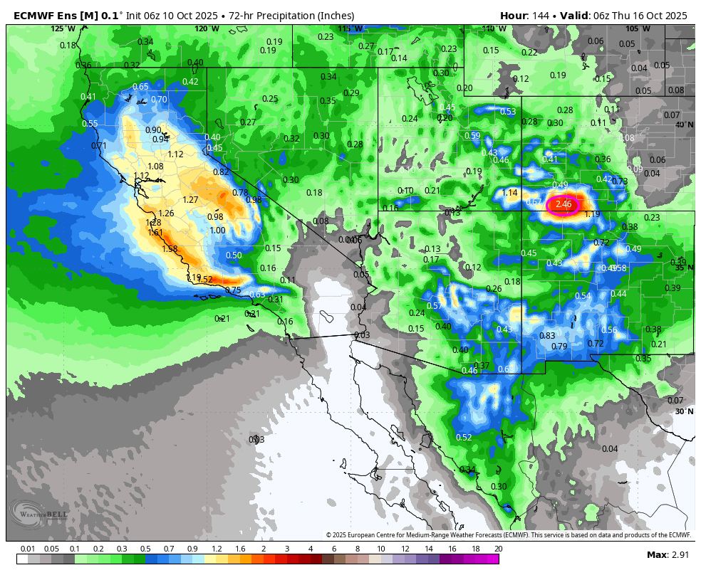
Euro Ensemble 72 hour product indicates 2.46″ of precip from Monday morning to Thursday morning. Yesterday’s product for the same time period showed 2.35″. It is being consistent.
Thursday and Friday: scattered showers could persist. Confidence is shaky on the details. Stay tuned.
Temps…
Friday highs will be near 60 to the high 60s and lows will be in the mid to high 40s.
Saturday and Sunday highs will be in the mid-50s to mid-60s. Saturday night lows will be near 40 to the mid-40s. Sunday night lows will be in the low to high 30s.
Monday and Tuesday highs will be in the upper-50s to mid-60s and lows will be in the high 30s to high 40s.
Wednesday and Thursday highs will be in the low-60s to upper 60s and lows will be in the mid 30s to low 40s.
***NOTE: Hard freeze Friday morning (October 17th and beyond).***
Winds…
Each afternoon gusts will be around 15mph. Expect higher gusts on Sunday as trough moves through, of 20-25mph.
As always, stronger isolated gusts are likely near a shower or thunderstorm.
The 8-14 day period… The San Juans are the BULLSEYE! The models are being pretty consistent now with the tropical systems. We are going to get wet!!! Things are still not clear as to what is going to happen after that. I’ll dig into that further tomorrow.
The good news is that the jet stream will slip south and be active. We will see more precipitation the first half of October than we did all monsoon season.
And we could see the first snowflakes in the 10 to 12 day time frame as we come under the influence of the polar front jet and colder air. We could see that first inch of snow or more the last week of October.
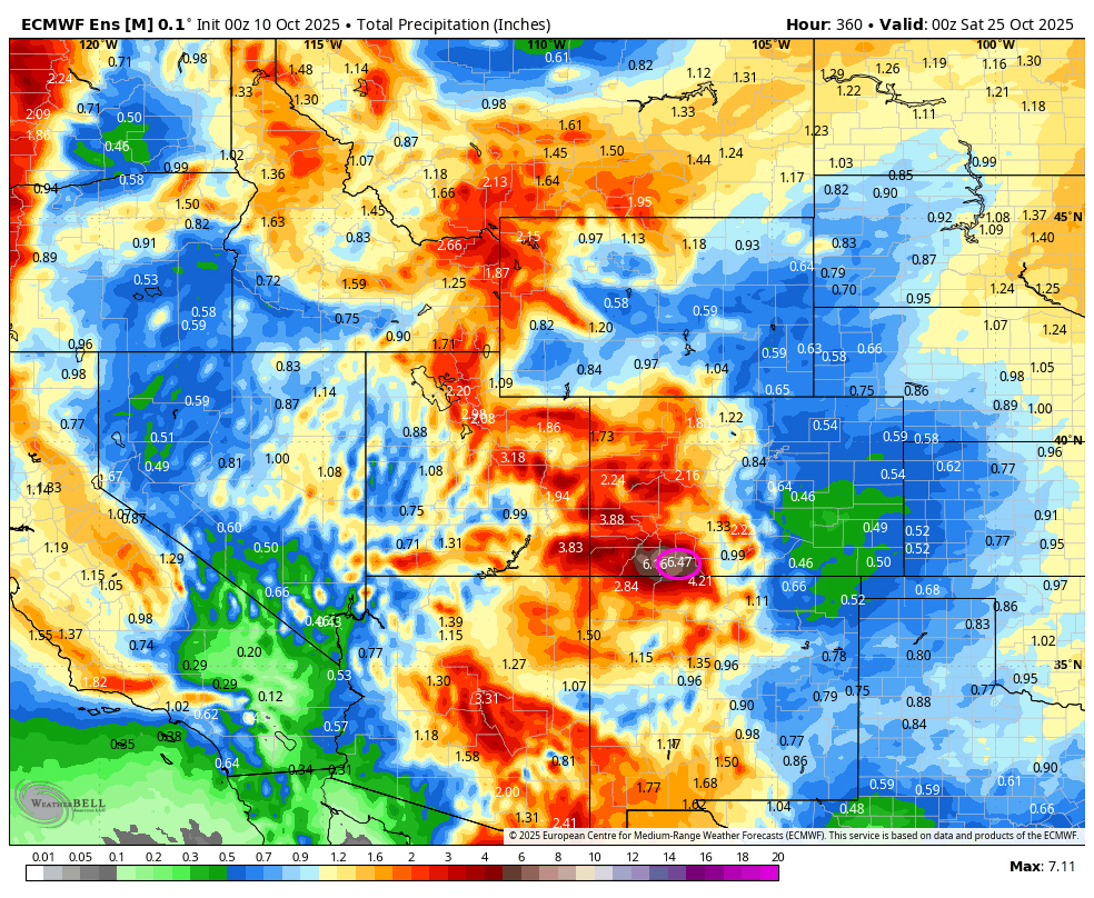
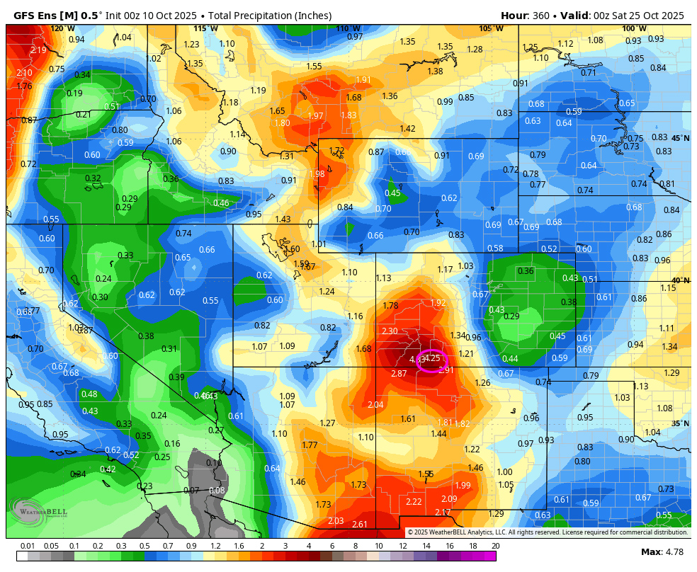
On the top, Euro ensemble precip to 25 Oct at 6am shows 6.47” in the Pagosa area! On the bottom, GFS ensemble precip has increased and shows 4.25”. There is still a big difference!
My next post will be tomorrow. Let us of any areas of flooding or damage in your area!
– Arleen


