

Pagosa Peak with fresh snow yesterday. – pic taken 3/4/2025
Wednesday – 5 Mar 2025 – 6:40pm
The past…
At Stevens Field the high temperature on Tuesday was 46. The low this morning was 18.
The peak wind at Stevens Field Tuesday afternoon was 26mph.
| Average High | Record High / Year | Average Low | Record Low / Year |
| 44 | 62 / 1972 | 12 | -21 / 1966 |
Precipitation summary… There was no measurable precip.
Forecast discussion…
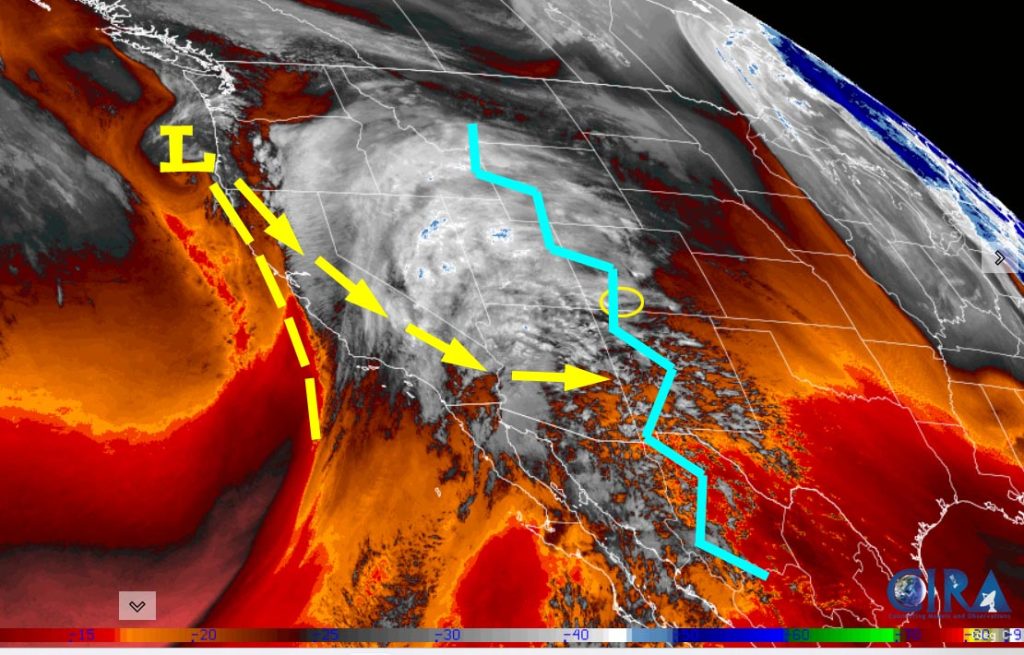
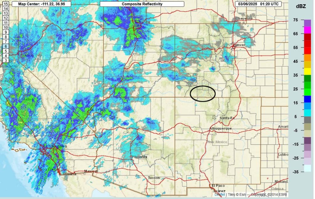
Forecast highlights…
*** The Grand Junction NWS has issued WINTER WEATHER WARNING for the southwest San Juan Mountains. 10-20” of snow and winds gusting to 60mph are expected between 11pm Wednesday to 11pm Friday. *** This does not include Pagosa Springs.
*** Expect periods of blizzard-like conditions late Thursday morning into Thursday evening. ***
*** Next storm 11-14 March. ***
Wednesday night into Saturday morning… We will be impacted by a double-barrel low pressure system. The first barrel will move through Thursday evening and the second will slip to our south Friday night.
Timing… The first scattered snowshowers will start over the mountains late Wednesday evening and then in the Pagosa area early Thursday morning. Occasional bands of heavy snow, and maybe thunder and lightning, are possible late Thursday afternoon into Thursday evening. Hit and miss snowshowers with minor accumulations will persist Thursday evening through Friday morning. Snowshowers will ramp up a bit Friday afternoon and then become more hit and miss Friday evening.
*** The snow level will bounce around between 7,000ft and 7,400ft Thursday. Plus temps will be above freezing so snow will struggle to accumulate. ***
Snow amounts Wednesday night to sunrise Friday…
Wolf Creek area: 8-12”
Pagosa area: 1-3”
Snow amounts Friday morning to sunrise Saturday…
Wolf Creek area: 1-3”
Pagosa area: up to 1” but it will be spotty
Temps… Wednesday night lows will be in the high 20s to low 30s. Thursday highs will be in the mid-30s to low 40s and lows will be in the mid-teens to low 20s. Highs Friday will be in the mid-30s to low 40s and lows will be in the low teens to low 20s.
Winds… *** Thursday afternoon gusts near Pagosa will be 30-40mph and in the mountains gusts will be 50-60mph. *** Friday afternoon gusts will be 15-20mph.

Saturday afternoon into Tuesday afternoon… A ridge will give us lots of sun and a warming trend.
Clouds will increase Monday night and Tuesday ahead the next low-pressure system.
Temps… Saturday highs will be in the low to high 40s and lows will be in the low teens to low 20s. Sunday and Monday highs will be near 50 to the high 50s and lows will be in the low teens to low 20s.
Winds… Afternoon gusts Saturday and Sunday will be around 15mph. Monday afternoon gusts will be 15-20mph.
Tuesday evening through Friday morning… The next storm will move through. That’s over a week out so forecast confidence is low in snow amounts and timing. It has potential to be another decent storm. Stay tuned for the details.

The next post will be tomorrow.
– Shawn


