
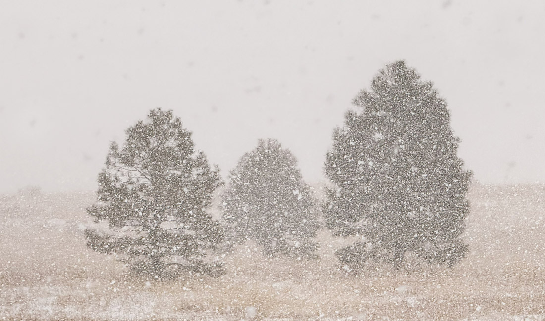
It snowed heavily for brief periods yesterday. – pic taken 3/3/2025
Tuesday – 4 Mar 2025 – 1:00pm
The past…
At Stevens Field the high temperature on Sunday was 54. The high on Monday was 41 at 10:55am. By 11:55am the temp had dropped to 30! The low this morning was 21.
The peak wind at Stevens Field Sunday afternoon was 26mph and on Monday afternoon it was 38mph.
| Average High | Record High / Year | Average Low | Record Low / Year |
| 43 | 63 / 1986 | 12 | -25 / 1966 |
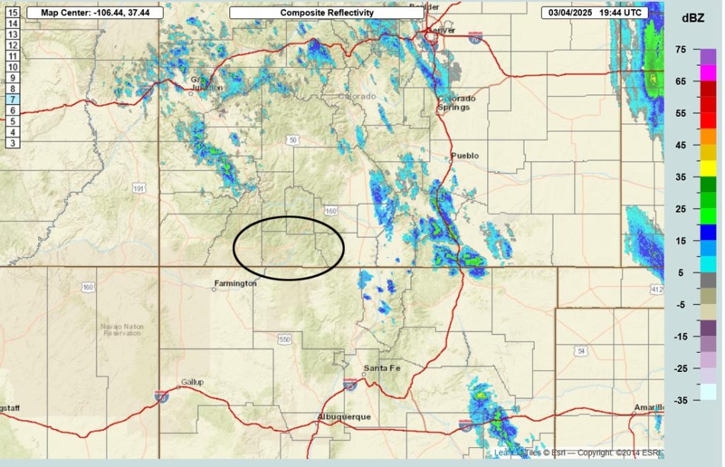
Precipitation summary… Bands of heavy snow moved across Archuleta County yesterday afternoon. Wolf Creek finally overperformed! They reported 9” of new snow this morning.

Forecast discussion…

Forecast highlights…
*** More snow Wednesday night into early Saturday morning. ***
*** Expect periods of blizzard-like conditions sunrise to sunset Thursday. ***
*** Next storm 11-14 March. ***
Late Tuesday afternoon to late Wednesday evening… A transient ridge will give us a brief break. Clouds will clear Tuesday night and temps will cool.
Temps… Tuesday highs will be in the low to high 40s and lows will be in the high single digits to high teens. Wednesday highs will be in the mid-40s to low 50s.
Winds… Tuesday afternoon gusts will be 20-30mph. Wednesday afternoon gusts will be 15-20mph.
Wednesday night into Saturday morning… A double barrel low pressure system will move through. The first barrel will move through Thursday afternoon and the second will move through Friday night.
Some of today’s forecast models indicate the second barrel sliding a little farther south so my forecast confidence is shaky in that one.
Timing… The first scattered snowshowers will start over the mountains around midnight Wednesday and then in the Pagosa area early Thursday morning. The heaviest snow is possible from roughly sunrise Thursday to sunset Thursday. Hit and miss snowshowers with minor accumulations will persist Thursday evening through Friday morning. Snowshowers will ramp up Friday afternoon through Friday evening and then will taper off after midnight.
The snow level will bounce around between 6,800ft and 7,200ft Thursday. Plus temps will be above freezing so snow will struggle to accumulate.
Snow amounts Wednesday night through Thursday night…
Wolf Creek area: 8-12”
Pagosa area: 1-3”
Snow amounts Friday morning to sunrise Saturday…
Wolf Creek area: 3-6”
Pagosa area: 1-2”
I’ll adjust the timing and snow amounts as the data gets better.
Temps… Wednesday night low will be in the mid-20s to low 30s. Thursday highs will be in the high 30s to low 40s and lows will be in the high teens to mid-20s. Highs Friday will be in the mid-30s to low 40s and lows will be in the low teens to low 20s.
Winds… *** Thursday afternoon gusts near Pagosa will be 30-40mph and in the mountains gusts will be 45-55mph. *** Friday afternoon gusts will be 15-20mph.

Saturday afternoon into Tuesday afternoon… A ridge will give us lots of sun and a warming trend.
Clouds will increase Monday night and Tuesday ahead the next low-pressure system.
Temps… Saturday highs will be in the low to high 40s and lows will be in the low teens to low 20s. Sunday highs will be in the mid-40s to low 50s and lows will be in the low teens to low 20s. Monday highs will be in the high 40s to mid-50s and lows will be in the mid-teens to mid-20s.
Winds… Afternoon gusts Saturday and Sunday will be around 15mph. Monday afternoon gusts will be 20-25mph.
Tuesday evening through Friday… The next storm will move through. That’s over a week out so forecast confidence is low in snow amounts and timing. It has potential to be another decent storm. Stay tuned for the details.
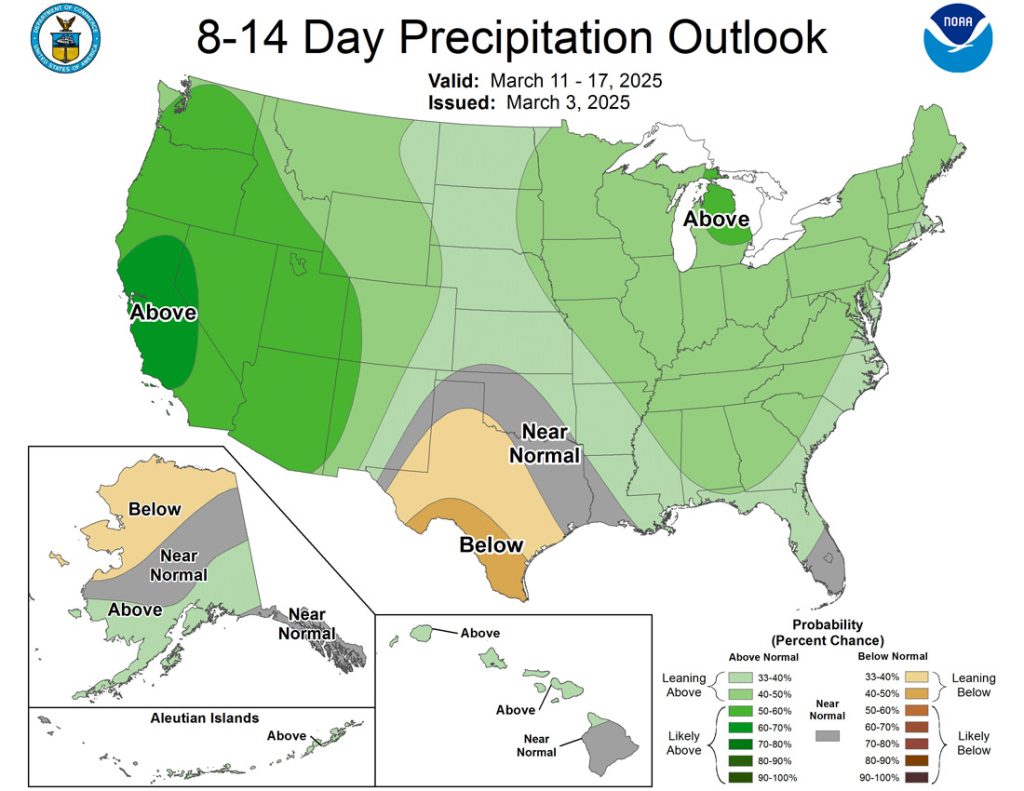
The 8-14 day period… There will be multiple storms before 15 March and then the pattern could get less active.

The inset shows total snow possible for Wolf Creek. It’s read left to right and times are in Zulu. By 19 Mar, 23” of snow is possible for Wolf Creek. Most of the precip is expected this Thursday and Friday and then next Wednesday through Friday.
The next post will be tomorrow.
– Shawn


