

Happy pup in the snow! – pic taken 2/16/2025
Monday – 17 Feb 2025 – 4:00pm
The past…
At Stevens Field the high temperature on Saturday was 34 and on Sunday it was 39. The low this morning was 14. The cold spots dipped into the mid-single digits.
The peak wind at Stevens Field Saturday afternoon was 20mph and on Sunday afternoon it was 7mph.
| Average High | Record High / Year | Average Low | Record Low / Year |
| 42 | 67 / 1943 | 8 | -30 / 1910 |
Precipitation summary… There was no measurable precip in the last 24 hours.
Forecast discussion…
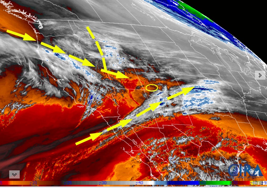
There is nothing on radar in our area Monday afternoon.
Forecast highlights…
*** Monday night into Tuesday morning a few spotty snowshowers, mostly over the mountains. ***
*** Another weak storm will move through Thursday afternoon into Friday afternoon. ***
*** Lots of sun, dry, and warm next week. ***
Monday night into Tuesday afternoon… We’ll get a few “scraps” as a trough moves through northern Colorado. It’s a wimpy storm with low snow amounts.
Snow amounts…
Wolf Creek area: 1-3”
Pagosa area: a dusting in the lucky spots
Temps… Lows Monday night will be low teens to low 20s. Tuesday highs will be in the high 30s to mid-40s and lows will be in the mid-single digits to mid-teens.
Winds… Tuesday afternoon gusts will be around 15mph.

Tuesday night through Thursday morning… A transient ridge will push patches of mid and high clouds through the area, but it will be dry.
Temps… Lows Tuesday night will be in the mid-single digits to mid-teens. Wednesday highs will be in the mid-30s to mid-40s and lows will be near 10 to near 20.
Winds… Gusts Wednesday afternoon will be 15-20mph.
Thursday afternoon through Friday afternoon… We’ll get a few “scraps” as another system moves through northern Colorado. There will be a few spotty snowshowers, mostly over the mountains. Snow accumulations will be minimal.
Snow amounts…
Wolf Creek area: up to 2”
Pagosa area: up to a half inch in the lucky spots
Temps… Thursday highs will be in the mid to high 40s and lows will be in the mid-teens to low 20s. Friday highs will be in the high 30s to mid-40s and lows will be in the high single digits to mid-teens.
Winds… Afternoon gusts will be 15-20mph.

Friday night through Sunday… Ridging will build over the desert southwest. We’ll see lots of sun and a warming trend.
Temps… Friday night lows will be in the high single digits to mid-teens. Saturday highs will be in the mid-40 to low 50s and lows will be in the mid-teens to low 20s. Sunday highs will be in the low to high 50s and lows will be in the high teens to mid-20s.
Winds… Afternoon peaks will be around 10mph.
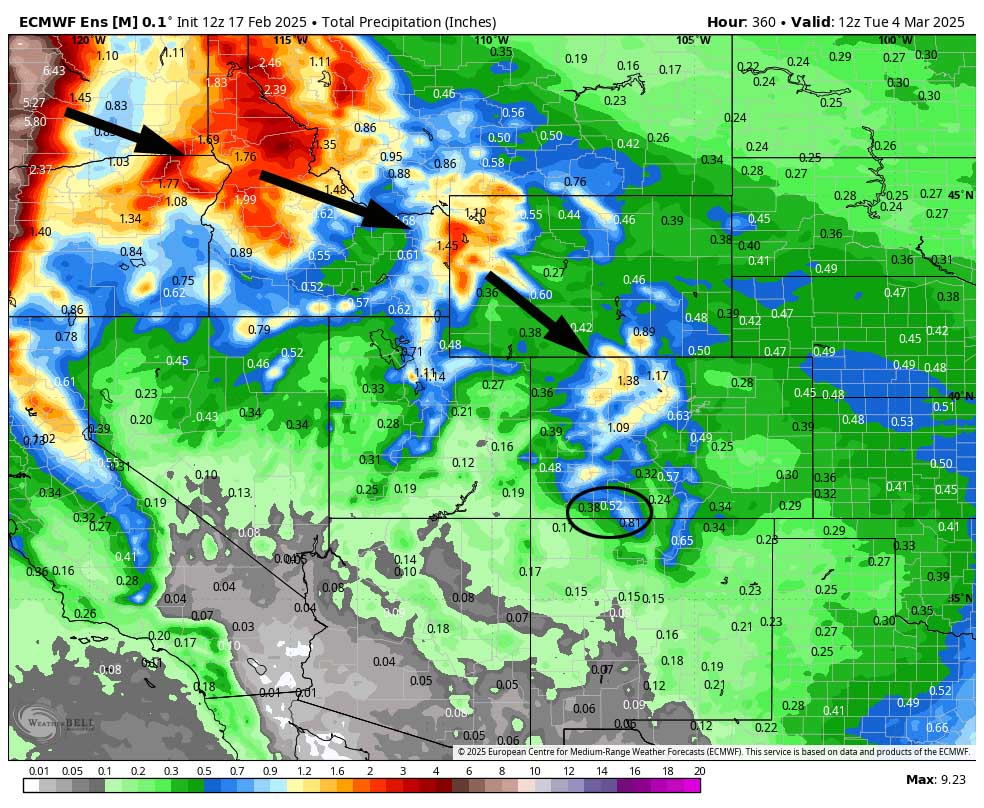
8-14 day period… We will be dry and warm most of next week and then the weather pattern could get more active the first week of March.
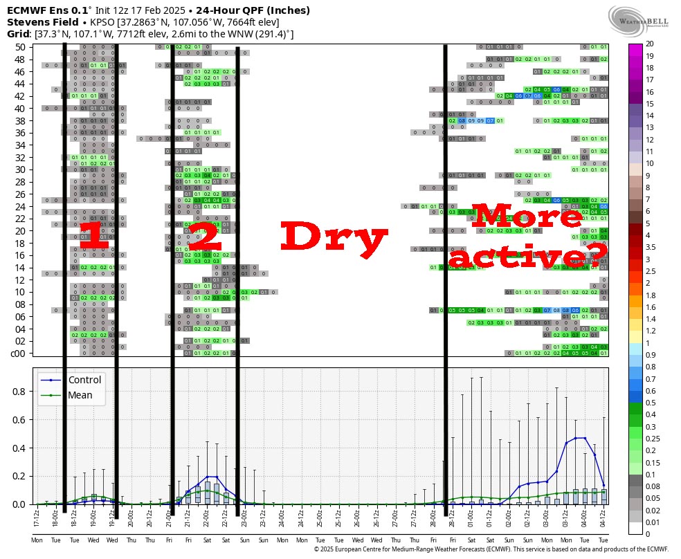
1 is the weak system moving through in the next 24 hours.
2 is another weak system moving through on Friday.
Then it’s dry most of next week.
Finally, the pattern could get more active as we move into March.
The next post will be on Wednesday.
– Shawn


