

Loving our winter wonderland! – Pic taken 11/8/2024
Friday – 8 Nov 2024 – 12:30pm
The past…
At Stevens Field the high temperature Thursday afternoon was 37 and the low this morning was 21.
The peak wind at Stevens Field on Thursday was 20mph.
| Average High | Record High / Year | Average Low | Record Low / Year |
| 53 | 66 / 1934 | 19 | -7 / 1948 |
Precipitation summary… Periods of light snow fell across much of the county yesterday. Wolf Creek reported 2” of new snow this morning bringing their storm total to 24”.


Forecast discussion…
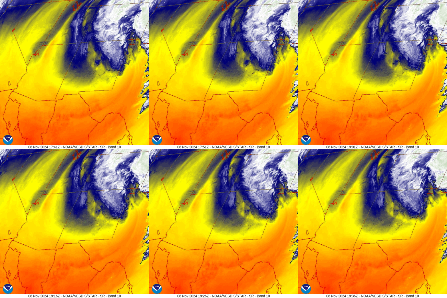
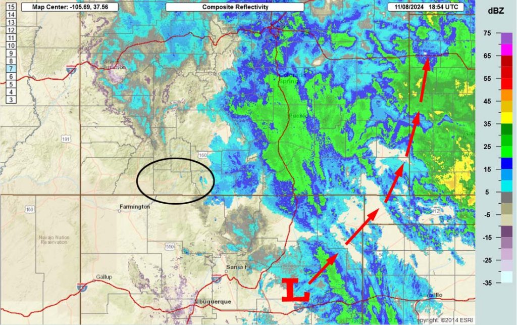
Forecast highlights…
*** The WINTER WEATHER ADVISORY for the eastern San Juan Mountains above 10,000ft, which includes Wolf Creek Pass, will end 5am Saturday. ***
*** Hit and miss snowshowers will persist into early Saturday morning. ***
*** Be careful if you must travel through northeast NM or eastern Colorado. ***

Rest of Friday through early Saturday morning… The low is spinning over central NM and moving slowly towards the northeast. It will move through the southeast corner of Colorado later this evening.
Upper-level flow in our area is out of the southeast, but will become out of the north as the low moves through eastern Colorado. This puts us on the dry side of the mountains. Most of the snow will fall along and east of The Divide.
The best chance for us to get snowshowers is late Friday afternoon into Friday evening. Scattered snow showers will linger over the mountains into early Saturday morning.
Snow levels…
Friday: rising to around 7,000ft
Friday night: dropping to around 6,000ft
Snow amounts during this period…
Wolf Creek area: 2-4”
Valley: a trace to 1”
Winds… Friday afternoon peak winds will be 10-15mph.
Temps… Highs Friday will be in the high 30s to mid-40s and lows Friday night will be in the mid-teens to mid-20s.

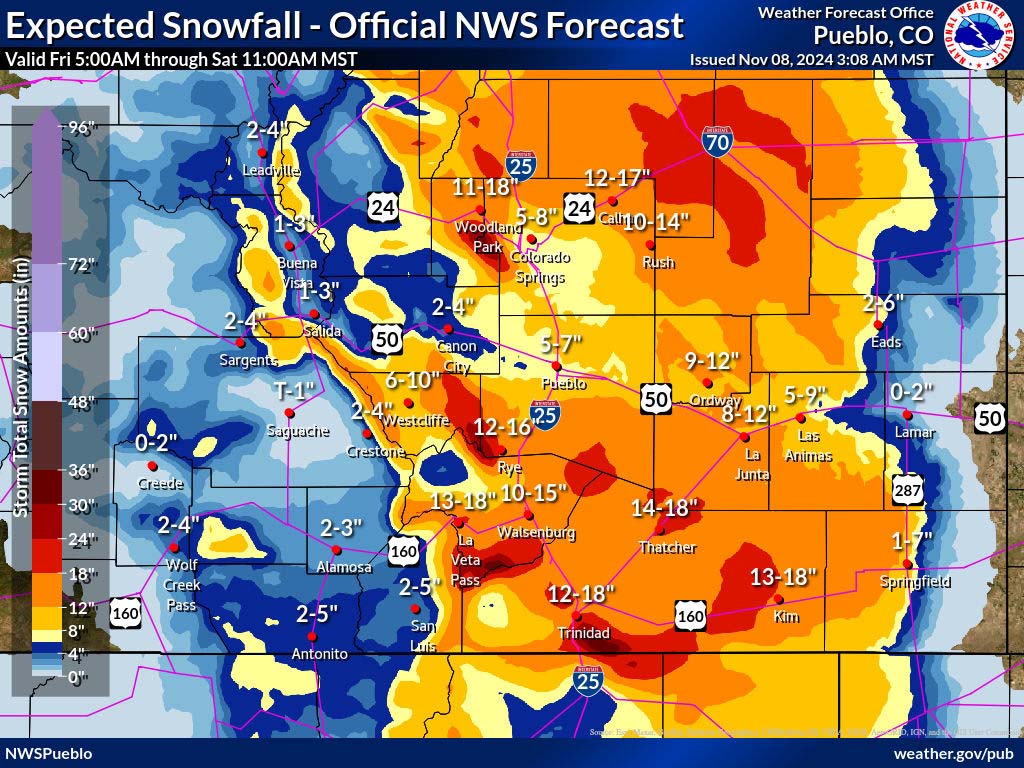

Saturday through Monday… Ridging will build over the region. We’ll see a lot of blue sky and temps will warm closer to season averages.
Winds… Afternoon peaks will be 10-15mph
Temps… Highs Saturday will be in the low to high 40s and lows Saturday night will be in the low teens to low 20s. Highs Sunday and Monday will be in the mid-40s to mid-50s and lows will be in the mid-teens to mid-20s.
Tuesday and Wednesday… The next system will move through. Upper-level winds, storm energy, and moisture are all weak. My expectations are low – a few spotty snowflakes in the valley and an inch or two in the mountains. The best chance for precip is Tuesday afternoon and evening.
Winds… Tuesday afternoon gusts will be 20-25mph and on Wednesday gusts will be around 15mph.
Temps… Highs will be in the low to high 40s and lows will be in the mid-teens to mid-20s.
Thursday and Friday… Transient ridging will give us lots of blue sky and temps near seasonal averages.
Winds… Afternoon winds will be 10-15mph.
Temps… Highs will be around 50 to the high 50s and lows will be in the high teens to mid-20s.
Next Saturday and beyond… The weather pattern could get active again with chances for more snow.
My next post will be Saturday afternoon or evening.
– Shawn


