
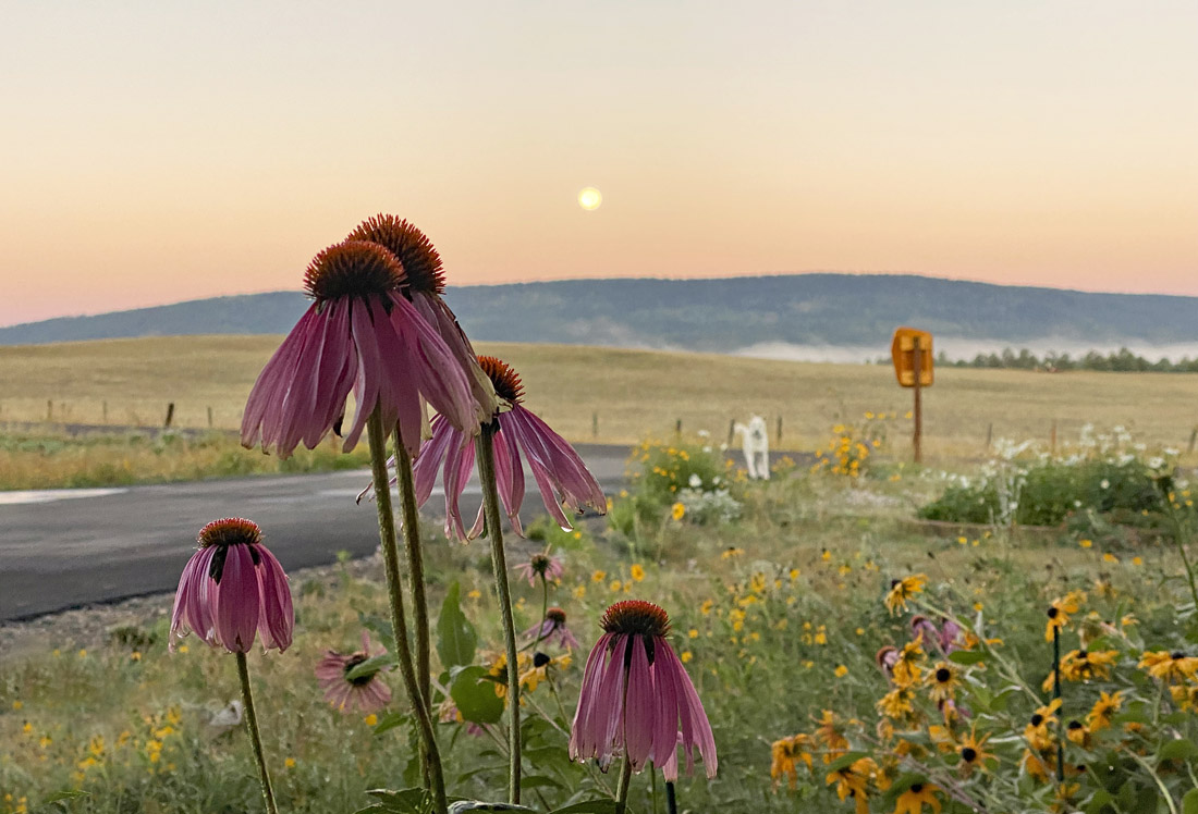
Despite the frost, the flowers are trying hard to hang on – pic taken 9/18/2024
If images fail to load in the email, please click the title of the post. Thanks!
Wednesday – 18 Sep 2024 – 2:15pm
The past…
At Stevens Field the high temperature Tuesday was 62. The low this morning was 36. Many folks dropped into the low 30s and reported frost this morning.
The peak wind at Stevens Field Tuesday was 37mph at 11:35am.
| Average High | Record High / Year | Average Low | Record Low / Year |
| 73 | 86 / 1956 | 36 | 9 / 1993 |
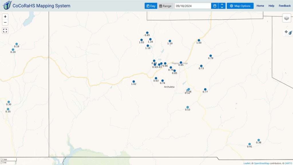
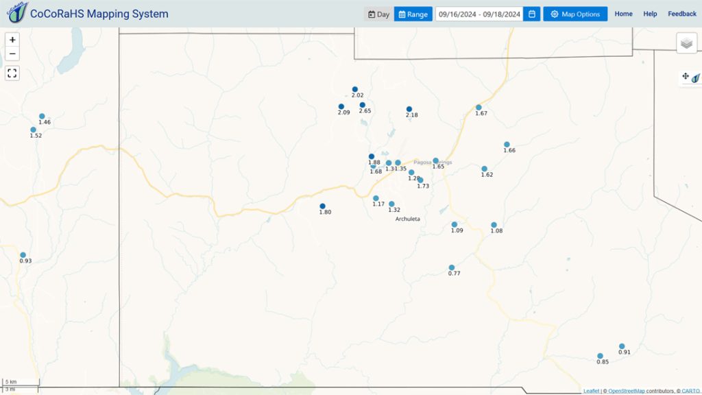
Precipitation summary… Precip reports are impressive. For perspective, a few locations got more than the average September precip of 2” in just 2 days!
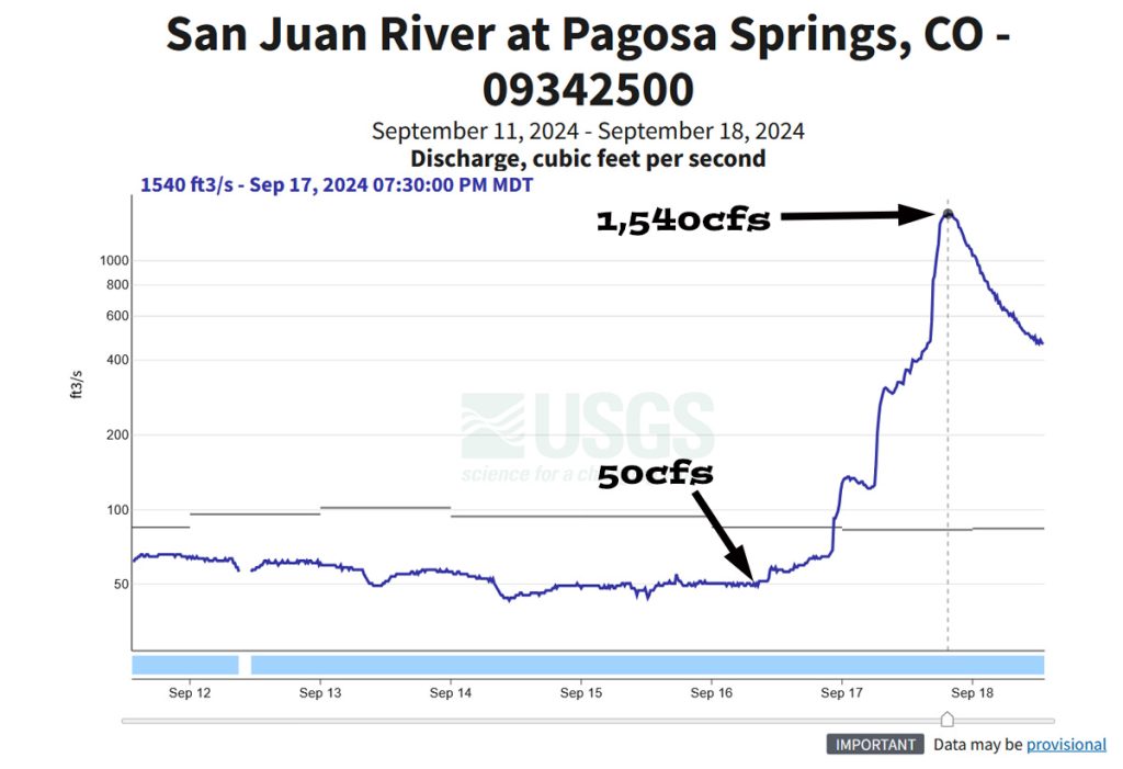
River flow… Local streams started rising quickly Tuesday afternoon with the influx of heavy rain.

Forecast discussion…

There is nothing on radar in our area Wednesday afternoon.
Forecast highlights…
*** Cold spots WILL drop below freezing each night the rest of the week. ***
*** Scattered showers and thunderstorms Saturday afternoon and evening. ***
Wednesday through Friday afternoon… Upper-level southwest flow will be dry and stable. We’ll have lots of sun, pleasant afternoons and chilly mornings.
Winds… Wednesday and Thursday afternoon peaks will be around 15mph. Friday afternoon gusts will be 15-20mph.
Temps… Wednesday highs will be in the mid-60s to low 70s and lows will be 30-40. The cold spots cold spots could dip into the high 20s. Thursday and Friday highs will be near 70 to the high 70s and lows will be in the low 30s to low 40s.
Friday night through Saturday night… A low-pressure system will move through the region. It won’t have much moisture so shower activity will be limited.
Mid and upper-level clouds will increase Friday night. A spotty light shower is possible over the mountains towards sunrise.
Shower activity will increase a bit by late morning. The best chance for showers and a thunderstorm or two is in the afternoon and into the evening.
Precip amounts will be low and spotty.
Winds… Afternoon gusts will be 15-20mph.
Temps… Friday night lows will be in the mid-30s to mid-40s. Highs Saturday will be in the low to high 60s and lows will be in the low 30s to low 40s.
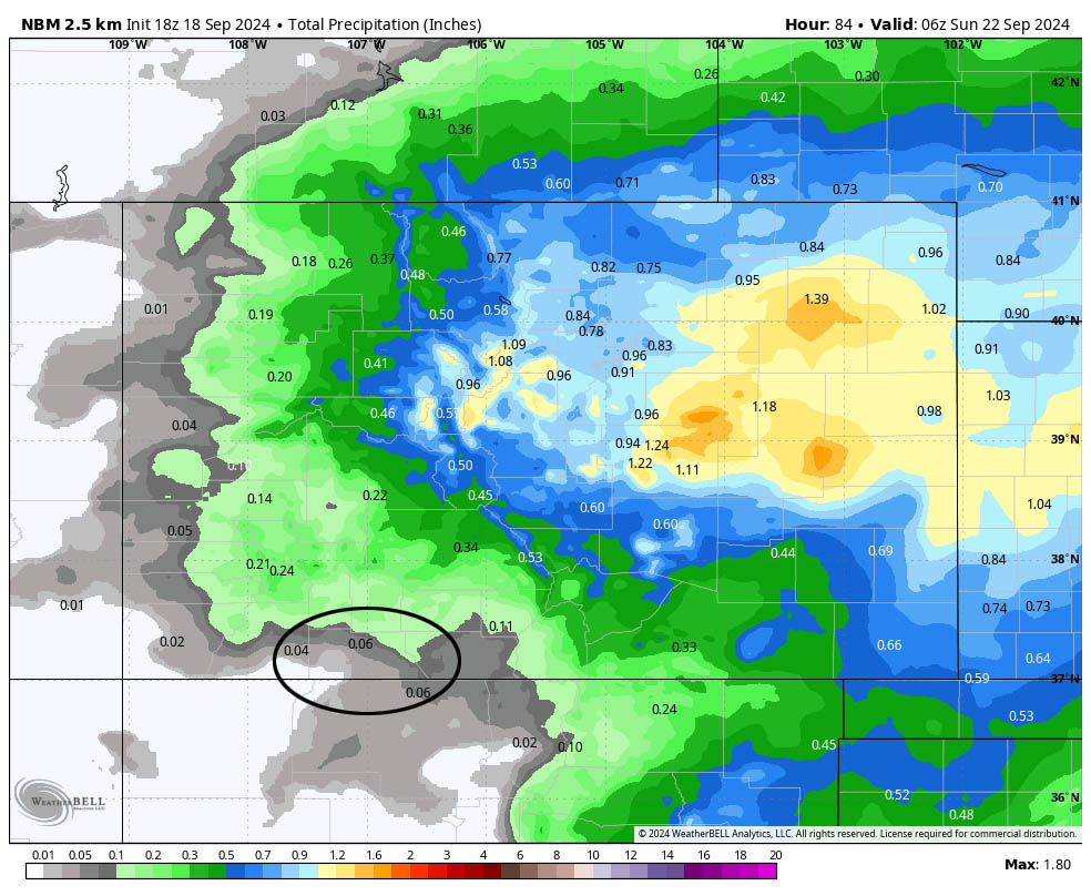
This looks good to me but precip amounts will vary.
Sunday through Tuesday… The forecast models really diverge for next week. Some models show a big high and dry weather while others show a cut-off low with a chance for spotty showers and thunderstorms. For now I think we’ll be dry with seasonal temps.
Winds… Afternoon gusts will be around 15mph.
Temps… Highs will be in the mid-60s to mid-70s and lows will be in the low 30s to low 40s.
The next forecast post will be on Friday.
– Shawn


