

A few small thunderstorms developed quickly late yesterday afternoon over parts of the county – pic taken 7/8/2024
If images fail to load in the email, please click the title of the post. Thanks!
Tuesday – 9 July 2024 – 3:20pm
The past…
At Stevens Field the high temperature Monday afternoon was 88 and the high so far on Tuesday is 80. The low this morning was 46.
The minimum relative humidity yesterday was 20% with a dew point of 36. Today it was 20% with a dew point of 35. Moisture is slowly increasing.
The peak wind at Stevens Field yesterday afternoon was 18mph. Today’s peak wind so far is 16mph.
| Average High | Record High / Year | Average Low | Record Low / Year |
| 84 | 96 / 1989 | 44 | 28 / 1912 |
Precipitation summary… A few small spotty showers and thunderstorms dropped a few raindrops late yesterday afternoon.
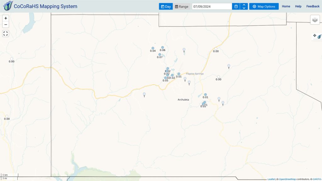
It’s not much, but it’s a start.
Forecast discussion…


Forecast highlights…
*** The chance for afternoon showers and thunderstorms will slowly ramp up through the week. ***
Rest of Tuesday through Monday… The high will gradually shift east and weaken. By Wednesday afternoon it is expected to be over eastern NV/western UT. By Saturday afternoon it is expected to be to our north along the UT/CO border.
This is not ideal for us but will allow a little more moisture and instability to creep into our area. The chance for a spotty afternoon shower or thunderstorm will slowly increase through the week.
Each morning we’ll wake up to bright blue skies. Then scattered cumulus clouds will build over the mountains during the late morning. By mid-afternoon, a couple of those cumulus clouds will grow into showers and a thunderstorm or two. Clouds will decrease each evening and we could be treated to pretty sunsets and a rainbow.
Forecast shower and thunderstorm movement:
Tuesday: toward the south-southeast, Wednesday: toward the south-southeast, Thursday: toward the south, Friday: toward the south-southwest, Saturday: primarily toward the southwest but “slow movers” will have variable movement, Sunday: primarily toward the west-southwest but “slow movers” will have variable movement.
For “slow movers” keep an eye out for storms developing over your head.
Winds… Afternoon peaks will be around 15mph, but isolated higher gusts are possible near a shower or thunderstorm.
Temps… Highs will be in low to high 80s and lows will be in the mid-40s to low 50s.
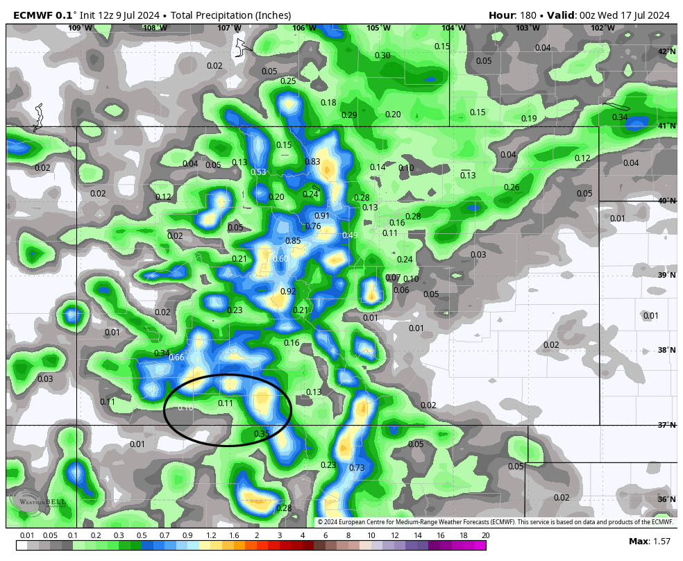
Other forecast models precip total for the same period: GFS: 0.15”, WPC: 0.25”, NBM: 0.44”, Euro AI: 0.21”, Euro ensemble: 0.17”, GFS ensemble: 0.66”, Canadian ensemble: 0.87”.
8-14 day precip… The high will wobble around the region. For us it’s a weak monsoon pattern with marginal moisture and instability.
Towards the end of this period, the high could shift to our east into a more favorable position to bring us stronger monsoon moisture.

My next forecast post will be Thursday afternoon.
– Shawn


2 Responses
As always, you do an excellent job!! Can’t tell you how much I appreciate your work and accuracy. It continues to make a difference in our lives of volunteering, gardening and hiking.
Dawn & Chris Olson
Chromo, CO
Dawn & Chris,
Thank you so much for your kind words. We’re so happy to receive a report that we’re making a positive difference in your lives.
Arleen & Shawn