

Increased smoke this morning indicates a weather pattern change – pic taken 7/5/2026
Sunday – 5 Jul 2026 – 4:00pm
The past…
Stevens Field Observations
Friday: High: 82, Low: 38, Peak wind: 26mph, Afternoon humidity: 4-6%
Saturday: High: 83, Low: 39, Peak wind: 23mph, Afternoon humidity: 7-9%
| Average High | Record High / Year | Average Low | Record Low / Year |
| 83 | 95 / 1989 * | 42 | 24 / 1912 |
* In 1989 there were 8 days in a row with record highs. From 3 to 10 July highs ranged from 93 to 99. *
Precipitation summary… There has been no recent measurable precip.
Current satellite, radar, and smoke…
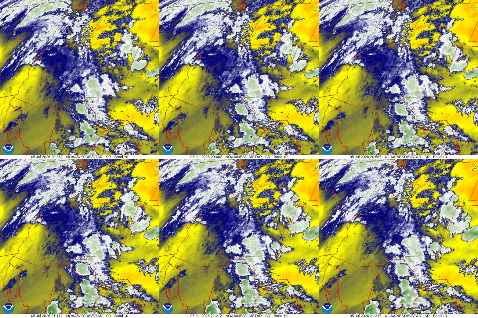
There is nothing on radar in our area Sunday afternoon.

(Archuleta County is circled in black. Acreage totals are from Sunday morning.)
Forecast highlights…
*** Fire danger remains very high. The entire San Juan National Forest is under stage 2 fire restrictions. ***
*** Spotty afternoon storms Monday, Tuesday, and Wednesday. More lightning than rain. Watch for new fires. ***
*** 9 to 14 July will be mostly dry, but there’s a slight chance for a spotty storm each afternoon, mostly over the mountains. Storms will produce more lightning than rain. ***
*** Starting around 15 Jul there will be a slow ramp up for increased afternoon storms. ***
Monday through Wednesday … We’ve traded the strong southwest flow pattern for a ridge pattern. Winds are weaker – yay, but smoke has increased – boo.
A surge of moisture and instability will help kick up a few afternoon and evening showers and thunderstorms. It’s a weak chance on Monday and a better chance on Tuesday and Wednesday.
Unfortunately there isn’t enough moisture for a soaking. We’re more likely to see lightning than rain. *** New lightning fires are possible. ***
Thursday afternoon through next weekend… The ridge will slide farther to our southwest. That puts us on the more stable and drier side with flow out of the west and northwest. There’s a slight chance for a spotty storm each afternoon, mostly over the mountains, but I think we will stay dry.
High temps next weekend will be 5-10 degrees above average.
*** Fire danger will remain high. ***
Temps…
Sunday night lows will be near 40 to the high 40s.
Monday through Friday highs will be in the mid 80s to the low 90s and lows will be in the low to high 40s.
Next weekend highs will be in the high 80s to the mid 90s and lows will be in the low 40s to the low 50s.
Winds…
Monday through Wednesday, each afternoon gusts will be 15-20mph. Isolated stronger gusts are possible near showers and thunderstorms.
Thursday afternoon and evening gusts will be around 25mph.
Friday, Saturday, and next Sunday, each afternoon gusts will be 15-20mph.

13 to 20 Jul… There is a lot of uncertainty for this period. Some forecast models expect the high to remain in the Four Corners area – boo hiss, while other models slide the high to our east – yay! I think the monsoon will slowly get more active starting around 15 July.
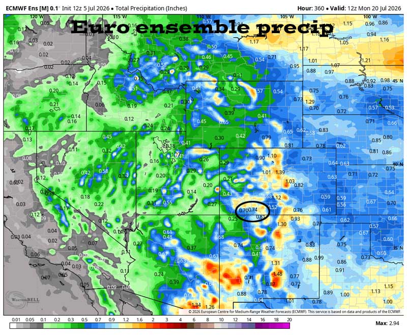
Precip amounts have bounced around over the last two days.
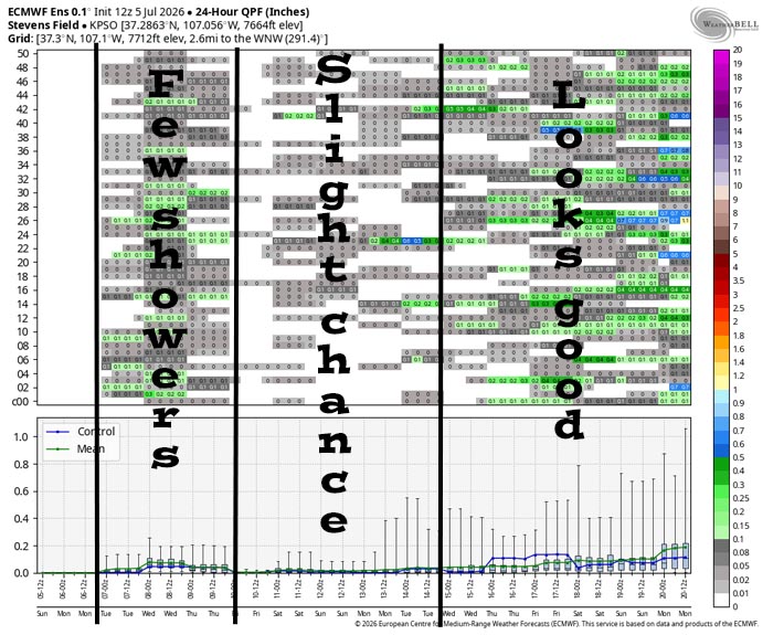
There are scattered showers with light precip amounts Monday, Tuesday, and Wednesday. Thursday to next Tuesday there’s just a slight chance for a spotty shower or thunderstorm. Most forecast products show us dry through this period. Starting around 15 July, the pattern will slowly get more active each day with increasing chances for showers and thunderstorms.
The next post will be Tuesday afternoon.
THANKS to everyone who came out to see the parade! And THANKS for saying hi to us at our booth!
– Shawn


