
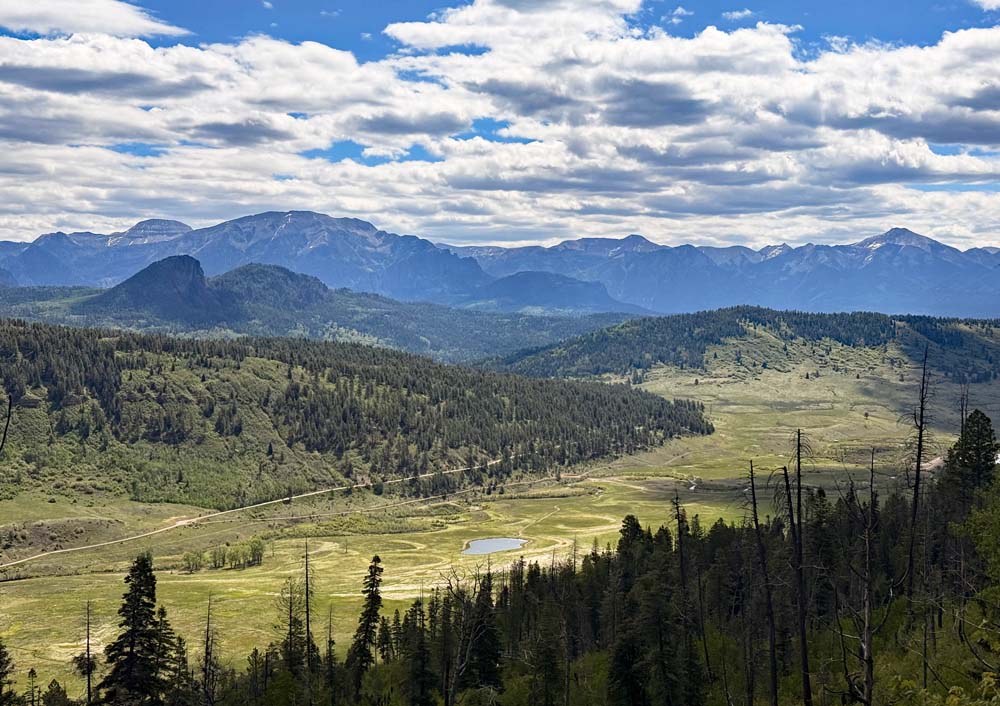
The weather is fantastic for getting outside! Love this view of the Weminuche valley. – pic taken 5/29/2026
Friday – 29 May 2026 – 5:15pm
The past…
Stevens Field Observations
Wednesday: High: 73, Low: 37, Peak wind: 20mph
Thursday: High: 76, Low: 39, Peak wind: 26mph
| Average High | Record High / Year | Average Low | Record Low / Year |
| 72 | 88 / 1910 | 32 | 17 / 1916 |
Precipitation summary… There has been no recent measurable precip.
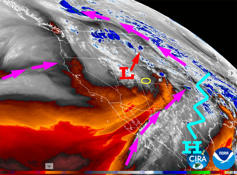
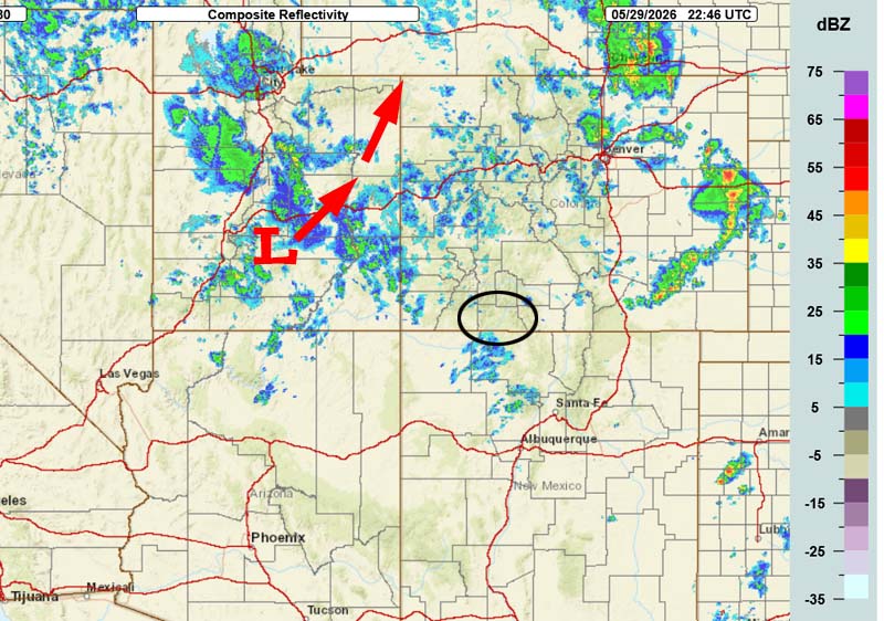
Current satellite and radar…
Forecast highlights…
*** San Juan National Forest fire danger is “VERY HIGH”. ***
*** Cold spots will flirt with freezing temps Saturday and Sunday mornings. ***
*** Dry with breezy afternoons through Monday. ***
*** Tuesday through next Friday spotty afternoon showers and thunderstorms. ***
Forecast details…
Friday evening through Monday… Friday evening a low moving north through eastern UT could kick up a spotty mountain shower or thunderstorm.
For the rest of this period, we’ll wake up each day to nearly clear skies and then we’ll see a few more clouds each afternoon. It will remain breezy each afternoon.
Tuesday through next Friday… A “monsoon-like” pattern will try to set up. Moisture and instability will increase so we’ll see spotty afternoon showers and thunderstorms each day.
Good news: It won’t be as breezy.
Bad news: We could see “dry lightning” and will have to keep an eye out for new fires.
Temps…
Friday night lows will be near freezing to the low 40s.
Saturday highs will be in the mid 60s to the low 70s and lows will be near 30 to the high 30s.
Sunday highs will be near 70 to the high 70s and lows will be in the mid 30 to the low 40s.
Monday through next Friday highs will be in the mid 70s to the low 80s and lows will be in the high 30s to the mid 40s.
Winds…
Friday evening gusts will be 30-35mph.
Saturday afternoon gusts will be 25-30mph.
Sunday and Monday, each afternoon gusts will be around 25mph.
Tuesday through next Friday, each afternoon gusts will be 15-20mph.

6 Jun to 13 Jun… There is a lot of uncertainty for this period. It looks more likely that the ridge will set up to our west and cut off our moisture feed and instability. I think we will be mostly dry and warm with highs in the high 70s to high 80s.
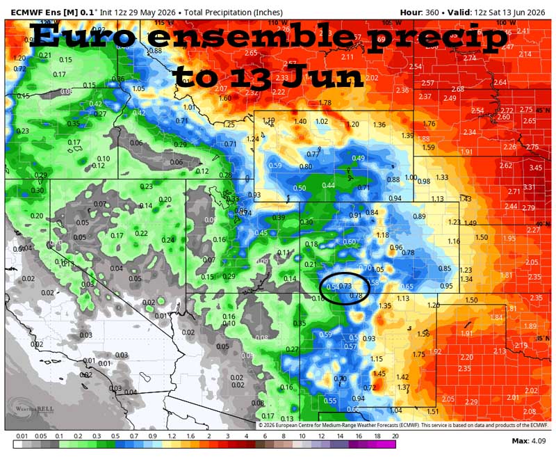
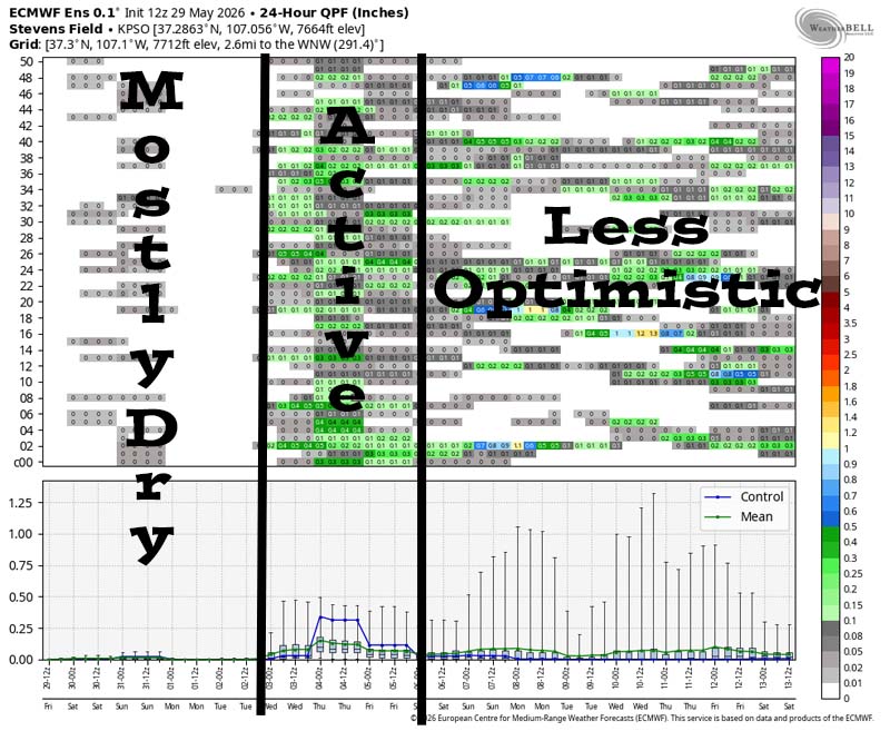
It’s dry through most of Tuesday and then it’s more active late Tuesday afternoon into Friday afternoon. I’m losing confidence that the pattern will remain active through the rest of the period.
The next post will be Sunday afternoon.
– Shawn


