
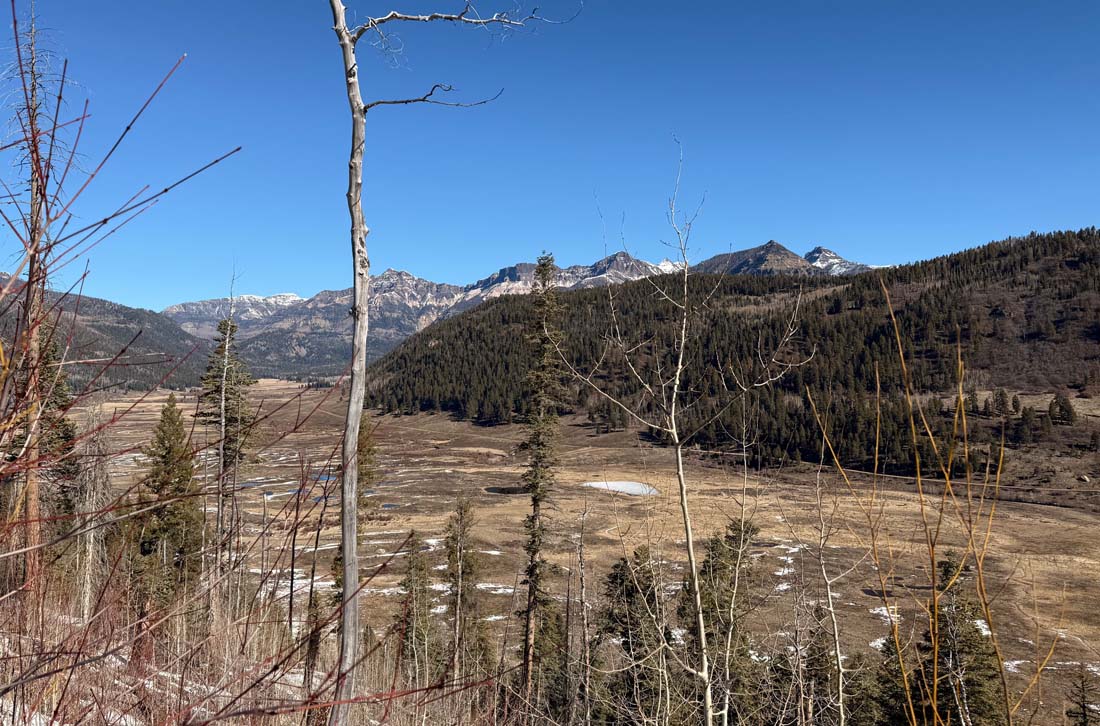
There should be 2-3 feet of snow in this valley – Pic taken 3/4/2026
Thursday – 5 Mar 2026 – 3:15pm
Stevens Field Observations
Tuesday: High: 54, Low: 26, Peak wind: 25mph
Wednesday: High: 56, Low: 20, Peak wind: 17mph
| Average High | Record High / Year | Average Low | Record Low / Year |
| 44 | 62 / 1972 | 12 | -21 / 1966 |
Precipitation summary… There has been no recent measurable precip.
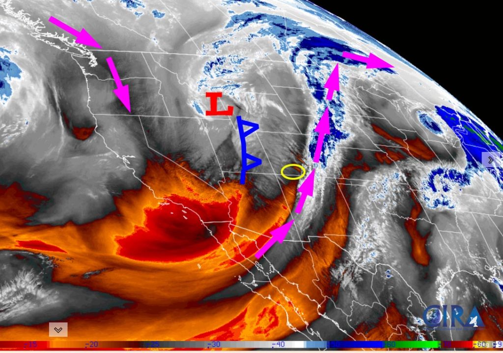
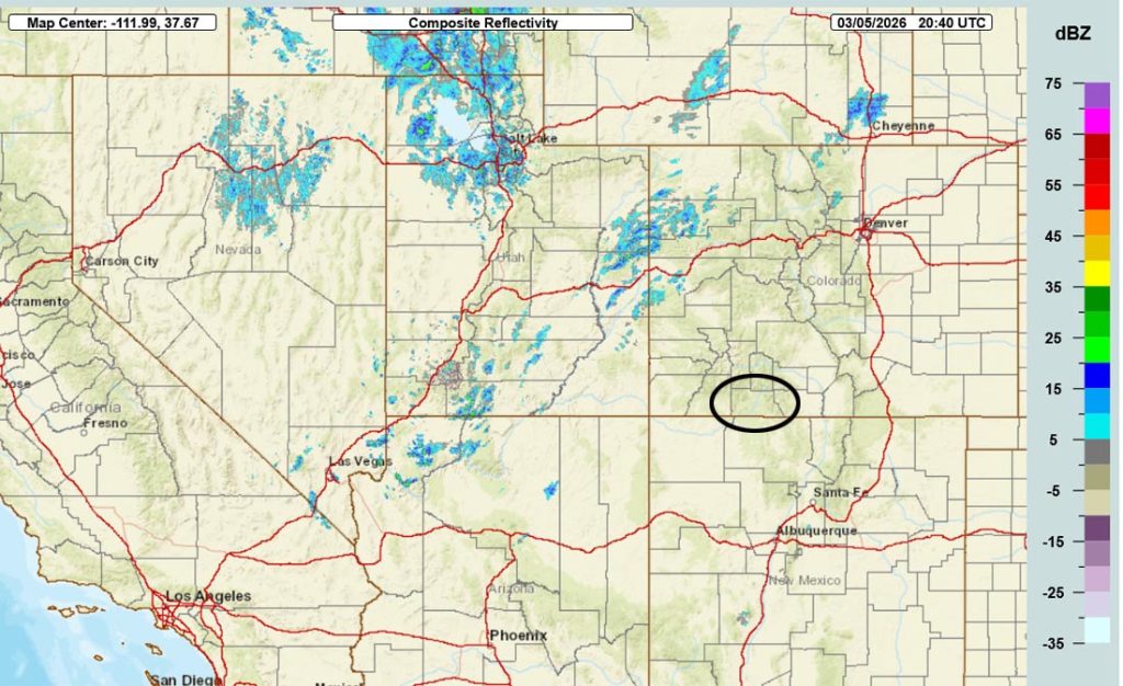
Current satellite and radar…
Forecast highlights…
*** There is a WINTER WEATHER ADVISORY for the southwest San Juan Mountains above 9,500ft. 5-10” of snow and wind gusts to 40mph are expected from 6pm Thursday to midnight Friday. ***
*** The best chance for snow in the Pagosa area is sunrise to early Friday afternoon. Snowshowers will persist in the mountains into early Friday evening. ***
*** After this storm, we’ll be dry and warm for a while. ***
Forecast details…
Thursday night through Friday evening… A cold front will move through around midnight tonight and then the upper-level trough will move through around sunset Friday. Between the cold front and trough, we’ll have scattered snowshowers. Temps will be 10-15 degrees colder Friday.
For my fellow weather geeks, this is what happens… Behind the cold front, colder air will move in from the surface up to around 20,000ft – cold air advection, abbreviated as CAA. Ahead of the supporting 500mb trough, vorticity increases – positive vorticity advection, abbreviated as PVA. Vorticity is the spinning of air and coincides with upward vertical motion that results in clouds and precip when the ingredients come together. Another primary ingredient for us, southwest flow between the cold front and the trough result in orographic lift and adiabatic cooling over our mountains.
This storm is missing two other ingredients: a strong jet stream and moisture.
A tidy little summary: CAA + PVA + orographic lift + moisture = clouds and precip.
This is our heavy snow pattern. Unfortunately, in this case, there isn’t much moisture, jetstream support is weak, and it’s a short duration storm with the ingredients lining up for 10-12 hours.
Timing… The first scattered snowshowers will begin over the mountains after midnight and then over the Pagosa area around sunrise. The best chance for snow in the Pagosa area is from sunrise to early Friday afternoon and then hit and miss showers will persist through the afternoon. Showers will be more persistent over the mountains and then decrease through Friday evening.
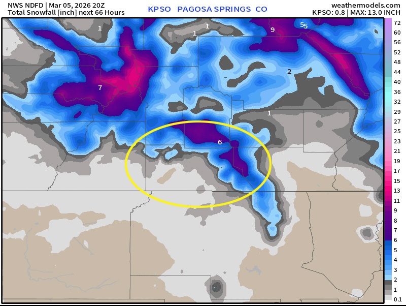
Snow amounts…
Mountains above 9,000ft: 4-8” – expect winter travel conditions
Pagosa Springs area: a dusting to 2” – snow will mostly stick on cold surfaces
Friday night through Monday… A ridge will build over our area while a cut-off low spins over the Baja Peninsula. We’ll have partly cloudy skies and will be dry.
Tuesday… We’ll see a few more clouds as a cut-off low moves through southern NM.
Wednesday and next Thursday… The big evil ridge will build over the southwest US coast. The storm track will be well to our north. We’ll have lots of sun and temps will be 10-15 degree above average.
Temps…
Thursday night lows will be near 20 to the high 20s.
Friday highs will be in the mid 30s to the low 40s and lows will be near 10 to the high teens.
Saturday highs will be in the mid 40s to the low 50s and lows will be in the mid teens to the low 20s.
Sunday highs will be in the low to high 50s and lows will be in the high teens to the mid 20s.
Monday through next Thursday highs will be in the mid 50s to the low 60s and lows will be in the low to high 20s.
Winds…
Friday afternoon gusts will be around 20mph near Pagosa and 35-40mph in the high country.
Saturday, Sunday, and Monday, each afternoon gusts will be around 15mph near Pagosa and around 30mph in the high country.
Tuesday afternoon gusts will be 20-25mph near Pagosa and 35-40mph in the high country.
Wednesday and next Thursday, each afternoon gusts will be around 15mph near Pagosa and 30-35mph in the high country.

12 Mar to 20 Mar… The ridge off the west coast will flatten some and allow a more west to east flow across the northern half of the country. The storm track will be too far north to have much impact on us. I think most of this period will be warm and dry.

The next post will be on Saturday.
– Shawn


