

It was a nice day for a pup walk! – Pic taken 3/3/2026
Tuesday – 3 Mar 2026 – 6:15pm
The past…
Stevens Field Observations
Sunday: High: 63*, Low: 26, Peak wind: 20mph
Monday: High: 56, Low: 27, Peak wind: 22mph
* Tied the record high of 63 set in 1943. *
| Average High | Record High / Year | Average Low | Record Low / Year |
| 44 | 62 / 1986 | 13 | -18 / 1916 |
Precipitation summary… There has been no recent measurable precip.
Current satellite and radar…
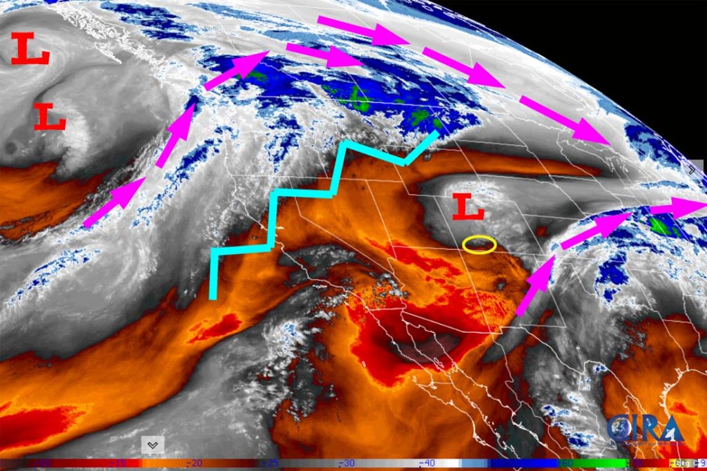
There is nothing on radar in our area late Tuesday afternoon. There are scattered rain showers along parts of I-25 through Colorado.
Forecast highlights…
*** Weak storms Friday and next Tuesday with low precip amounts. ***
Forecast details…
Wednesday through Thursday evening… A transient ridge will move through. We’ll have scattered clouds and remain dry.
Thursday night through Friday evening… A trough and a cold front will move through from the west with limited moisture. We’ll see more clouds and a few spotty showers, but precip amounts will be low. It will be windy Thursday and 10-15 degrees colder Friday.
The snow level could drop below 7,000ft but just a dusting of snow is possible in the Pagosa area. Wolf Creek could get 1-3” of snow.
Friday night through Monday… A ridge will build over our area while a cut-off low spins over the Baja Peninsula. We’ll have partly cloudy skies and will be dry.
Next Tuesday… We might catch the northern edge of a cut-off low that will be well to our south. We’ll see a few more clouds and scattered showers. Precip amounts will be low. If the system moves any further south, we won’t get anything.
Temps…
Tuesday night lows will be near 20 to the high 20s.
Wednesday and Thursday highs will be near 50 to the high 50s and lows will be in the high teens to the high 20s.
Friday highs will be in the high 30s to the mid 40s and lows will be near 10 to the high teens.
Saturday highs will be in the mid 40s to the low 50s and lows will be in the high teens to the mid 20s.
Sunday, Monday, and next Tuesday highs will be in the mid 50s to the low 60s and lows will be in the low to high 20s.
Winds…
Wednesday afternoon gusts will be 15-20mph near Pagosa and 30-35mph in the high country.
Thursday afternoon gusts will be 25-30mph near Pagosa and 40-45mph in the high country.
Friday through Monday, each afternoon gusts will be around 15mph near Pagosa and 30-35mph in the high country.
Next Tuesday afternoon gusts will be around 25mph near Pagosa and 35-40mph in the high country.
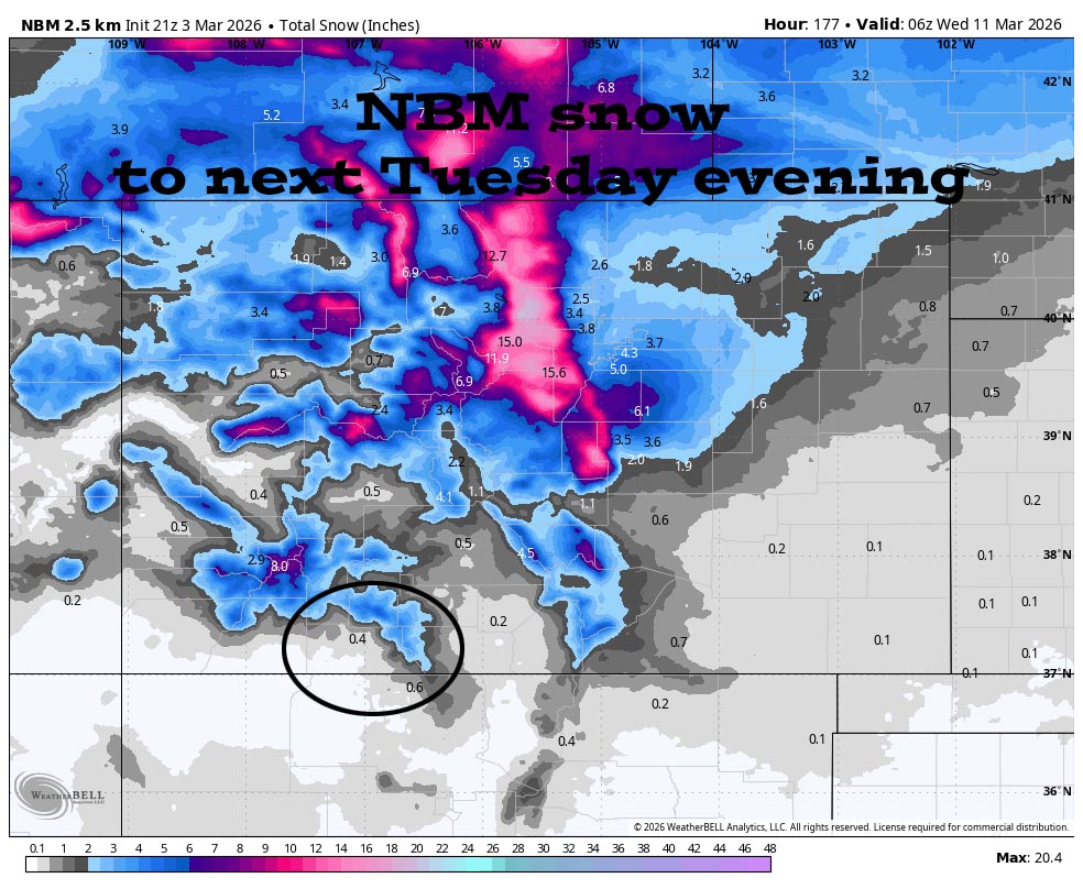
10 Mar to 18 Mar… The ridge off the west coast will flatten some and allow a more west to east flow across the northern half of the country. The storm track will be too far north to have much impact on us. We might see a few periods of scattered showers, but I don’t see any big storms on the horizon.
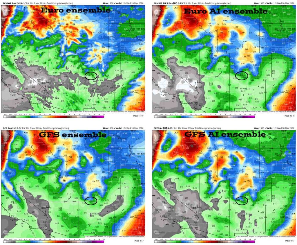
Euro precip amounts are trending down for us while the GFS has been steady.
The next post will be on Thursday.
– Shawn


