

The balloons had good flying weather for the Durango Snowdown this morning! – Pic taken 1/31/2026 by Marissa Myers, Chief Pilot and Owner of Pagosa Adventure
Saturday – 31 Jan 2026 – 2:30pm
The past…
Stevens Field Observations
Thursday: High: 42, Low: 8, Peak wind: 9mph
Friday: High: 43, Low: 10, Peak wind: 17mph
| Average High | Record High / Year | Average Low | Record Low / Year |
| 40 | 58 / 1986 | 3 | -35 / 1917 |
Precipitation summary… There has been no recent measurable precip.
Current satellite and radar…

There is nothing on radar in our area Saturday afternoon.
Forecast highlights…
*** Lots of sun and temps around 10 degrees above average. ***
*** Dry until around 11 Feb and then the weather pattern will get more active. ***
Forecast details…
Saturday night through Tuesday morning… The pesky ridge will be the primary influence on our weather for most of this period. Patches of mid and high clouds will occasionally move through region, but we’ll stay dry.
Late Tuesday and Wednesday… A weak system with limited moisture will move north to south along the Front Range. We’ll see a few more clouds, but I don’t expect any precip.
Thursday through next Saturday… A strong high will build over the Great Basin and prevent weather systems from impacting the western US.
The ridge will start weakening Friday and Saturday, so we’ll see a few more clouds.
Temps…
Saturday night lows will be in the low teens to low 20s.
Sunday through next Saturday highs will be in the high 40s to mid-50s and lows will be in the mid-teens to mid-20s.
Winds…
Sunday through next Saturday, each afternoon peak winds will be around 10mph in the Pagosa area and around 20mph in the high country.

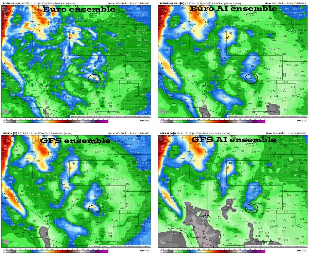
7 Feb to 15 Feb… The models hint at a more active weather pattern starting around 11 Feb. Precip amounts are trending up – yay!


The next post will be on Monday.
– Shawn


