

Tommy found some pretty good snow near Lobo Overlook! – Pic taken 1/12/2026
Tuesday – 13 Jan 2026 – 3:15pm
The past…
Stevens Field Observations
Sunday: High: 44, Low: 11, Peak Wind: 9mph
Monday: High: 50, Low: 16, Peak Wind: 7mph
| Average High | Record High / Year | Average Low | Record Low / Year |
| 38 | 59 / 1956 | 2 | -42 / 1963 |
Precipitation summary… There was no measurable precip in the last 24 hours.
Current satellite and radar…
There is nothing on radar in our area Tuesday afternoon.
Forecast highlights…
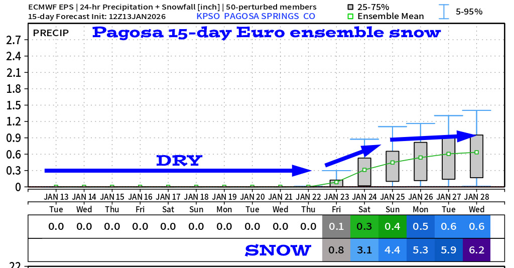
*** We’ll have lots of blue sky and will be dry for another week. ***
*** A storm is trying to take shape 22-24 Jan. ***
Forecast details…
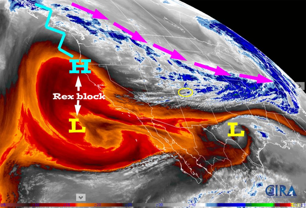
Rest of Tuesday through next Tuesday… A Rex block will keep most of the western US dry. In our area, occasional patches of high clouds will move through, but we’ll have lots of sun and light winds. Tuesday, Wednesday, and Thursday temps will be 10-15 degrees warmer than average.
A weak cold front will move through our area Thursday evening. The only impacts to us are slightly stronger winds on Friday and temps around 5 degrees cooler starting Friday.
Temps…
Tuesday, Wednesday, and Thursday highs will be in the high 40s to mid-50s and lows will be in the high teens to high 20s.
Friday and Saturday highs will be in the mid-40s to the low 50s and lows will be in the mid-teens to mid-20s.
Sunday, Monday, and next Tuesday highs will be in the mid-40s to low 50s and lows will be in the high teens to high 20s.
Winds…
Wednesday and Thursday, afternoon peak winds will be 5-10mph in the Pagosa area and 15-20mph in the high country.
Friday, afternoon gusts will be 10-15mph near Pagosa and around 30mph in the high country.
Saturday through next Tuesday, each afternoon peak winds will be 5-10mph in the Pagosa area and 15-20mph in the high country.

20 Jan to 28 Jan… The ridge will weaken just enough to allow a weak storm to move through 22-24 Jan and then the ridge wants to build right back up – ugh.


The next post will be on Thursday.
– Shawn


