

Tommy appreciates another pretty sunrise – Pic taken 12/31/2025
Thursday – 1 Jan 2026 – 2:00pm
The past…
Stevens Field Observations
Tuesday: High: 49, Low: 15, Peak Wind: 7mph
Wednesday: High: 54, Low: 18, Peak Wind: 6mph
| Average High | Record High / Year | Average Low | Record Low / Year |
| 35 | 59 / 1981 | 0 | -20 / 1991 |
Precipitation summary… There has been no recent measurable precip.
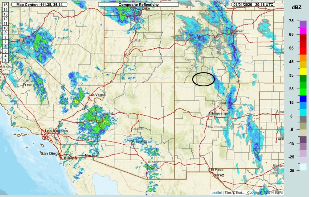
Current satellite and radar…
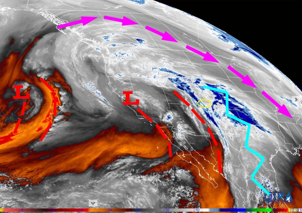
Moisture is steaming into our area from the south but upper-level flow is more westerly and there isn’t much storm energy to turn the moisture into precip.
The little low over CA will move over our heads around noon on Friday but there won’t be much left of it.
Forecast highlights…
*** Rest of Thursday into early Friday afternoon there will be scattered rain showers in the valley and scattered snow showers in the mountains with light precip amounts. ***
*** Late Friday afternoon through Sunday we’ll have variably cloudy skies and will stay dry. ***
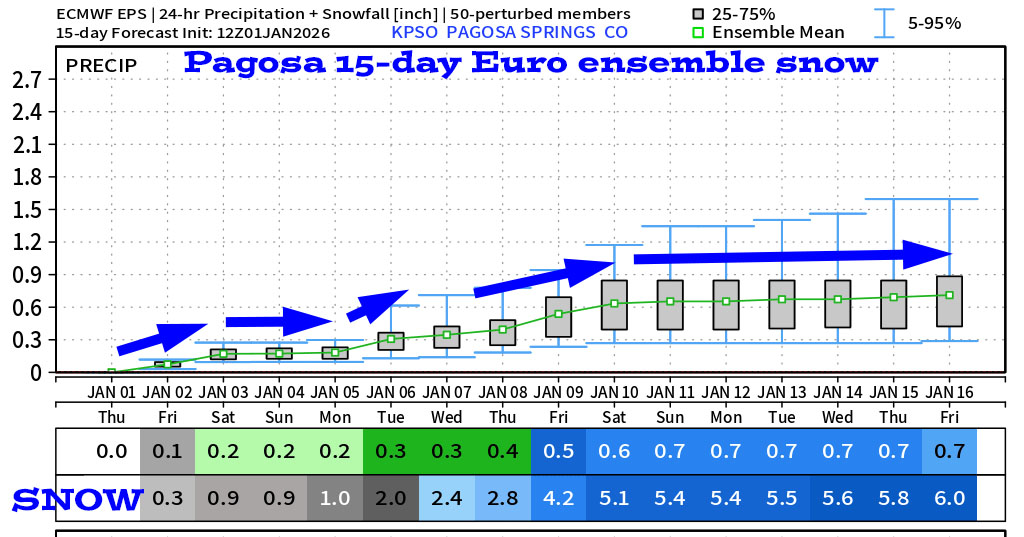
*** Monday and the rest of next week looks active with multiple chances for light snow. ***
Forecast details…
Thursday into early Friday afternoon… A weak system will move through early Friday afternoon. The system will move west to east across CO with upper-level flow out of the west. This doesn’t favor us, so my expectations are low.
Snow levels will be 8,000-8,500ft.
Up to 0.10” of rain is possible below 8,000ft. Up to a half inch of snow is possible 8,000-8,500ft. 2-4” of snow is possible in our mountains – most will fall early Friday morning into early Friday afternoon.
Late Friday afternoon through Sunday… The ridge will wobble over our heads and slightly to our east. This puts us on the edge of a weak system on Sunday. Patches of clouds will move through and there might be a few spotty snowshowers over the mountains on Sunday, but I expect the Pagosa area to stay dry.
A few lucky spots in the mountains could get an inch of snow Sunday, but don’t hold your breath.
Monday and the rest of next week… A long-wave trough will set up over the western US – finally! This means that the storm track will be in our “neighborhood” and a series of low-pressure systems will impact us. Unfortunately, none of the systems are impressive, but there is still time for things to come together for a decent storm.
Rough timing and snow amounts…
Storm 1 – Monday morning to Monday evening
Pagosa area: a dusting of snow
Mountains: 1-2”
Storm 2 – Wednesday night to the following Saturday morning
Pagosa area: 2-4”
Mountains: 5-10”
*** There is still a lot of uncertainty. I’ll adjust the details as the data gets better. ***
Temps…
Thursday highs will be in the mid-30s to low 40s and lows will be high 20s to the high 30s.
Friday highs will be in the low to high 40s and lows will be in the high teens to mid-20s.
Saturday and Sunday highs will be in the mid-40s to low 50s and lows will be in the high teens to high 20s.
Monday and Tuesday highs will be in the low to high 40s and lows will be in the high teens to high 20s.
Wednesday and next Thursday highs will be in the high 30s to mid-40s and lows will be in the mid-20s to low 30s.
Winds…
Thursday, Saturday, Sunday, and Wednesday afternoon peak winds will be around 10mph in the Pagosa area. In the high country, afternoon gusts will be 20-25mph.
Friday, Monday, Tuesday, and next Thursday afternoon gusts will be 10-15mph in the Pagosa area and 25-30mph in the high country.
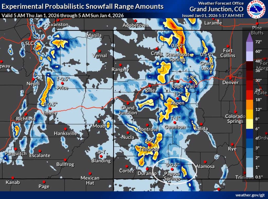
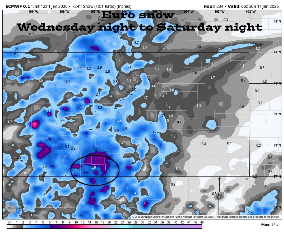
10 Jan to 16 Jan… Some models show the storm track staying in our “neighborhood” while others show the ridge building back over the region. I don’t see anything to get excited about and I think this period will be quiet.

Those amounts vary considerably. I don’t trust the forecast models.

The next post will be on Saturday.
– Shawn


