

It’s always a treat to see and hear these guys! – Pic taken 12/30/2025
Tuesday – 30 Dec 2025 – 1:15pm
The past…
Stevens Field Observations
Sunday: High: 40, Low: 19, Peak Wind: 18mph
Monday: High: 45, Low: 13, Peak Wind: 7mph
| Average High | Record High / Year | Average Low | Record Low / Year |
| 35 | 55 / 1956 | 1 | -25 / 1909 |
Precipitation summary… There has been no recent measurable precip.
Current satellite and radar…
There is nothing on radar in our area Tuesday afternoon.
Forecast highlights…
*** The rest of Tuesday through Wednesday will be mostly sunny, with light winds, warming temps, and dry weather. ***
*** Thursday morning into Friday morning a few scattered showers are possible with light precip amounts. ***
*** Friday afternoon through Monday a few spotty snowshowers are possible over the mountains, but the Pagosa area will stay dry. ***
Forecast details…
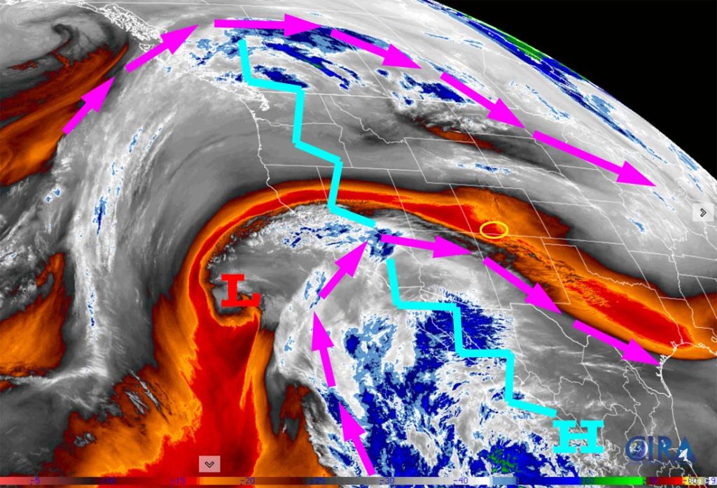
The rest of Tuesday through Wednesday… The ridge will weaken a little and move a little to our east late Wednesday. For most of this period we’ll have lots of sun, light winds, dry weather, and temps will gradually warm. Clouds will increase from the south Wednesday evening.
Thursday into Friday morning… A weak system will move through Thursday morning into Friday morning. The system will move west to east across CO with upper-level flow out of the west. This doesn’t favor us, so my expectations are low.
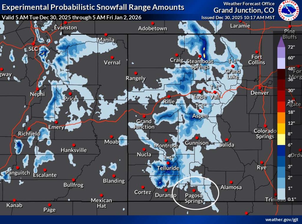
The snow level will be around 8,500ft. A few “rainflakes” are possible in the Pagosa area and 1-2” of snow is possible in the mountains.
Friday afternoon through Monday… The ridge will wobble over our heads and slightly to our east. This puts us on the edge of a few weak systems. Patches of clouds will move through and there might be a few scattered snowshowers over the mountains, but I expect the Pagosa area to stay dry.
A few lucky spots in the mountains could get an inch of snow Sunday or Monday, but don’t hold your breath.
Temps…
Tuesday highs will be in the mid-40s to the low 50s and lows will be in the mid-teens to mid-20s.
Wednesday highs will be in the high 40s to mid-50s and lows will be near 20 to near 30.
Thursday highs will be in the low to high 40s and lows will be in the high 20s to mid-30s.
Friday through Monday highs will be in the mid-40s to low 50s and lows will be in the high teens to mid-20s.
Winds…
Afternoon peak winds will be around 10mph in the Pagosa area. In the high country, afternoon gusts will be 20-25mph. The windy spots will be around 5mph stronger on Sunday.
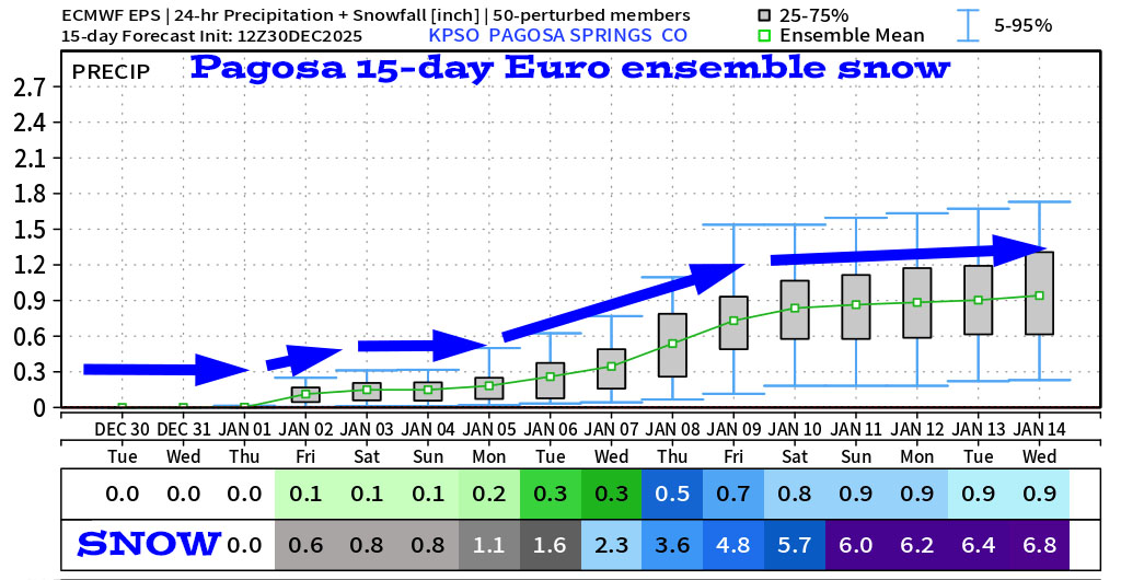
6 Jan to 14 Jan… This period looks active, but I don’t see any big storms on the horizon. Let’s hope a storm parks itself over us and bumps up our snowpack!

The forecast models are fluctuating considerably so I don’t trust them.

The next post will be on Thursday.
– Shawn


