

Not snow but Tommy loves it anyway! – Pic taken 12/28/2025
Sunday – 28 Dec 2025 – 4:30pm
The past…
Stevens Field Observations
Friday: High: 48, Low: 30, Peak Wind: 8mph
Saturday: High: 43, Low: 31, Peak Wind: 20mph
| Average High | Record High / Year | Average Low | Record Low / Year |
| 36 | 54 / 1989 | 1 | -25 / 1988 |
Precipitation summary… Wolf Creek reported 5” of new snow. That’s about half of what I expected.
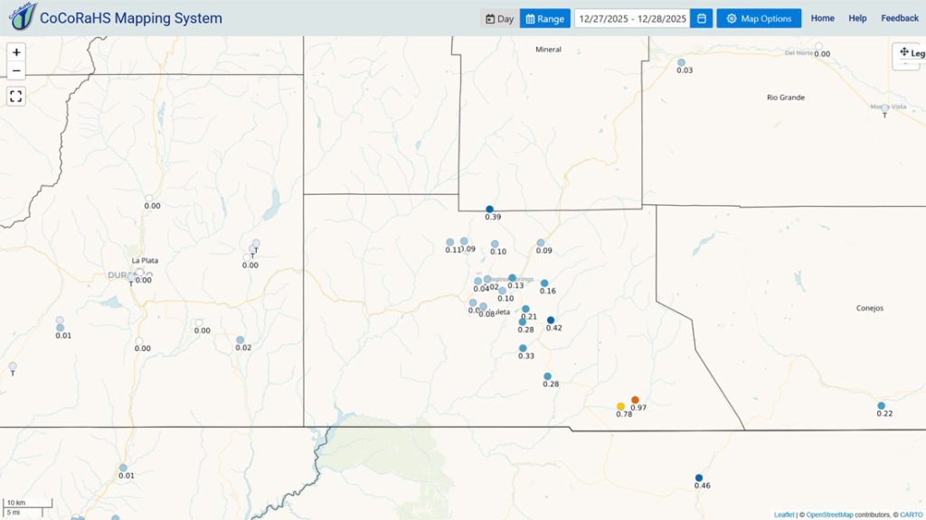
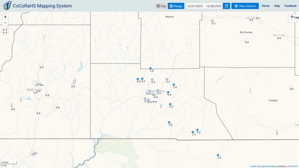
Our friends in the Chromo area were the rain and snow lottery winners!
Current satellite and radar…

There is nothing on radar in our area Sunday afternoon.
Forecast highlights…
*** Sunday afternoon through Wednesday will be mostly sunny, with light winds, warming temps, and dry weather. ***
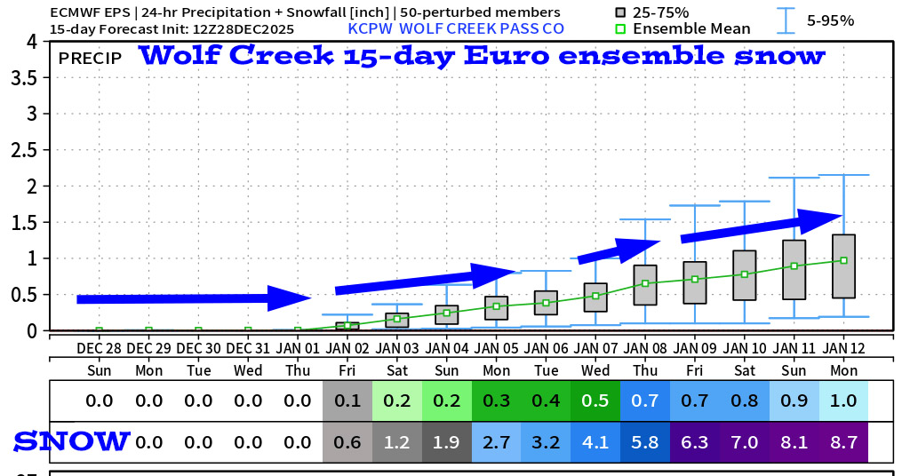
*** Thursday into the first part of next week looks active with chances for light precip. ***
Forecast details…
Sunday afternoon through Wednesday… A ridge will build back over the region. We’ll have mostly sunny skies, light winds, dry weather, and temps will gradually warm to above average.
Thursday through next weekend… A weak system will move through Thursday into Friday morning and then another weak system is possible next weekend into next Monday.
Details…
Storm 1 Thursday into Friday morning the snow level will be around 8,500ft. A few “rainflakes” are possible in the Pagosa area and 1-3” of snow is possible in the mountains.
Storm 2 next weekend into next Monday the snow level will start around 8,500ft and gradually drop to 7,000ft. Much like the system that just moved through, this won’t be organized and will lack moisture so precip amounts will be low. In the Pagosa area up to 1” of snow is possible and in the mountains 2-4” of snow is possible.
*** I will adjust the details as the data gets better. ***
Temps…
Sunday night lows will be mid-single digits to mid-teens
Monday highs will be in near 40 to the high 40s and lows will be in the high single digits to high teens.
Tuesday and Wednesday highs will be in the mid-40s to the mid-50s and lows will be in the mid-teens to mid-20s.
Thursday through next weekend highs will be in the low to high 40s and lows will be in the high 20s to mid-30s.
Winds…
Sunday through Thursday, afternoon peak winds will be around 10mph in the Pagosa area. In the high country, afternoon gusts will be 20-25mph.
Friday through next weekend afternoon gusts will be 10-15mph in the Pagosa and 25-30mph in the mountains.

There is still a lot of uncertainty for this forecast period.
5 Jan to 13 Jan… Upper-level zonal, west to east flow will push weak, fast-moving systems through the region. This doesn’t favor us. I don’t expect much snow during this period.

The forecast models are fluctuating considerably so I don’t trust them.

The next post will be on Tuesday.
– Shawn


