
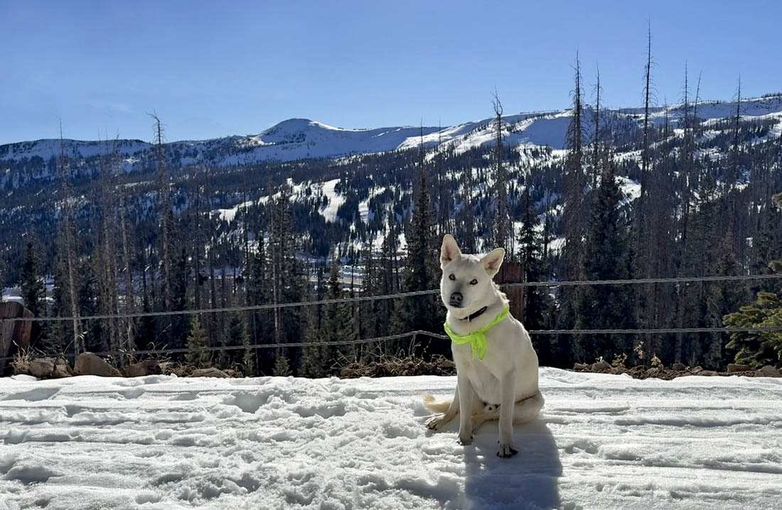
Tommy had a fun snow adventure up by Wolf Creek! – Pic taken 12/16/2025 by Arleen
Tuesday – 16 Dec 2025 – 5:30pm
The past…
Stevens Field Observations
Sunday: High: 56, Low: 21, Peak Wind: 6mph
Monday: High: 52, Low: 23, Peak Wind: 6mph
| Average High | Record High / Year | Average Low | Record Low / Year |
| 40 | 60 / 1959 | 5 | -24 / 1940 |
Precipitation summary… There has been no recent measurable precip.
Current satellite and radar…
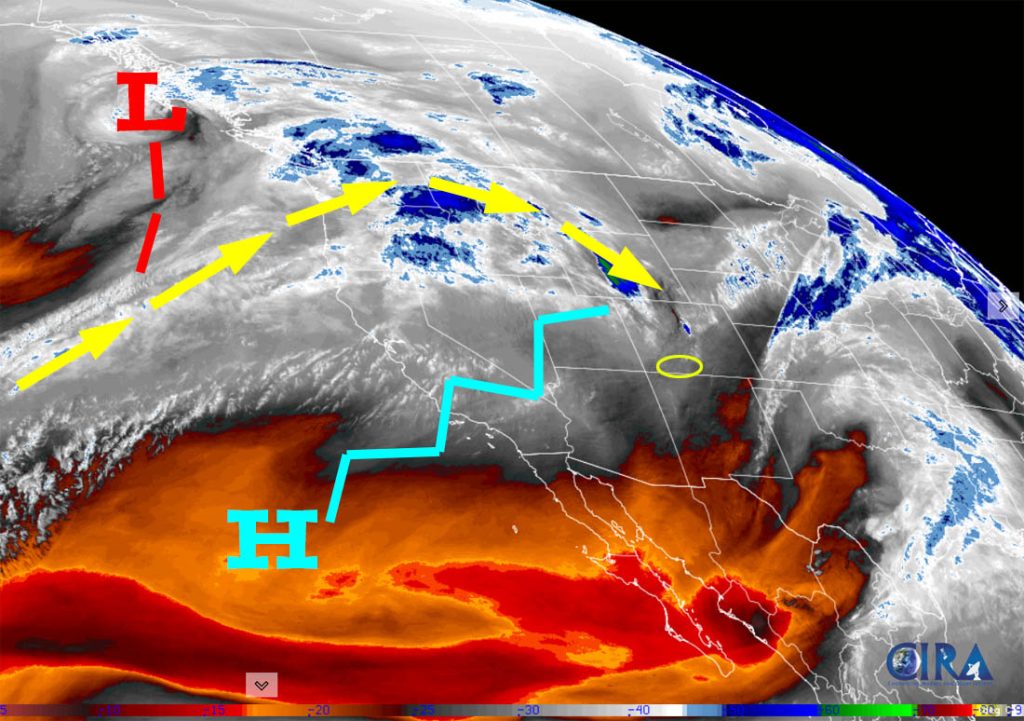
There is nothing on radar in our area Tuesday afternoon.
Forecast highlights…
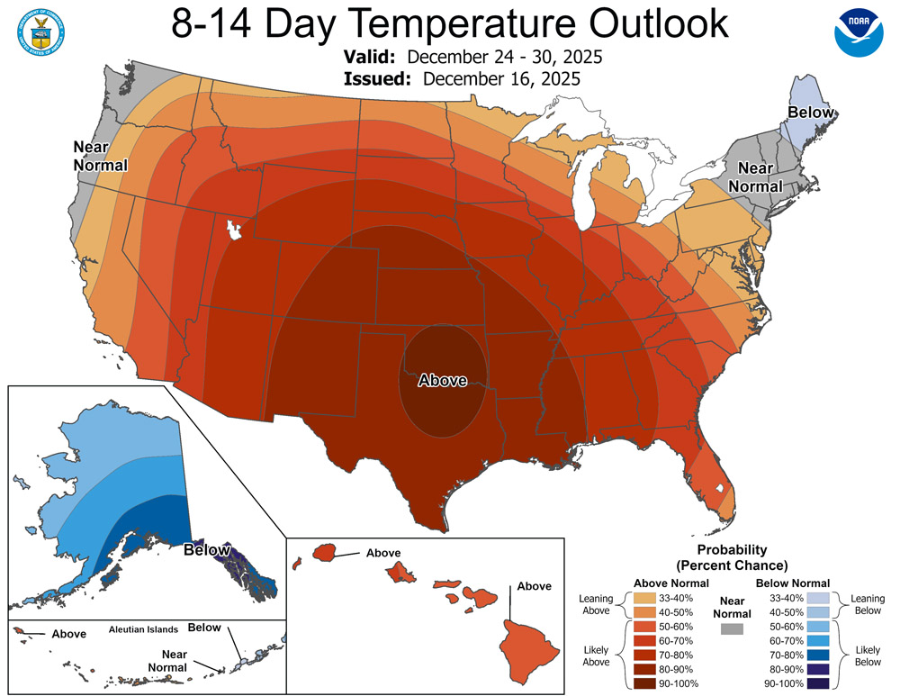
*** Lots of sun, mostly dry, and warm temps through 24 Dec. ***
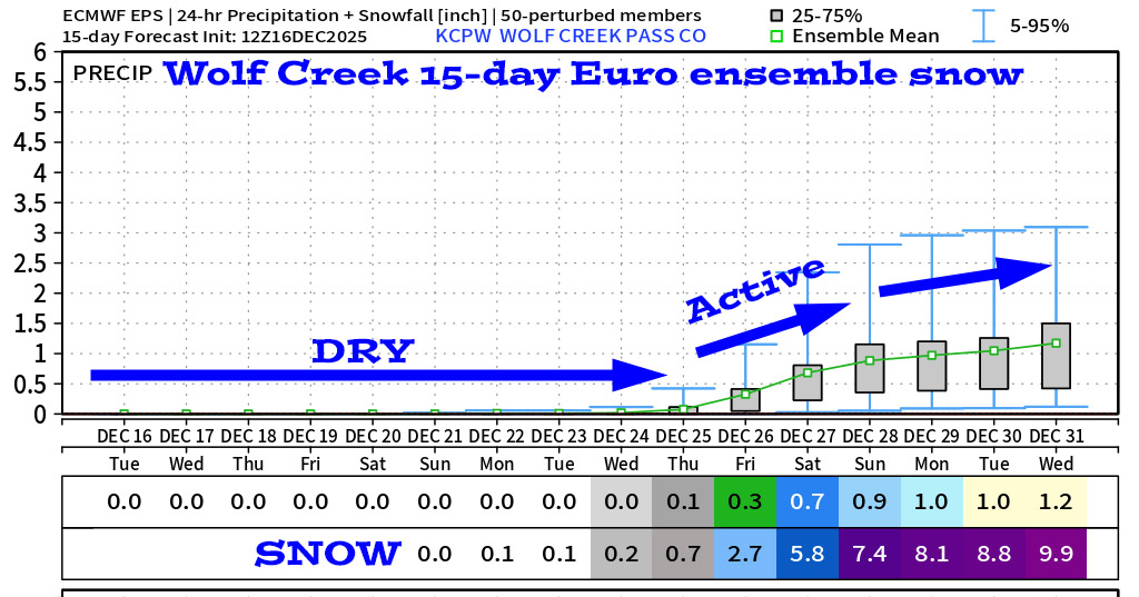
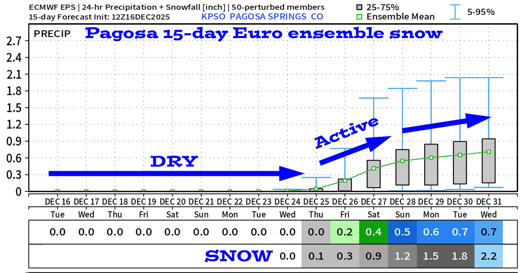
*** The weather pattern will try to get more active starting around 25 Dec. ***
Forecast details…
Rest of Tuesday through next Wednesday… A giant, blocking, evil ridge is forcing the storm track well to our north. We’ll have lots of sun and temps 10-15 degrees above average.
Temps…
Tuesday night lows will be in the mid-teens to mid-20s.
Wednesday through next Wednesday highs will be in the high 40s to mid-50s and lows will be in the mid-teens to mid-20s.
Winds…
In the Pagosa area, afternoon peak winds will be 10-15mph each day. In the high country, winds will gust to around 30mph with the strongest gusts around 35mph Wednesday afternoon into Wednesday night.
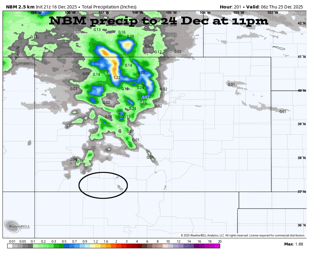
The 9-14 day period… The giant, blocking, evil ridge is expected to shift towards the Gulf around 24 Dec. This would allow a long southwest fetch to push moisture into the desert Southwest. Right now jetstream support and storm energy look weak so precip amounts have trended down.
Of course there is no cold air to our southwest, so this system will start off warm. Initially snow levels will creep up to around 9,000ft and then drop below 8,000ft around 27 Dec.
This is 9-14 days out, so my confidence in the details is still minimal, but this is how it looks right now…
The best chance for precip is Christmas night through 27 Dec.
Mountains: 8-16”
Pagosa area above 8,000ft: 1-3”
Pagosa are below 8,000ft: up to 1”
*** Again, I have very little confidence in the timing or snow amounts. Both will continue to change as the storm gets closer and the data gets better. ***


The next post will be on Thursday.
– Shawn


