

Love these fall scenes in Pagosa Country! – pic taken 10/16/2025
Monday – 20 Oct 2025 – 4:00pm
The past…
Stevens Field Observations
Saturday: High: 59, Low: 26, Peak Wind: 16mph
Sunday: High: 63, Low: 28, Peak Wind: 20mph
| Average High | Record High / Year | Average Low | Record Low / Year |
| 61 | 77 / 1991 | 25 | 10 / 1946 |
Precipitation summary and river levels… There has been lots of sun and no precip in the last 2 days.
Current satellite and radar…

There is nothing on radar in our region Monday afternoon.
Forecast highlights…
*** Monday afternoon through Wednesday afternoon there will be lots of sun and dry weather. ***
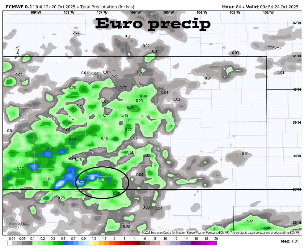
*** Wednesday night and Thursday a little bit of valley rain and a little bit of mountain snow is possible. ***
*** Friday and Saturday will be nice. ***
*** Sunday and Monday we might catch the southern end of a trough and a few scattered showers. ***
Forecast details…
Monday afternoon through Wednesday afternoon… A ridge will give us sunny and dry weather through Wednesday afternoon.
Wednesday night and Thursday… A weak trough will move through and kick up a few scattered showers.
The best chance for precip is Thursday morning through Thursday afternoon. Precip amounts will be low. The Wolf Creek area will get a dusting to 2” of snow.
Friday and next Saturday… Transient ridging will give us partly cloudy skies, dry weather, and temps near average.
Sunday and Monday… A trough will skirt to our north. We’ll have more clouds and a few spotty showers and thunderstorms. Precip amounts will be low unless the system dips farther south.
Temps…
Monday night lows will be in the mid-20s to mid-30s.
Tuesday highs will be near 60 to the mid-60s and lows will be in the mid-20s to mid-30s.
Wednesday highs will be in the mid to high 60s and lows will be in the low 30s to the low 40s.
Thursday through Monday highs will be in the mid-50s to low 60s and lows will be in the high 20s to the high 30s. On clear nights, the cold spots will dip into the mid-20s.
Winds…
Gusts each afternoon through Saturday will be 15-20mph.
Sunday and Monday afternoon gusts will be 25-30mph.
*** As always, stronger isolated gusts are likely near a shower or thunderstorm. ***

The 8-14 day period… The models show a weak system around 26-28 Oct but are otherwise mostly dry.


The next post will be on Wednesday.
– Shawn


