

Much of the county was treated to an incredible sky last night! – taken on 10/15/2025
Thursday – 16 Oct 2025 – 1:00pm
The past…
Stevens Field Observations
Wednesday: High: 69, Low: 43, Peak Wind: 32mph
| Average High | Record High / Year | Average Low | Record Low / Year |
| 64 | 78 / 1958 | 26 | 11 / 1956 |
Precipitation summary, river levels, lake levels, and drought conditions…
A band of showers and thunderstorms developed over western Archuleta County yesterday afternoon and got stronger is hit the eastern part of the county and Chama.
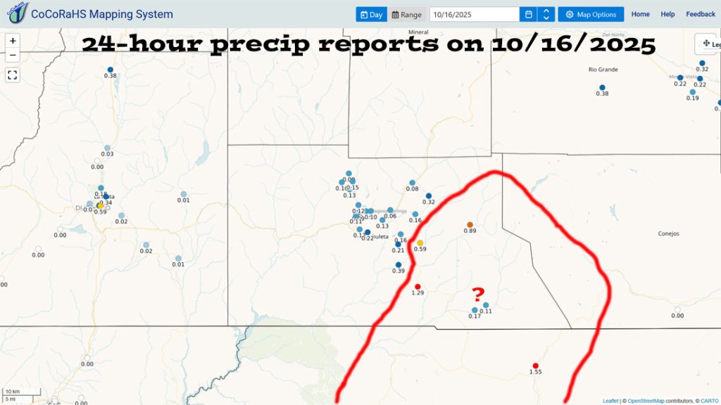
A strong band of showers and thunderstorms moved through the area circled in red. Note the 1.55” for Chama. Those two reports near Chromo near baffle me. It’s amazing that the band of strong showers skirted them!

For perspective, October average precip for Pagosa Springs is 2.27” and 4.39” for Wolf Creek Pass.


Area streams are still high but are coming down steadily so the lakes will continue to rise a bit over the next few days.
That inflow on 14 Oct is incredible.

Current satellite and radar…

There is nothing on radar in our region around noon on Thursday.
Forecast highlights…
*** HARD FREEZE in the Pagosa Springs area Thursday and Friday nights with temps in the low to high 20s. ***
*** Thursday afternoon through Tuesday there will be lots of sun and dry weather. ***
*** Wednesday and next Thursday a weak system with a little bit of valley rain and little bit of mountain snow is possible. ***
Forecast details…
Rest of Thursday through Tuesday… Ridging will build over the region and give us lots of sun and dry weather. Temps will be 5 degrees below average to near average.
Wednesday and next Thursday… A weak trough will move through and kick up a few scattered showers. Precip amounts will be low. Mountains above 10,000ft could get 2-5″ of snow.
Temps…
Thursday and Friday highs will be in the mid-50s to low 60s and *** lows will be in the low to high 20s. ***
Saturday, Sunday and Monday highs will be near 60 to the high 60s and lows will be in the mid-20s to mid-30s.
Tuesday, Wednesday, and next Thursday highs will be in the mid-50s to low 60s. Tuesday night low will be in the mid-20s to low 30s. Wednesday and next Thursday lows will be near 30 to the high 30s.
Winds…
Thursday, Friday, Saturday, and Sunday afternoon gusts will be 15-20mph.
Monday afternoon gusts will be 25-30mph.
Tuesday, Wednesday, and next Thursday afternoon gusts will be 15-20mph.
*** As always, stronger isolated gusts are likely near a shower or thunderstorm. ***
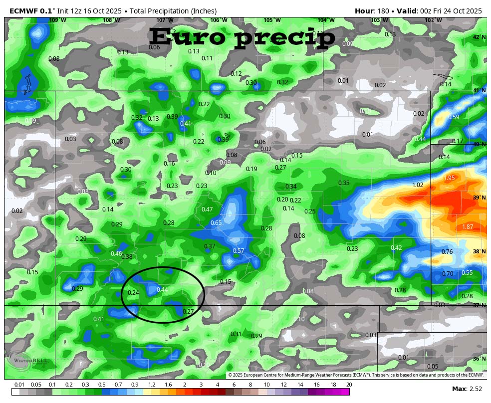
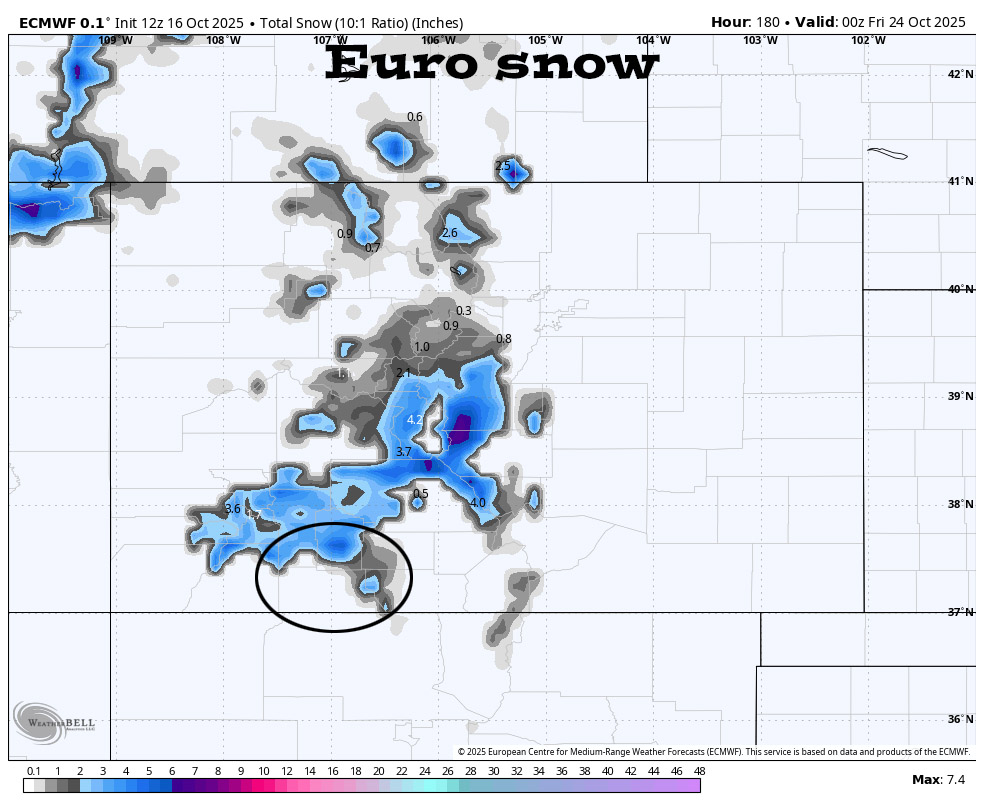
The 8-14 day period… The models show a weak system around 27-28 Oct but are otherwise mostly dry.

The next post will be on Saturday.
Please come see us tomorrow at 5:30pm at Pagosa Lodge!
– Shawn


