
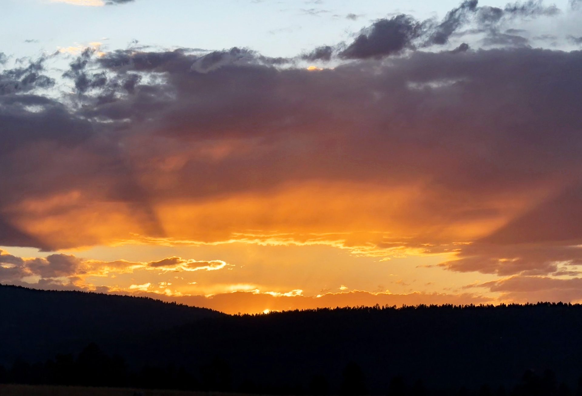
The only good from the fire smoke is pretty sunsets. – Pic taken 8/7/2025
Friday – 8 Aug 2025 – 6:30pm
The past…
At Stevens Field the high temperature on Thursday was 88 and so far today (Friday) it has been 86. The low on Thursday morning it was 49 and this morning it was 52.
The minimum relative humidity Thursday afternoon and today (Friday) was 11% with a dew-point of 27. This indicates it is still very dry. Remember, we want to see dew-points in upper 40s for good monsoon showers.
The peak wind at Stevens Field on Thursday was 29mph and today (Friday) has been 38mph!
| Average High | Record High / Year | Average Low | Record Low / Year |
| 82 | 90 / 1969 | 45 | 29 / 1956 |
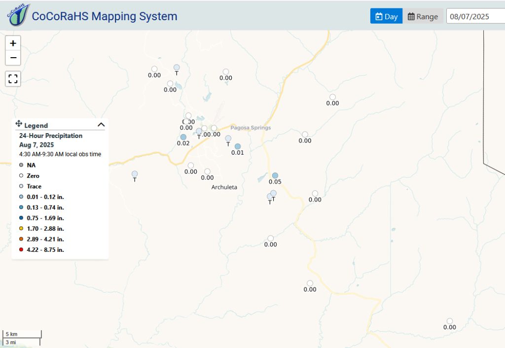
Precipitation summary… There were a few reports yesterday morning of precipitation that fell Wednesday afternoon. Sarah down on Hwy 84 reported .05″ There was one trace report this morning for precip from yesterday afternoon/evening. Sharp eye, Mark!
Fire and smoke…
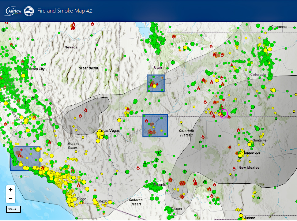
Fire.AirNow.gov site is showing good air quality over Pagosa at this time. We have smoke coming into our area from a number of fires. Smoke will settle and be worse overnight and in the morning.
As of Friday, The Middle Mesa Fire burning east of Navajo Lake just south of the CO/NM border is 4,837 acres and 7% contained.
The Stoner Mesa Fire west of Rico in Dolores county is up to 1,142 acres this afternoon and 0% contained.
The Dragon Bravo Fire that is in Arizona and responsible for most of the smoke advecting into our area is at 134,049 acres and 36% contained.
Forecast discussion…
Satellite
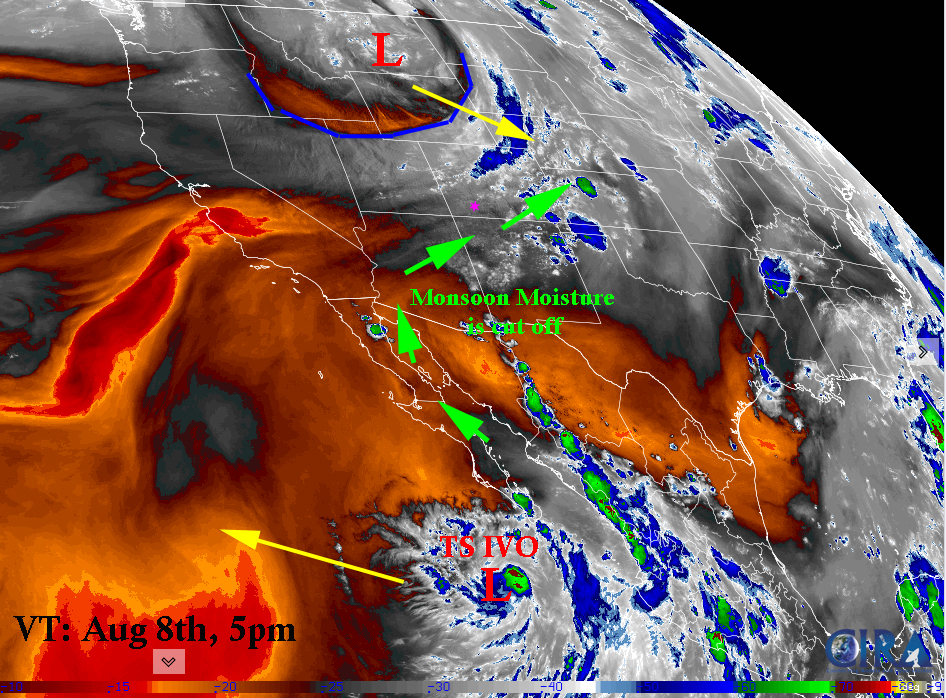
Satellite image: Valid Time August 8th, 5:00pm.
The Polar Front Jet has dipped into northern Utah and southern Wyoming dragging an area of low pressure and frontal system with it. This is very unusual for this time of the year. It is more of a fall sort of weather system. It has beaten back our subtropical ridge. In addition the monsoonal moisture fetch has been cut off.
HellO, IvO, why don’t you come visit? It won’t. It will just head out into the Pacific.
Radar
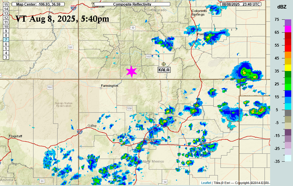
Forecast highlights…
*** NOTE: Stage 2 Fire Restrictions are in effect for the entire San Juan National Forest!!!***
*** Stage 1 Fire Restrictions are in effect for Archuleta County***
*** Concerned about fire danger through the week with lots of sun, warm, dry, and gusty afternoon winds. ***
*** If you spot smoke, call Archuleta County dispatch at 970-731-2160. ***
Friday… Subtropical Ridge has been pushed to the south. Area of low pressure is moving in from the north pressing against what is left of our subtropical ridge to the south. This is causing a compression of the gradient and very blustery winds.
Partly Cloudy with fair weather cumulus. Notice the cumulus has not been building in the afternoon heat at all.
Temps… Highs will be in the mid-80s to upper-80s and lows will be in the low 40s to mid-40s.
Winds… afternoon gusts could gust as high as 40mph.
Saturday
Mostly Cloudy with upper level cloudiness as a weak frontal system pushes through. Flow will primarily be out of northwest. We could see smoke from the Stoner Mesa Fire
Temps: Highs will be in the mid-80s to upper-80s. Lows will be lo-40s to mid-40s. It is a very weak cold front…
Winds: afternoon gusts will be around 30mph. Expect to see some higher gusts as front pushes through in the morning.
Sunday through Thursday
The ridge will try to rebuild. Moisture will slowly advect into area with chance of precip increasing each day and chance of gusty winds decreasing. Sunday will be partly cloudy and we will see increasing clouds each day as well.
There is a slight chance on for an isolated shower or thunderstorm every day. Consider yourself lucky if you get enough rain to wet the ground. Unfortunately, it means lightning without higher relative humidities and rain. So the chances of wildfire outbreaks increases.
Temps: Highs will will increase throughout the week from low-80s to low 90s by Thursday. Lows will be mid-40s.
Winds: Sunday will still have afternoon winds gusting to 25mph. The rest of the week will see afternoon gusts to 20mph. As always, stronger isolated gusts are likely near a shower or thunderstorm.
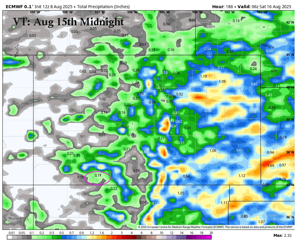
Total Precip Amounts from today through Friday, the 15th at midnight. Weak precip in the valley. Up to 1″ in the mountains.
The 8-14 day period… A weak monsoon pattern with weak moisture and weak instability will persist. Expect isolated showers and thunderstorms most afternoons. Precip amounts will vary considerably. There is the potential for an uptick after the 18th. And the GFS is hinting at a tropical system after the 23rd. That is a ways out yet but something to keep an eye on.
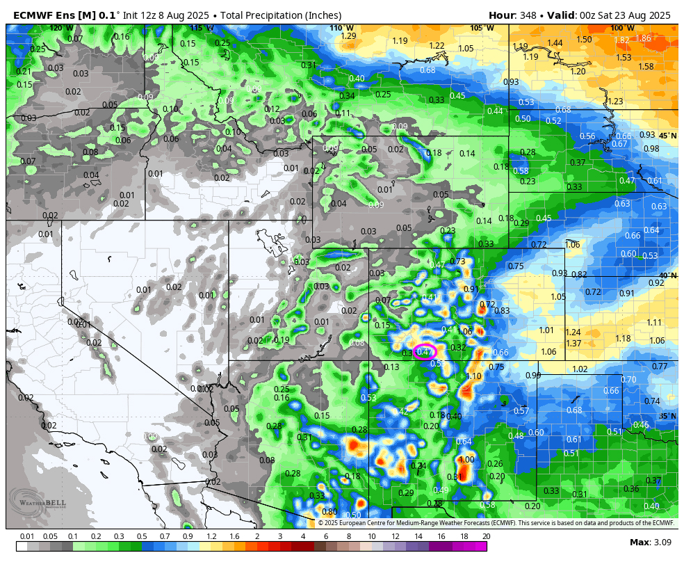
The Euro model shows .47″ for Pagosa and up to 1.8″ for the mountains over the next two weeks.
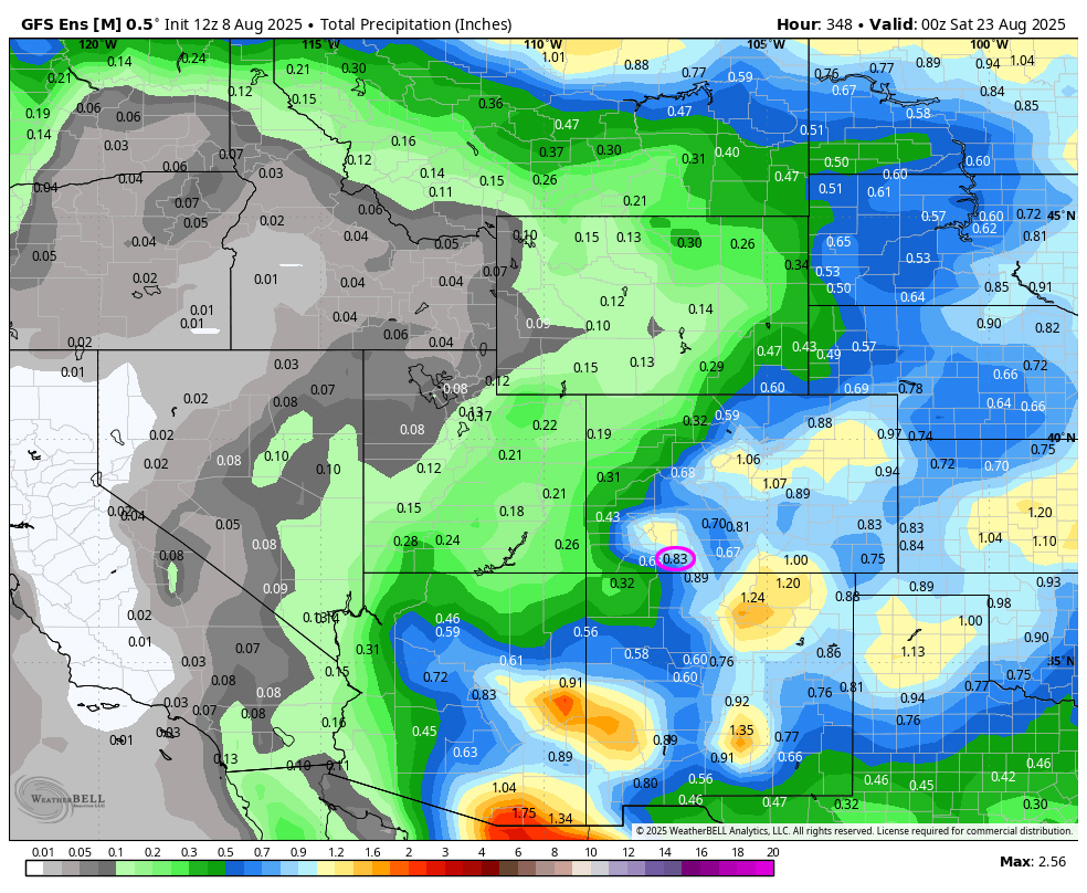
The GFS model shows .83″ for Pagosa and up to 1″ for the mountains over the next two weeks.
We need a good, deep tropical moisture storm to give the southwest and the firefighters some relief.
Unless something interesting pops up, my next post will be on Sunday.
– Arleen


