

Beautiful sunset last night! Shows good mid-level moisture for today’s showers. June 29th (Click on title of post to picture)
Monday – 30 Jun 2025 – 4:50pm
The past…
At Stevens Field we’ve had typical early summer weather, warm, dry, gusty winds…
Sunday, Hi Tmp 87, Lo 44, Pk Wind G22, Min RH 8%, Dew Point 19.
Monday (today), Hi Tmp 81, Lo 49, Pk Wind G23, Min RH 25%, Dew Point 34.
| Average High | Record High / Year | Average Low | Record Low / Year |
| 82 | 97 / 1990 | 42 | 28 / 1942 |
Precipitation summary… There was no precip reported in the last 48 hours. There are a few showers in the area today. Those should be on tomorrow morning’s summary.
Remember, starting July 1st, 2025, the San Juan National Forest Zone 1 will go into Stage I Fire Restrictions. For more information and maps, refer to the San Juan National Forest website alert page.

Forecast discussion…
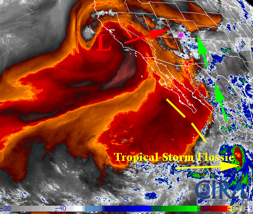
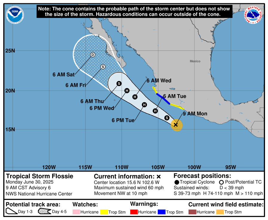
Main monsoon plume is to our east wrapping around subtropical ridge. A weak low is just off the coast of California and will move east. This will help enhance our southwest flow and tighten gradient. Later in the week, we’ll see residual moisture from Tropical Storm Flossie!
Radar
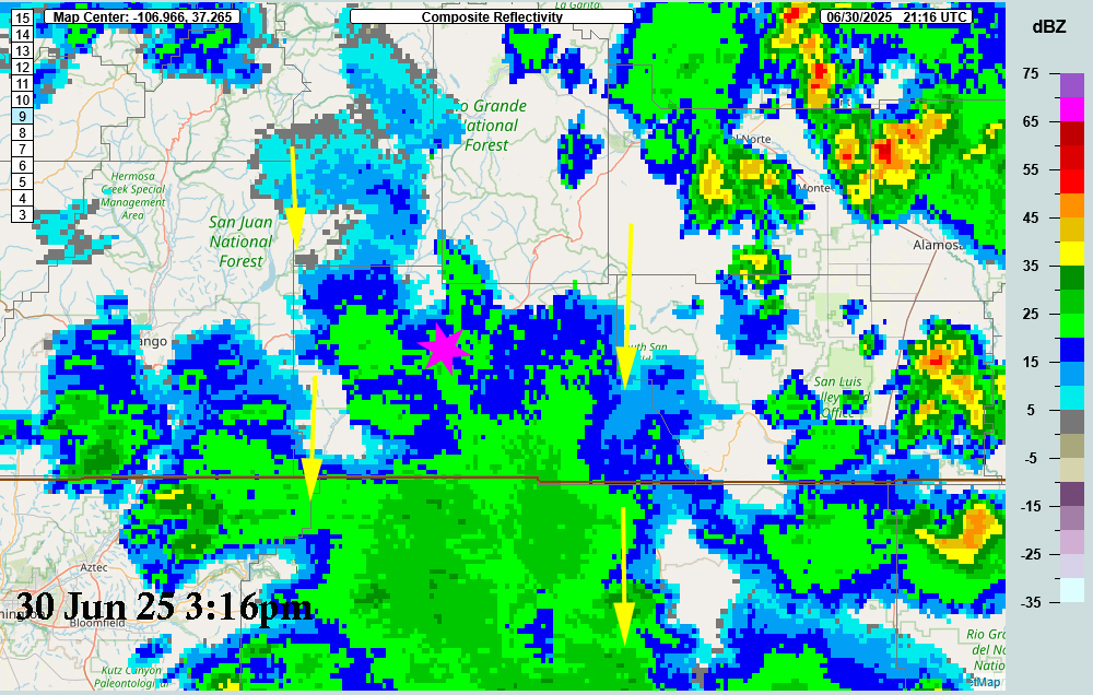
Today’s radar has been fun to watch. At 10am there wasn’t anything on radar. By 11:30am stuff had blown up everywhere there was a mountain! We had a few thunderstorms by 1:30pm. We had an area of lightning as of 3:00pm. There is very weak flow from the north to the south.
Forecast highlights…
*** Monsoon showers today through Thursday***
***Fair Weather returns for 4th of July and the weekend***
Monday through Thursday… We’ll wake up to bright sun and then clouds will start to build over the mountains in the late mornings and spread throughout the rest of county in the afternoon. Scattered showers and thunderstorms are possible each afternoon and into the evening. As Shawn says, we are usually treated to a pretty sunset, and sometimes a brilliant rainbow.
Thursday will be the cloudiest day and has the potential for the most precipitation as the remnants of TS Flossie moisture gets wrapped in monsoon flow.
A note about monsoon storms… Rain is not guaranteed for you every day. Convective showers are always spotty and usually short-lived. Subtropical monsoon moisture can result in very heavy downpours that only last 15-30 minutes.
The subtropical ridge is at a good height. Dew points will be near 50 through this time (though it is only 34 today – up 15 degrees in 24 hours). We really want them over 50. The polar front jet is still too far south. However, the first baroclinic low that generates and is moving into our area today will enhance our southwest flow and advection of the moisture.
The models are not agreement. The GFS was correct in TS Flossie deepening. The Euro fills Flossie much quicker than the GFS. The difference for us is that if the GFS solution is correct, we’ll get a lot more moisture advected into the flow and into our area.
Temps… Highs on Tuesday will be lo 80s to upper 70s and slowly cool down each day till Thursday when they will be in the upper 70s to lo 70s. Low temps till Thursday will be in the mid- 40s.
Winds… Afternoon gusts will mostly be around 15mph, but isolated 30-40mph gusts are possible near showers and thunderstorms.
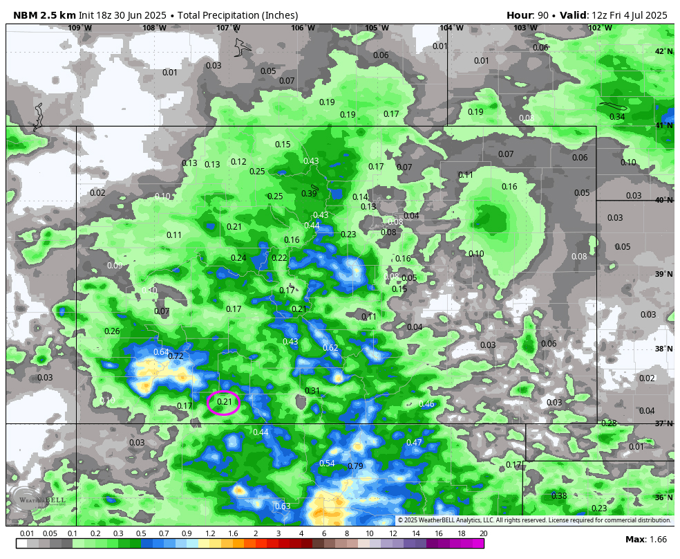
NBM precip to Friday morning shows 0.21” near Pagosa. This verifies well with product 2 days ago. Note: Precip will vary considerably.
Friday through Sunday
All models are agreeing that we will dry out for the 4th and for the weekend (July 5th/6th).
On Friday morning expect areas of fog or low stratus. Other wise it will be partly cloudy by noon and for the rest of the weekend.
Temps… Highs on Friday will be upper 70s to low 80s. Things will slowly warm up over the weekend as Sunday is expecting mid 80s to upper 80s for highs. Low temps low 40s to mid- 40s. Cold spots could see upper 30s on Friday and Saturday morning.
Winds… Afternoon gusts will mostly be around 15mph. Friday could see gusts near 22mph in the afternoon.
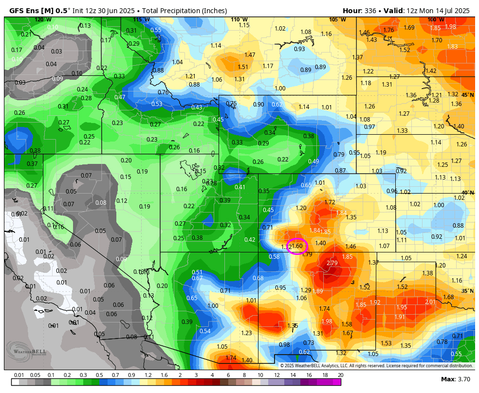
The 8-14 day period… The models really diverge. The Euro parks the ridge to our west over the 4 corners and cuts off the monsoon flow. The GFS keeps it just over our heads.
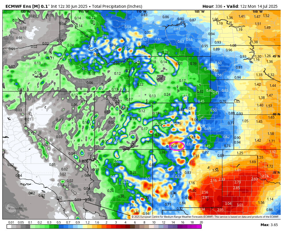
On the top, Euro ensemble precip to 13 Jul at 6am shows .81” in the Pagosa area. On the bottom, GFS ensemble precip shows 1.60”. Wow! The difference is due to what the two models are doing with the ridge and Flossie.
This is all spotty convective precip so amounts will vary considerably. A single slow-moving cell can drop 1” of rain in a short period over a small area. We’re playing the rain lottery!
Our next post will be on Wednesday.
– Arleen


