

Tommy had a nice morning at Hatcher Lake before the wind picked up – pic taken 3/31/2025
Monday – 31 Mar 2025 – 4:00pm
The past…
At Stevens Field the high temperature on Sunday was 45. The low this morning was 21.
The peak wind at Stevens Field on Sunday was 30mph.
| Average High | Record High / Year | Average Low | Record Low / Year |
| 52 | 72 / 1986 | 19 | -8 / 1975 |
Precipitation summary… We saw a few snowflakes yesterday afternoon and Wolf Creek got a dusting.
Forecast discussion…

There is nothing on radar in our region Monday afternoon.
Forecast highlights…
*** Three good chances for precip between Monday night and Sunday afternoon ***
*** The Grand Junction NWS has issued a WINTER WEATHER ADVISORY for the southwest San Juan Mountains. 4-8” of snow and winds gusting to 60mph are expected from 9pm Monday to 9pm Tuesday. *** This does not include Pagosa Springs.
*** Tonight into Tuesday afternoon falling snow, blowing snow, poor visibility, and slick roads will result in poor travel conditions across Wolf Creek Pass. ***
*** The Grand Junction NWS has issued a WIND ADVISORY for the San Juan River basin – this includes Pagosa Springs. Wind gusts to 50mph are expected 10am to 6pm Tuesday. ***
Monday night into next Sunday afternoon… Now it looks like three troughs will move through. The low currently off the WA coast will sink southeast into the northern AZ area and then wobble around for a few days. It will spin off a couple of weak troughs that will push bands of showers through the region.
Below are the best chances for precip. Spotty showers are possible between these periods and into Sunday afternoon, especially in the mountains.
1. Monday night into Tuesday evening – could see a thunderstorm or two during this period
2. Wednesday afternoon into Thursday evening
3. Friday afternoon into Saturday evening
None of the systems are strong, but the three together will result in good moisture for the region.
Snow levels will start around 8,500ft Monday night. By sunrise Tuesday, they’ll drop to around 7,600ft. The rest of this period the snow levels will bounce between 6,000ft each night to 7,200ft each afternoon.
We won’t need our snowblowers and snow shovels. Temps will be in the mid-30s to low 40s each afternoon so snow will struggle to accumulate. Any snow that falls during the night will melt in the afternoons.
*** Tuesday will be the windiest day of the week with gusts in the Pagosa area up to 45mph and gusts in the mountains 50-60mph. ***
Snow amounts Monday night through Tuesday night… Most of this will fall after midnight into Tuesday afternoon.
Mountains above 9,000ft: 4-8”
Pagosa area: up to 1”
Snow amounts Wednesday morning to sunrise Friday… Most of this will fall Wednesday afternoon into Thursday evening.
Mountains: 3-6”
Pagosa area: up to 2”
Snow amounts Friday morning to Sunday afternoon… Most of this will fall Friday afternoon into Saturday evening.
Mountains: 4-8”
Pagosa area: up to 2”
*** I’ll continue to make adjustments as the data gets better. ***
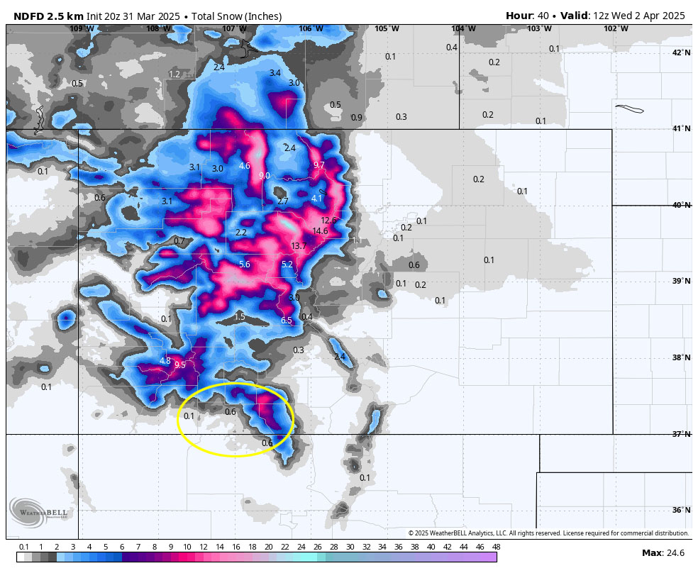

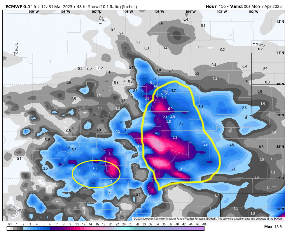
A couple of notes about this system… Most of this precip is expected between Friday afternoon and Saturday evening and then there will be hit and miss showers, mostly over the mountains. Upper-level flow could turn more southeasterly which would result in lower precip totals for us. South Fork could do well.
*** Travel along the I-25 corridor could be rough Friday night into Saturday afternoon. ***
The next post will be tomorrow. Arleen is also working on the monthly newsletter and I hope to get the monthly weather summary out in the next few days.
– Shawn


