

The pups love the new snow! – pic taken 3/14/2025
Friday – 14 Mar 2025 – 2:30pm
The past…
At Stevens Field the high temperature on Wednesday was 46 and on Thursday it was 45. The low this morning was 21.
The peak wind at Stevens Field last night was 43mph, at 12:55am.
| Average High | Record High / Year | Average Low | Record Low / Year |
| 47 | 62 / 1995 | 14 | -21 / 1913 |
Precipitation summary… The Pagosa area got around 2” more snow than I expected. Wolf Creek reported 12” of new snow this morning – in line with my forecast.
There were a bunch of great snow reports, pictures, and videos on our Facebook page – THANKS!

Forecast discussion…
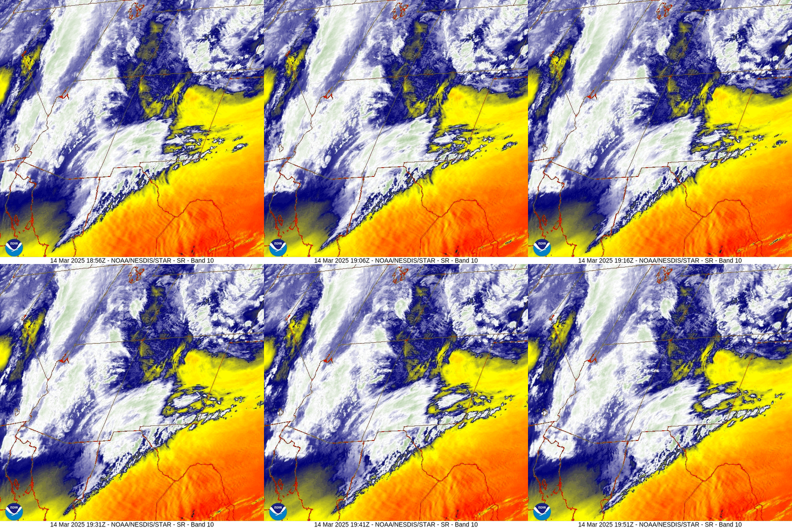

Forecast highlights…
*** We could be treated to a classic Pagosa Country sunset this evening! ***
*** Scattered snowshowers into Saturday afternoon. ***
*** Next storm Monday night into Tuesday night. ***
Rest of Friday through Saturday… Scattered snowshowers will gradually decrease Friday afternoon.
Between midnight and sunrise Saturday the high-resolution models show a little surge of storm energy and moisture moving through the southern part of the county. Those parts of the county could wake up Saturday to a half inch of new snow.
Saturday afternoon a weak trough will move through in northwest flow – not favorable for us. Scattered snowshowers will develop Saturday afternoon and then decrease Saturday evening.
Snow amounts from Friday at noon to sunrise Saturday…
Wolf Creek area: 2-4”
Pagosa area: up to 1” in the lucky spots
Snow amounts Saturday morning to midnight Saturday….
Wolf Creek area: 2-4”
Pagosa area: up to 1” in the lucky spots
Temps… Friday highs will be in the low to high 30s and lows will be in the mid-teens to low 20’s. If the clouds clear out more than expected, the lows will be 5-10 degrees colder. Saturday highs will be in the mid-30s to low 40s and lows will be the mid-single digits to mid-teens.
Winds… Friday afternoon gusts in the Pagosa area will be 25-35mph and in the mountains gusts will be 40-50mph. Saturday afternoon gusts will be 20-25mph.
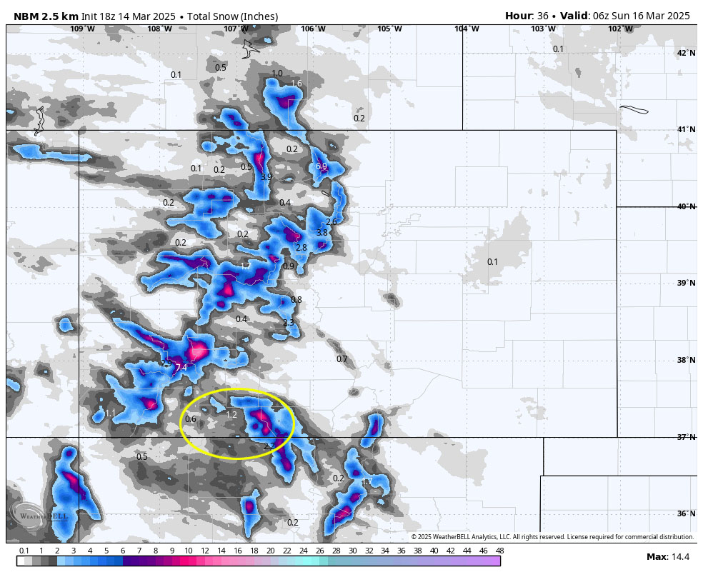
Sunday through Monday afternoon…
Sunday a fast-moving ridge will give us lots of sun and warmer temps.
Monday the ridge will move to our east and clouds will increase.
Temps… Sunday highs will be in the mid-40s to low 50s and lows will be mid-teens to mid-20s. Monday highs will be in the high 40s to mid-50s.
Winds… Sunday afternoon gusts will be 15-20mph. Monday afternoon gusts near Pagosa will be 20-25mph and the mountains could see gusts to 40mph.
Monday night into Tuesday night… The next storm will move through. It won’t have as much storm energy and moisture so precip amounts will be lower.
Scattered snowshowers will develop over the mountains late Monday night. The best chance for precip is sunrise to sunset Tuesday. Spotty snowshowers will persist into Tuesday night, mostly over the mountains, but additional snow accumulations will be minimal.
Snow amounts…
Wolf Creek area: 2-4”
Pagosa area: a dusting to 2”
Temps… Monday night lows will be in the low 20 to high 20s. Tuesday highs will be near 40 to the mid-40s and lows will be in the mid-teens to mid-20s.
Winds… *** Tuesday afternoon gusts in the Pagosa area will be 30-40mph and in the mountains gusts to 55mph are possible. ***

Wednesday morning through Thursday… A ridge will move through. We’ll see more sun and a warming trend.
Temps… Wednesday highs will be in the high 30s to the high 40s and lows will be in the high single digits to mid-teens. Thursday highs will be in the mid-40s to low 50s and lows will be in the mid-teens to low 20s.
Winds… Afternoon gusts will be around 20mph.
We hope to see you at the St Patrick’s Day Parade , tomorrow, March 15 at 11:15am at St Patrick’s Episcopal Church. Bundle up – it will be chilly!
The next post will be on Sunday. I’ll include the updated snowpack.
– Shawn


