
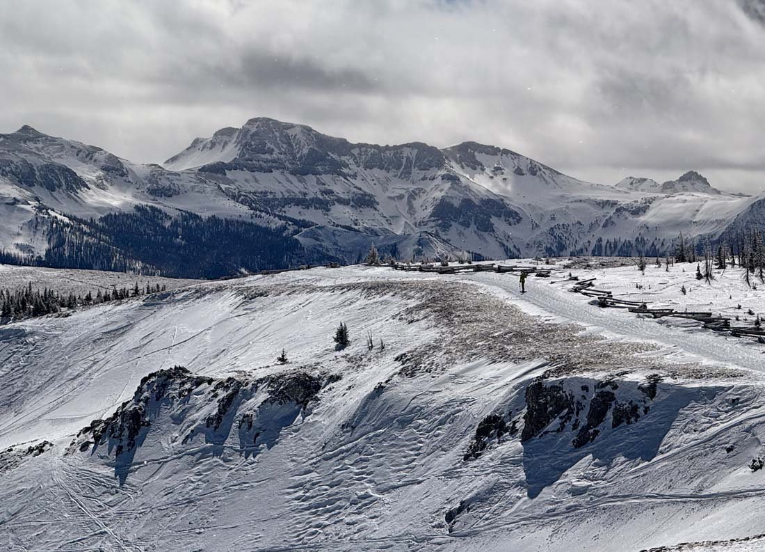
Hiking to the good stuff – pic taken 3/7/2025
Saturday – 8 Mar 2025 – 12:20pm
The past…
At Stevens Field the high temperature on Thursday was 39 and on Friday it was 41. The low this morning was 32.
The peak wind at Stevens Field Thursday afternoon was 52mph at 5:35pm and Friday evening it was 18mph.
| Average High | Record High / Year | Average Low | Record Low / Year |
| 47 | 66 / 1972 | 12 | -14 / 1931 |
Precipitation summary… Wolf Creek reported 3” in the last 24 hours. The Pagosa area got more snow than I expected.
The low tracked a little farther north and upper-level winds were light – the downslope component was weak. Wolf Creek’s winds were calm for a few hours over night.
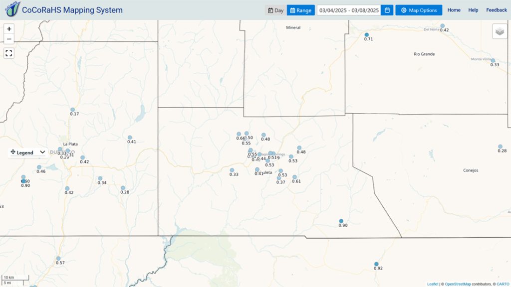
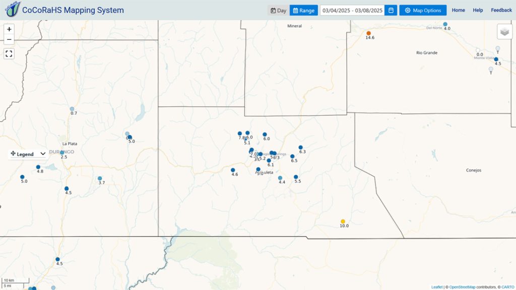
Our neighbor friends in South Fork got over 14”!
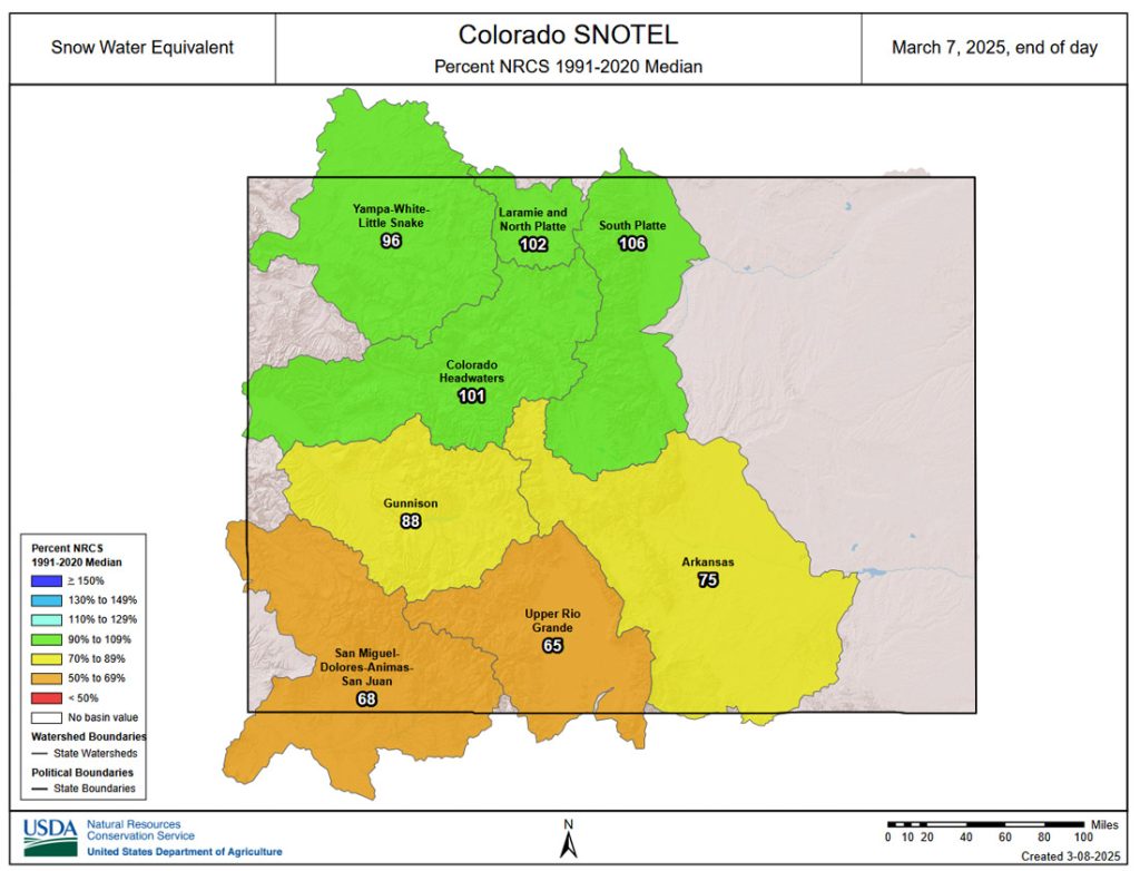
Forecast discussion…


Forecast highlights…
*** Lots of sun, warmer, and mostly dry through Wednesday. ***
*** Another round of snow Thursday and Friday. ***
Saturday afternoon into Tuesday afternoon… Spotty snowshowers will persist through Saturday afternoon. Lucky spots in the Pagosa area could get a half inch of snow. Wolf Creek could get another inch or two. Patchy fog will develop Saturday night into Sunday morning in low-lying areas.
Saturday night through most of Tuesday, a ridge will give us dry weather and a warming trend.
Clouds will increase Tuesday as the ridge moves to our east.
Temps… Saturday highs will be in the high 30s to mid-40s and lows will be in the low teens to low 20s. Sunday and Monday highs will be near 50 to the high 50s and lows will be in the low teens to low 20s. Tuesday highs will be in the high 40s to mid-50s.
Winds… Afternoon gusts Saturday and Sunday will be 10-15mph. Monday afternoon gusts will be 15-20mph. Tuesday afternoon gusts will be 20-25mph
Tuesday evening through Friday afternoon… Two systems will move through. The first one, Tuesday night into Wednesday morning, has just about gone poof. The second one, Thursday afternoon into Friday afternoon, is lining up nicely.
Timing… Spotty snowshowers will develop Tuesday evening into Wednesday morning, mostly over the mountains. Wednesday afternoon through Thursday morning should be dry. Thursday afternoon showers will gradually increase. The best chance for snow is Thursday evening into Friday morning, and then showers will be spotty through Friday afternoon.
The snow level could bounce up to 7,500ft during the day Thursday. “Rainflakes” will turn to snow after the sun sets Thursday evening.
Snow amounts Tuesday evening into Wednesday morning…
Our mountains: up to 1” – it will be spotty
Pagosa area: a dusting in a few spots
Snow amounts Thursday afternoon through Friday afternoon – most if it will fall Thursday night…
Wolf Creek area: 8-12”
Pagosa area below 7,500ft: 1-3”
Pagosa area above 7,500ft: 2-4”
Temps… Tuesday night lows will be near 20 to near 30. Wednesday highs will be in the mid-40s to low 50s and lows will be in the low 20s to near 30. Thursday highs will be in the low to mid-40s and lows will be in the high teens to mid-20s. Friday highs will be in the mid to high 30s and lows will be in the high single digits to mid-teens.
Winds… Wednesday afternoon gusts will be around 20mph. Thursday afternoon gusts in the Pagosa area will be 25-30mph and in the mountains gusts to 45mph are possible. Friday gusts in the Pagosa area will be 30-35mph and in the mountains gusts to 50mph are likely.
*** I’ll adjust timing and snow amounts as the data gets better. ***

Another storm is trying to take shape 17-19 March.
The next post will be on Monday.
– Shawn


