

It’s good to see pretty clouds this morning. I expect a foot of snow on that field by this time next week! – pic taken 8 Feb 2025
Saturday – 8 Feb 2025 – 11:40am
The past…
At Stevens Field the high temperature on Thursday was 54 and Friday it was 52. The low this morning was 25. The cold spots dipped into the mid-teens.
The peak wind at Stevens Field Thursday afternoon was 23mph and Friday afternoon it was 24mph.
| Average High | Record High / Year | Average Low | Record Low / Year |
| 41 | 56 / 1970 | 6 | -26 / 1989 |
Precipitation summary… There has been no recent measurable precip.
Forecast discussion…
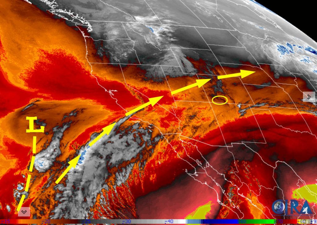
There is nothing on radar in our area.
Forecast highlights…
*** Sunday night through Tuesday morning hit and miss snowshowers – light snow accumulations. ***
*** Tuesday afternoon through early Wednesday afternoon increased snowshowers and a little more accumulation. ***
*** Thursday night into Saturday morning SNOWBLOWER ALERT and POOR TRAVEL CONDITIONS. ***
Saturday afternoon through Thursday morning… Upper-level southwest flow will gradually push more moisture into our area. It’s going to stay unsettled as weak troughs move quickly through the region. We’ll see periods of mostly cloudy skies and occasional bands of showers.
Timing…
Saturday afternoon through Sunday evening a spotty snowshower is possible in the mountains.
Sunday night through Tuesday morning there will be a few more hit and miss snowshowers.
Tuesday afternoon into early Wednesday afternoon is the best chance for snow.
Wednesday evening through Thursday morning a spotty snowshower is possible in the mountains.
Snow amounts Sunday night through Tuesday morning…
Wolf Creek area: 1-3”
Pagosa area: up to 1” in a few lucky spots
Snow amounts Tuesday afternoon through Wednesday afternoon…
Wolf Creek area: 3-6”
Pagosa area: 1-2”
Temps…
Saturday and Sunday highs will be in the mid-40s to low 50s and lows will be in the high teens to mid-20s.
Monday highs will be in the low to high 40s and lows will be in the mid-teens to mid-20s. Tuesday highs will be in the mid-30s to low 40s and lows will be in the low teens to low 20s.
Wednesday highs will be near 30 to the high 30s and lows will be in the mid-single digits to mid-teens.
Winds… Saturday and Tuesday afternoons gusts will be 25-30mph. In the mountains, gusts will be 35-45mph. Sunday afternoon gusts will be around 20mph. Monday and Wednesday afternoon gusts will be around 25mph.

Thursday afternoon through Saturday morning… The main storm system will move through. Jetstream, flow direction, moisture, and storm energy are trying to line up for a decent storm.
Timing… Snowshowers will gradually increase over the mountains Thursday afternoon and over the valley Thursday evening. The heaviest snow is possible late Thursday evening into Friday afternoon. Snowshowers will gradually taper off in the valley Friday evening and over the mountains Saturday morning.
Snow amounts…
Pagosa area: 6-12”
Wolf Creek area: 15-25”
*** Most of this snow will fall between Thursday evening and Friday afternoon. Expect poor travel conditions across the region. ***
Temps… Highs will be in the low to high 30s and lows will be in the high teens to high 20s.
Winds… Wednesday afternoon gusts will be around 25mph. Thursday and Friday afternoons gusts will be around 20mph.

Right now this looks good to me.
The next forecast post will be on Monday and then I’ll do a post every day through the storm.
– Shawn


2 Responses
Chris Tomer sees 50inches on Wolf Creek- hope so
We need back to back storms just like this one!