

1” of new snow on the Grinch. The Great Blizzard of January 2025! – Pic taken 1/13/2025
Monday – 13 Jan 2025 – 2:45pm
The past…
At Stevens Field the high temperature on Sunday was 30. As of 2pm on Monday it was 28. The low this morning was 9. The cold spots got down to around zero.
The peak wind at Stevens Field Sunday afternoon was 10mph and as of 2pm on Monday it was 10mph.
| Average High | Record High / Year | Average Low | Record Low / Year |
| 38 | 59 / 1956 | 2 | -42 / 1963 |
Precipitation summary… A band of light snow moved slowly through the area overnight. Some spots got more snow than I expected. Wolf Creek reported 3”

Forecast discussion…
There is nothing on radar in our area.
Forecast highlights…
*** Dry with a warming trend Tuesday through Friday. ***
*** Chilly with a chance for snow next weekend. ***
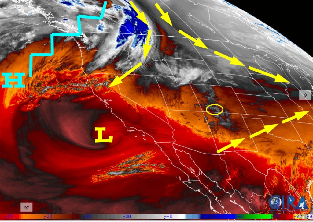
Monday afternoon through Friday… A low will spin off the southern CA coast while a ridge persists over us.
Monday afternoon spotty showers will fall mostly over the mountains. Lucky spots near Pagosa could get a half inch of new snow while Wolf Creek will get up to 1”.
Monday night clouds will clear, and temps will drop.
Tuesday through Thursday we’ll see lots of sun and a warming trend.
Friday clouds will increase ahead of our next low-pressure system.
Temps…
Monday highs will be in the mid-20s to low 30s and lows will be -5 to 10.
Tuesday highs will be in the low to high 30s and lows will be in the -5 to 10.
Wednesday highs will be in the mid-30s to low 40s and lows will be in the low single digits to mid-teens.
Thursday highs will be in the low to high 40s and lows will be in the low teens to low 20s.
Friday highs will be in the mid-30s to low 40s and lows will be in the mid-teens to low 20s.
Winds… Monday through Thursday afternoon peaks will be 5-10mph. Friday afternoon winds will peak around 15mph.
Saturday through early Monday morning… Initially it looked like a cut-off low was going to move slowly through the region. Now the cut-off is expected to stay to our south while a trough moves through Colorado from the northwest – the pattern that we’ve been stuck with for a while. Snow will favor Colorado’s northern mountains while we get scraps.
Snow in our area will be spotty and light. The best chance for snow is late Saturday morning through Sunday afternoon.
Snow amounts…
Pagosa area: a dusting to 2”
Wolf Creek area: 3-6”
Temps…
Saturday highs will be in the high 20s to mid-30s and lows will be in the mid-single digits to mid-teens.
Sunday highs will be in the mid-20s to low 30s and lows will be near zero to low teens. If clouds clear out Sunday night, temps will be 10 degrees colder.
Winds… Saturday afternoon gusts will be 20-25mph. Sunday afternoon gusts will be 15-20mph.
*** Up at Wolf Creek, high temps on Saturday will be in the low teens and winds will gust up to 35mph with wind chills in the -10 to -15 range. Sunday high temps will be in the high single digits with gusts to 25mph with wind chills in the -10 to -15 range. ***

For snow this equates to up to 1” near Pagosa and up to 6” in our mountains.
Except for the Canadian forecast model, all forecast models have trended down for precip/snow amounts.
The 8-15 day period… Our nemesis, the West Coast ridge, will try to rebound. Much like the last 6 weeks, we’ll get scraps from systems moving through the region from the northwest.

In the upper left the Euro ensemble shows 0.36”.
In the upper right the Euro AI shows 0.20”.
In the bottom left the GFS ensemble shows 0.40”.
In the bottom right the Canadian ensemble shows 1.19”.
The Canadian model still holds hope for a decent storm next weekend, but all of the other models have backed off.
My next post will be on Wednesday.
– Shawn


