
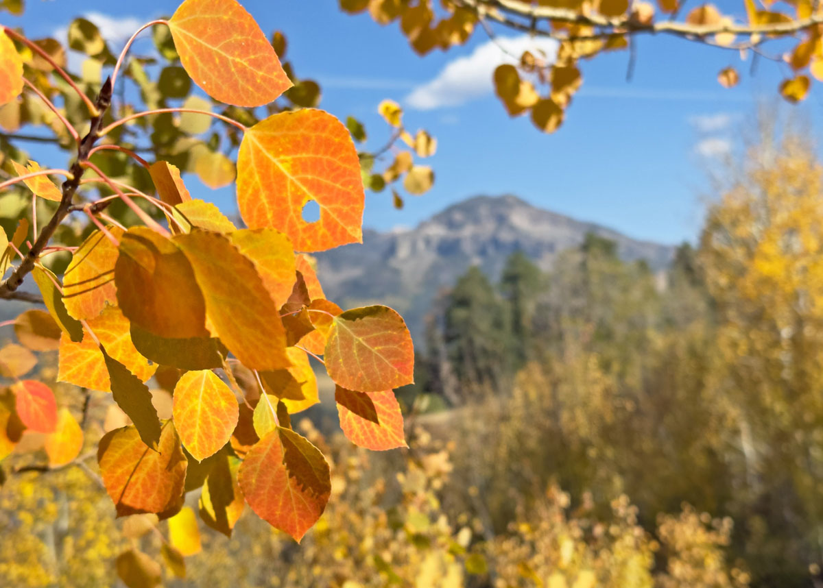
Enjoy the fall colors while you can! – pic taken 10/8/2024
If images fail to load in the email, please click the title of the post. Thanks!
Tuesday – 15 Oct 2024 – 6:00pm
The past…
At Stevens Field the high temperature Sunday was 75 and on Monday it was 73. The low this morning was 42. The cold spots dipped into the high 20s this morning.
The peak wind at Stevens Field on Sunday was 24mph and on Monday it was 20mph.
| Average High | Record High / Year | Average Low | Record Low / Year |
| 64 | 82 / 1958 | 26 | 14 / 1966 |
Precipitation summary… There has been no recent measurable precip.
Forecast discussion…
Forecast highlights…
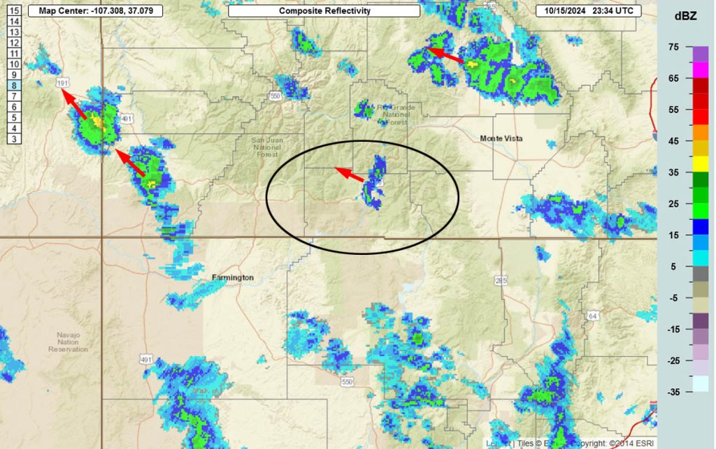
*** Scattered rainshowers and an isolated thunderstorm or two Tuesday evening and again Wednesday afternoon into Wednesday night. ***
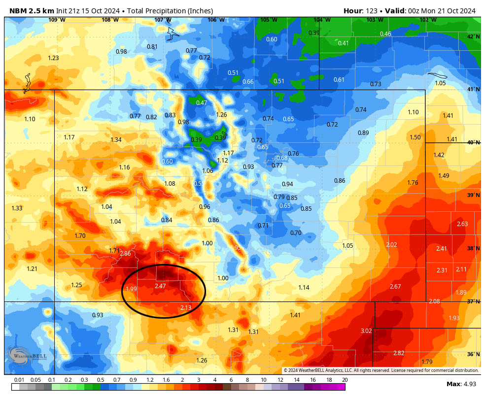
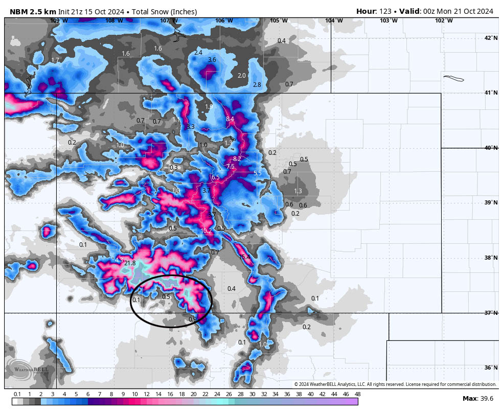
*** Thursday through Sunday evening SIGNIFICANT SNOW is possible for the mountains. The valley will get a little snow too. ***
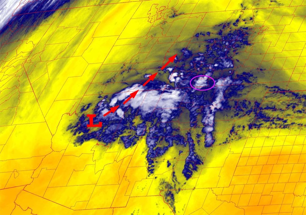
Rest of Tuesday through Wednesday… A weak low is spinning over northern AZ. It will move slowly towards the northeast over the next 24 hours and continue to weaken. There is just enough moisture or storm energy to kick up scattered showers and a thunderstorm or two.
The best chance for a little precip is Wednesday afternoon into Wednesday night. The mountains above 10,500ft could get 1” to 2” of snow.
Winds… Afternoon gusts will be 15-25mph.
Temps… Tuesday lows will be in the high 20s to high 30s. Wednesday highs will be in the high 50s to high 60s and lows will be in the high 20s to high 30s.

Thursday through Sunday… A trough will move through Thursday and then a low-pressure system is expected to spin over the Four Corners region Friday through Sunday. Waves of storm energy and moisture will move through our area and kick up showers and an occasional thunderstorm.
Timing…
Showers will develop over the mountains early Thursday morning and then over the valley after sunrise and persist into Thursday evening. An isolated thunderstorm or two is possible in the afternoon.
There will be a lull Thursday night with just a few scattered showers mostly over the mountains.
Friday morning into Sunday evening the low will spin over AZ and send waves of showers and an occasional thunderstorm our way. Snow will fall heavily in the mountains at times.
Snow levels…
Thursday during the day: around 10,600ft
Thursday night: 10,000-10,500ft
Friday during the day: around 9,500-10,000ft
Friday night: 8,000-8,500ft
Saturday during the day: around 8,500-9,000ft
Saturday night: 8,000-8,500ft
Sunday during the day: around 8,500-9,000ft
Sunday night: 7,500-8000ft
Forecast snow amounts:
Mountains above 10,000ft: 16” to 24”
Valley above 8,500ft: 2” to 4”
Valley 8,000-8,500ft: up to 2”
Valley below 8,000ft: up to a half inch
Winds… Thursday and Friday gusts will be 20-30mph. Saturday and Sunday gusts will be 15-20mph.
Temps… Thursday highs will be in the low to high 50s and lows will be in the low 30s to low 40s. Friday and Saturday highs will be in the high 40s to high 50s. Friday lows will be in the high 20s to high 30s. Saturday lows will be in the mid-20s to low 30s. Sunday highs will be in the mid-40s to low 50s and lows will be in the low to high 20s.
Monday and beyond… Ridging will build back over the region. We’ll have lots of sun, dry weather, breezy afternoons, and temps will rebound back towards seasonal averages.
The next forecast post will be on Wednesday.
– Shawn


2 Responses
Thanks for your knowledge!! Hoping for our first snow!!!
Kathleen! Thank you for your kind words! Looking for the flakes!