

Our sunsets are the best! – pic taken 9/7/2024
If images fail to load in the email, please click the title of the post. Thanks!
Friday – 13Sep 2024 – 7:20pm
The past…
At Stevens Field the high temperature Thursday afternoon was 78 and Friday it was 76. The low this morning was 43. The cold spots dipped into the low 30s.
The minimum relative humidity Thursday was 16% with a dew point of 26. Friday it was 15% with a dew point of 25.
The peak wind at Stevens Field Thursday afternoon was 30mph and on Friday it was 25mph.
| Average High | Record High / Year | Average Low | Record Low / Year |
| 74 | 90 / 1945 | 39 | 28 / 1957 |
Precipitation summary… There has been no recent measurable precip.
Forecast discussion…

There is nothing on radar in our area Friday evening.
Forecast highlights…
*** Cold spots could drop below freezing early Saturday morning and early Sunday morning. ***
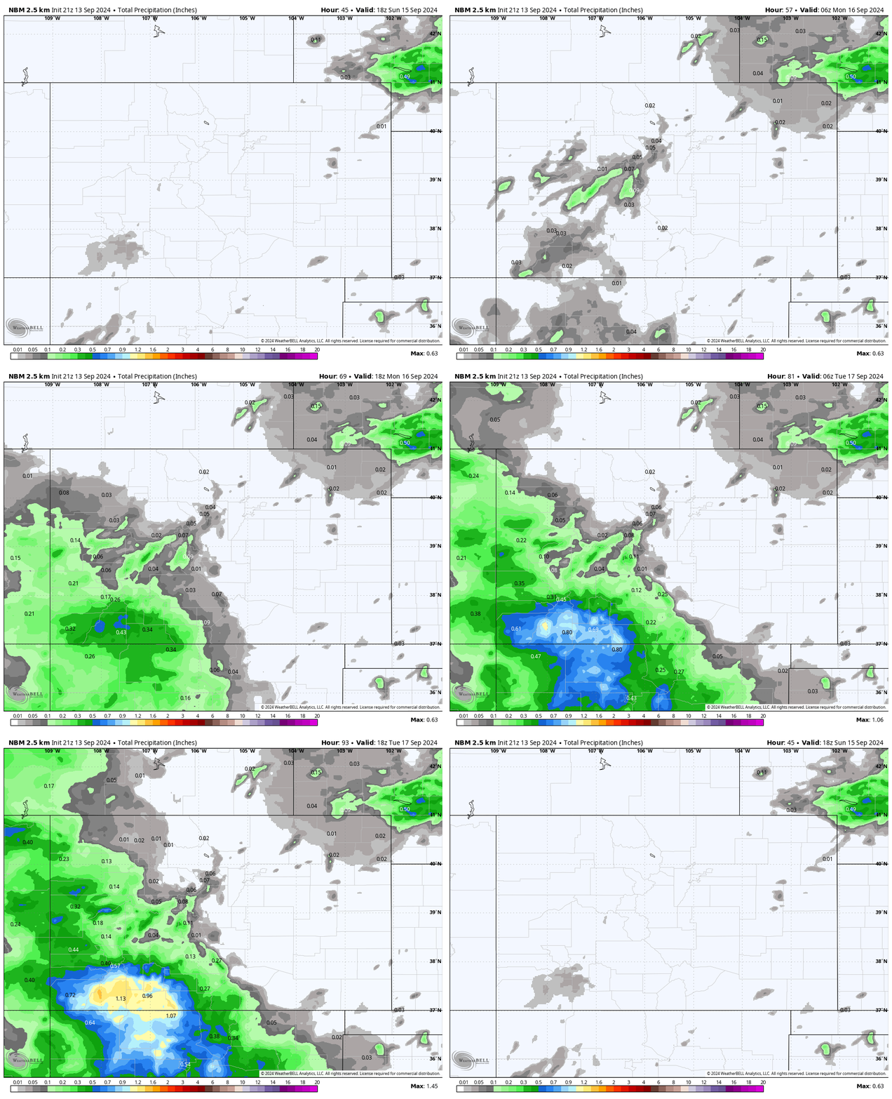
*** Fall-like storm Sunday night through Tuesday afternoon. ***
*** Potential for up to 1” snow above 12,000ft Tuesday! ***
*** Cold spots WILL drop below freezing Tuesday, Wednesday, and Thursday nights. ***

Saturday… Upper-level southwest flow will remain dry and stable. We’ll have lots of sun and remain dry.
Winds… Saturday afternoon gusts will be 15-20mph.
Temps… Highs will be in the mid-70s to low 80s and lows will be in the mid-30s to mid-40s. *** The cold spots could drop below freezing. ***
Sunday through Tuesday… We’ll catch the southern end of a strong low-pressure system as it moves through the western US.
Sunday clouds will increase through the day and then scattered showers will develop during the afternoon and overnight, especially over the mountains.
Monday showers will ramp up through the day and overnight. The best chance for a soaking rain is Monday evening to mid-morning Tuesday.
Tuesday showers will gradually start tapering off late in the morning and into the afternoon.
*** Potential for up to 1” of snow above 12,000ft on Tuesday. ***
Winds… Sunday and Monday afternoons gusts will be 15-20mph. Tuesday gusts will be 20-25mph.
Temps… Sunday highs will be 70-80 and lows will be in the mid-30s to mid-40s. Monday highs will be in the mid-60s to mid-70s and lows will be in the high 30s to high 40s. Tuesday highs will be in the low 60s to low 70s and lows will be in the low 30s to low 40s. *** The cold spots will be below freezing Tuesday night. ***
Wednesday and Thursday… Upper-level southwest flow will be dry and stable. We’ll have lots of sun, pleasant afternoons and chilly mornings.
Winds… Afternoon gusts will be 15-25mph.
Temps… Highs will be in the mid-60s to low 70s and lows will be 30-40.
The next forecast post will be on Sunday and then we’ll do a post each day through the storm.
– Shawn


