

Impressive lightning captured by Naomi. IG @stupiduglyacres. Pic taken 8/20/2024
If images fail to load in the email, please click the title of the post. Thanks!
Update: Friday, August 23, 2024, 7:15pm.
...FLOOD ADVISORY IN EFFECT UNTIL 945 PM MDT THIS EVENING...

* WHAT...Flooding caused by excessive rainfall is expected.

* WHERE...A portion of southwest Colorado, including the following
  counties, Archuleta and La Plata.

* WHEN...Until 945 PM MDT.

* IMPACTS...Minor flooding in low-lying and poor drainage areas.

* ADDITIONAL DETAILS...
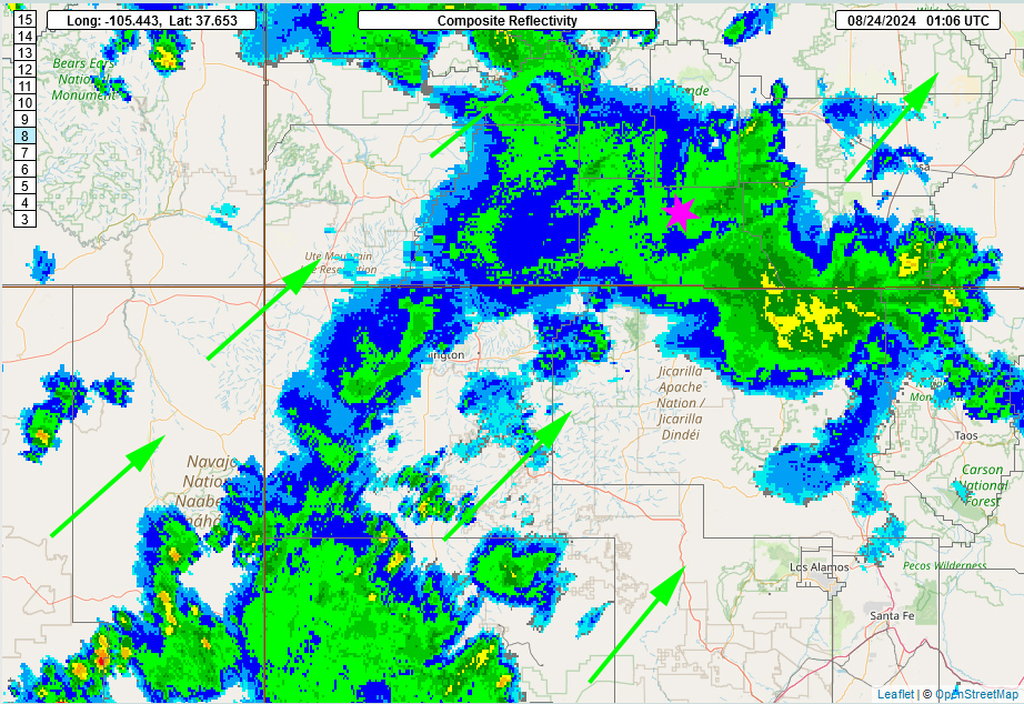
  - At 642 PM MDT, Doppler radar indicated heavy rain due to
    thunderstorms. Minor flooding is ongoing or expected to begin
    shortly in the advisory area. Between 0.3 and 0.6 inches of
    rain have fallen.
  - Some locations that will experience flooding include...
    Bayfield, Ignacio and Oxford.
  - http://www.weather.gov/safety/flood

PRECAUTIONARY/PREPAREDNESS ACTIONS...

Turn around, don`t drown when encountering flooded roads. Most flood
deaths occur in vehicles.
We’ll have a detailed weather update out tomorrow afternoon.
– Arleen
Thursday – 22 Aug 2024 – 7:30pm
The past…
At Stevens Field the high temperature Wednesday afternoon was 83. The high today has been 85. The low this morning was 53.
The minimum relative humidity Wednesday was 20% with a dew point of 40. So far this afternoon it has been 30% relative humidity with a dew point of 43.
The peak wind at Stevens Field Wednesday afternoon was 41mph at 9:15pm. So far this afternoon the peak gust has been 21mph.
| Average High | Record High / Year | Average Low | Record Low / Year |
| 80 | 91 / 1910 | 44 | 29 / 1956 |
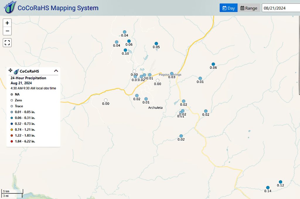
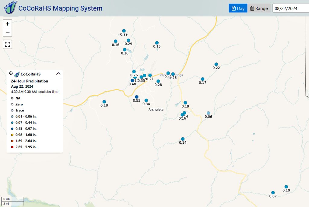
Precipitation summary… We had thunderstorms move through Tuesday night from about midnight till 2am with a little rain and a lot of lightning. We had thunderstorms march across Archuleta county from the south to the north from about 8pm to 10pm last night with a LOT of lightning, moderate to heavy rainshowers, and high winds.
Forecast discussion…

Forecast highlights…
*** Isolated evening storms are possible tonight.***
***Friday, Saturday, and Sunday will be more active with a good soaking & possibility of localized flooding in low lying areas. ***
*** Any storm can produce brief periods of heavy rain, small hail, gusty winds, and lightning, especially Thursday through Sunday. ***
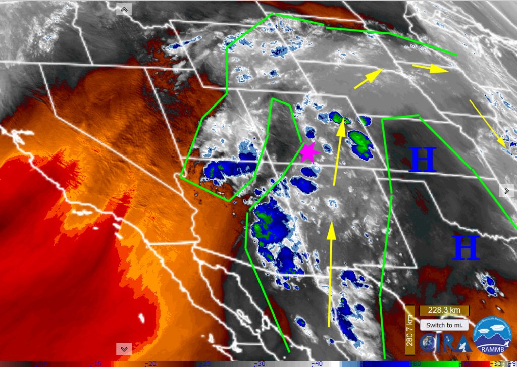
The rest of today: Thunderstorms are starting to pop in central Archuleta county! The ridge is now centered over Kansas. A longwave trough is moving east from the northwest. These two features will compress the flow over our area. The models have been struggling with placement of the narrow band of monsoon moisture. However under this compression, the band will increase in width. We’ll be under this moisture starting tonight.
Friday through Sunday: We’ll have mostly cloudy to cloudy skies with only occasional breaks of sun. There will be areas of fog in the early morning hours. We’ll see an increase in storm activity. The flow will be out of the southwest with good PWATs advecting in. At the same time with the trough approaching from the west, there will be a few upper level disturbances (think spinning) that will help kick off storms and rainshowers. Storms will be possible any time of day but will be most likely in the afternoons and evenings.
Winds… Afternoon peaks will be around 20mph through the period. Higher gusts are likely near storms.
Temps… Lows throughout the period will be mid-40s to low 50s. Highs will be in the lo-70s to upper 70s.

Monday through Wednesday: We’ll have clear to partly cloudy skies with mostly cloudy in the afternoon. There will be areas of fog in the early morning hours on Monday. Monday will dry out with the monsoon being cut off for a day. Only isolated thunderstorm activity over the mountains. The monsoon will try to set up again mid-week. Expect more thunderstorm activity but still isolated. The models are wavering a lot as to how strong the ridge will be and to its location and how much moisture will advect into our area after Monday.
Winds… Afternoon peaks will be around 15mph through the period. Higher gusts are likely near storms.
Temps… Lows throughout the period will be mid-40s to low 50s. Highs will be in the mid-70s to low 80s.

Precipitation will all be convective showers so amounts will vary considerably.
The 8-14 day period… Thursday through Wednesday: The high will wobble around the Four Corners area. Monsoon moisture and instability will be marginal leading to hit and miss storms each afternoon. Again, the models are not in agreement on the same solution. As we transition into September, we can expect the monsoon to weaken and to see less thunderstorm activity.
Temps will be near average.
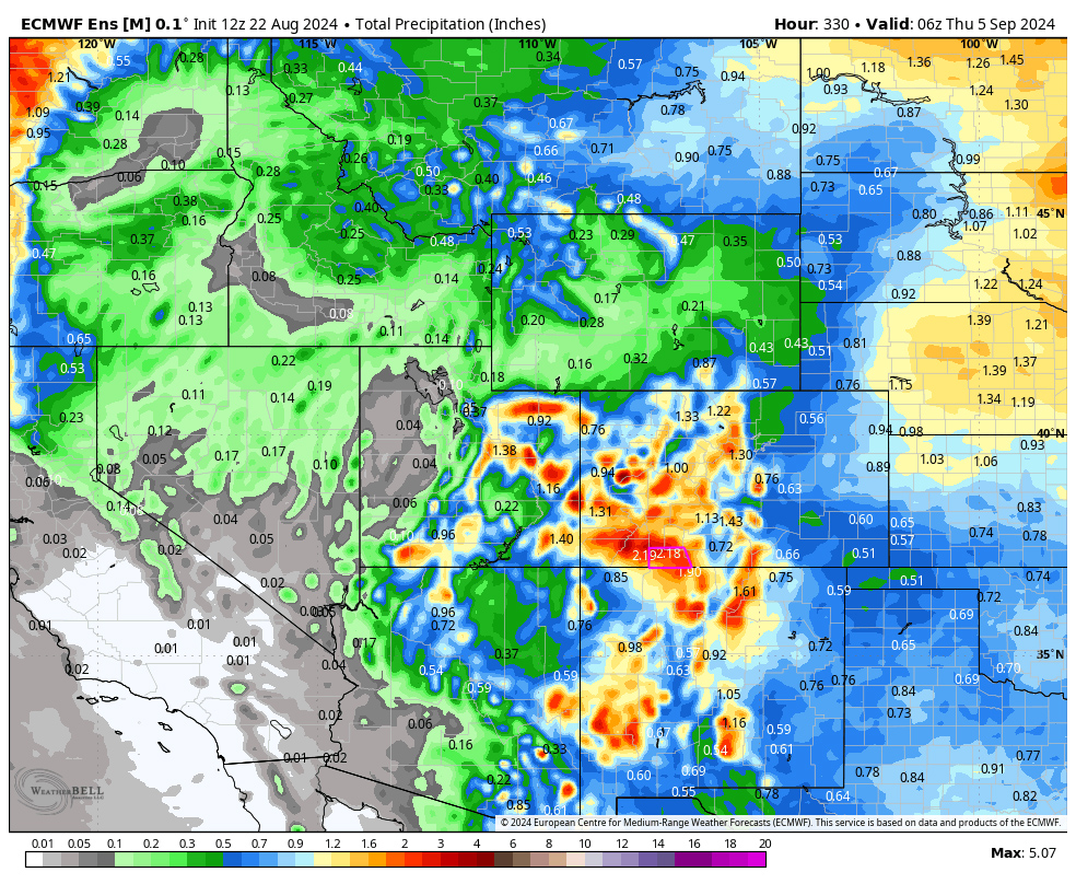
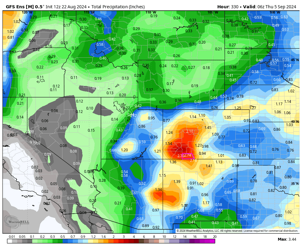
The Euro ensemble precip to 4 Sep at 6am above expects 2.18” in the Pagosa area while GFS below expects 2.74”. Most of this is expected Friday, Saturday, Sunday and half of it falling during the last 11 days of this period. It’s all convective afternoon showery precip so amounts will vary considerably.
Our next forecast post will be on Saturday.
– Arleen


