
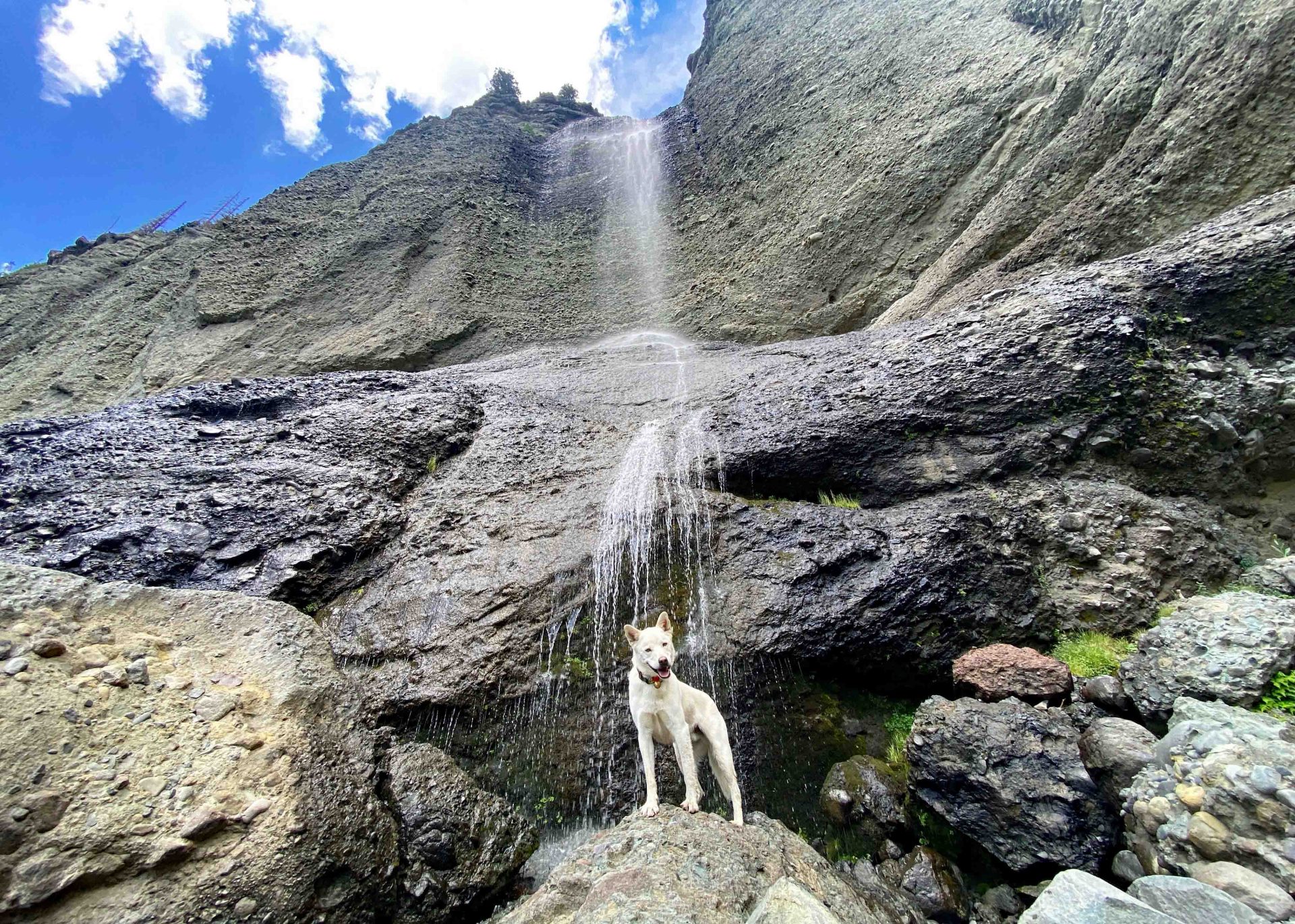
Falls Creek Falls was down to a trickle but Tommy could still feel a refreshing spray – pic taken 8/19/2024
If images fail to load in the email, please click the title of the post. Thanks!
Tuesday – 20 Aug 2024 – 6:00pm
The past…
At Stevens Field the high temperature Sunday afternoon was 83 and the high on Monday was 86. The high today has been 87. The low this morning was 52.
The minimum relative humidity Sunday was 22% with a dew point of 40. Monday it was 37% with a dew point of 19. So far this afternoon it has been 18% relative humidity with a dew point of 39.
The peak wind at Stevens Field Sunday afternoon was 18mph and on Monday it was 22mph. So far this afternoon the peak gust has been 16mph.
| Average High | Record High / Year | Average Low | Record Low / Year |
| 80 | 90 / 1945 | 45 | 30 / 1985 |
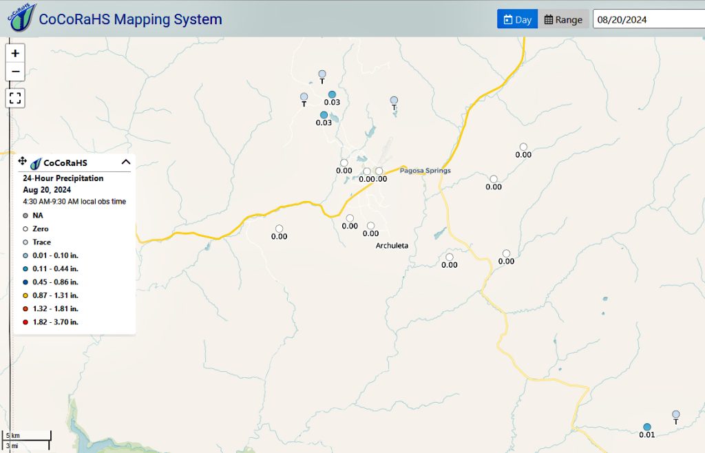
Precipitation summary… We saw mostly fair weather cumulus though a few clouds managed to harness all the energy and moisture in the atmosphere and a few folks got more than a sprinkle.

Forecast discussion…

Forecast highlights…
*** Isolated afternoon storms are possible today and Wednesday.***
***Thursday, Friday, and Saturday will be more active with a good soaking & possibility of localized flooding in low lying areas. ***
*** Any storm can produce brief periods of heavy rain, small hail, gusty winds, and lightning, especially Thursday through Saturday. ***
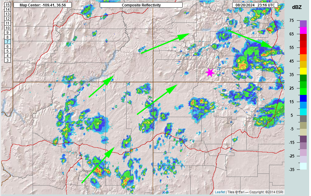
The rest of today and Wednesday: The high centered over eastern New Mexico is going to slowly move to the east as a deep trough to the west and an area of low pressure to the northwest start to move east cutting off the dry air.
Dry air is still in place over our area and has tampered the storms that have tried to build. Our dewpoint is only 40 – we want it to be at least 50 for good rainshower activity. Precipitable Water (PWAT) amounts will start to rise as the flow adjusts. We might see a few sunset surprise showers today. We should see increased activity tomorrow but still only isolated activity with a few rain lottery winners.
Thursday through Saturday: We’ll see an increase in storm activity. The flow will be out of the southwest with good PWATs advecting in. At the same time with the trough approaching from the west, it will have a few upper level disturbances (think spinning) that will help kick off storms and rainshowers. Storms will be possible any time of day but will be most likely in the afternoons and evenings.
Winds… Afternoon peaks will be around 15mph through Wednesday and then around 20mph the rest of the period. Higher gusts are likely near storms, especially Thursday through Saturday.
Temps… Lows throughout the period will be mid-40s to low 50s. Wednesday highs will be in the low to high 80s. Thursday, Friday, and Saturday highs will be in the mid-70s to low 80s.
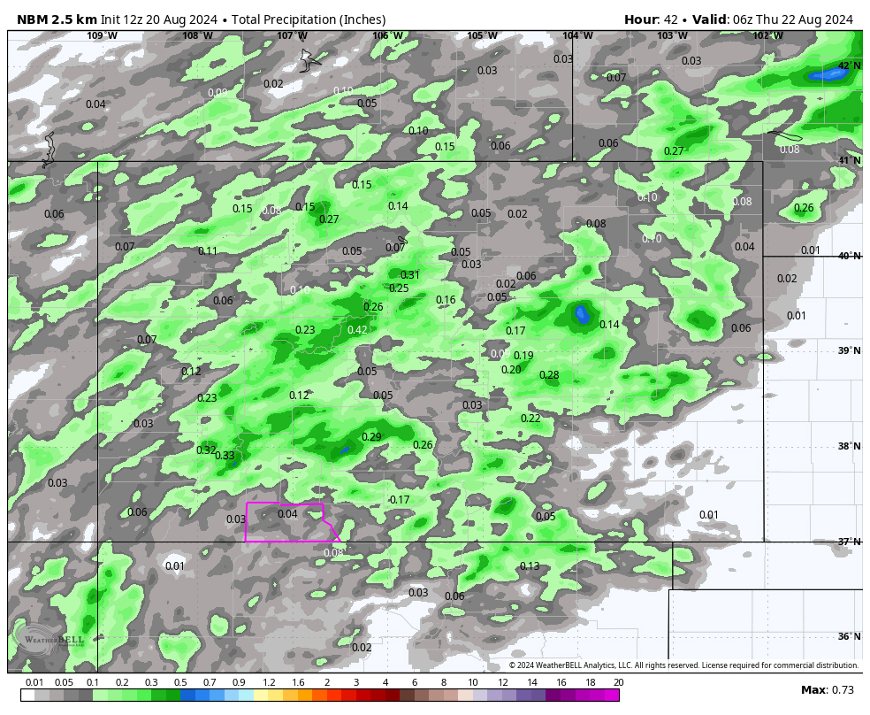
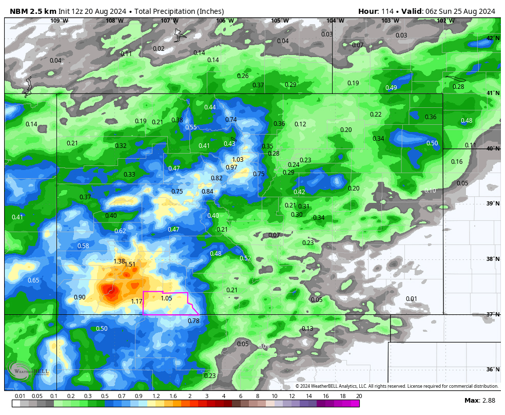
Precipitation will all be convective showers so amounts will vary considerably.
The 6-14 day period… Sunday through Wednesday: The high will wobble around the Four Corners area. Monsoon moisture and instability will be marginal leading to hit and miss storms each afternoon. Starting Thursday, an easterly wave in the Gulf of Mexico will pump monsoon moisture into the flow and instability will increase resulting in an increase of storm activity.
Temps will be near average.
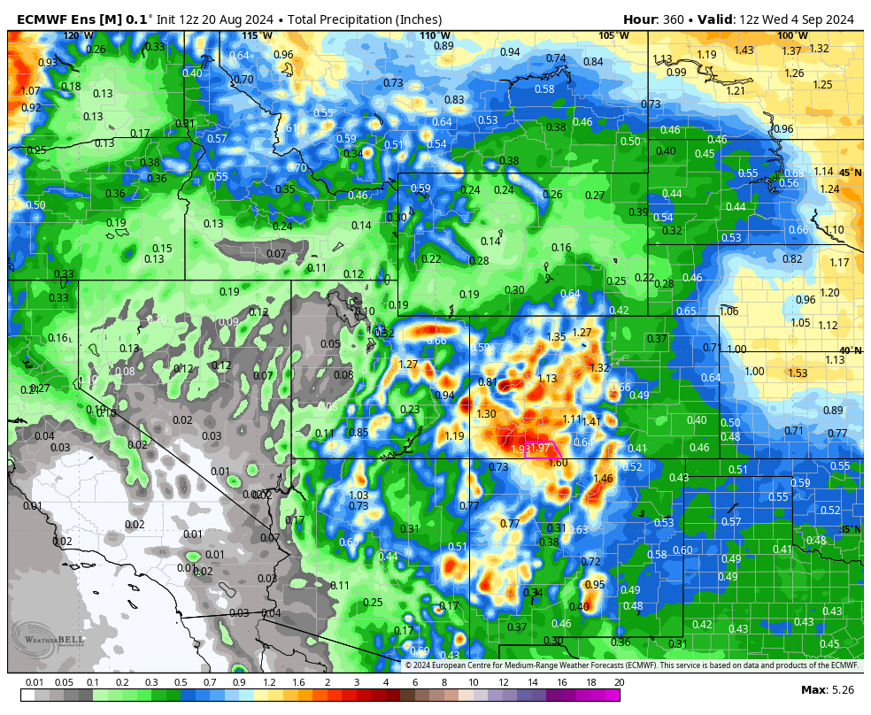
The Euro ensemble precip to 4 Sep at 6am above expects 1.97” in the Pagosa area while GFS below expects 2.45”. Most of this is expected Thursday, Friday, and Saturday and then the last week or so of this period. It’s all convective afternoon showery precip so amounts will vary considerably.

My next forecast post will be on Thursday.
– Arleen


2 Responses
Hey Arleen…do you know how to email a message to the forecasters in Grand Junction. I always read the forecast discussion & the person who posted @ 12:35 this afternoon said at the end of the discussion it was his/her last post. I just wanted to thank him/her. It was a funny last post about rain/ snow dances…lol. Thks!
Hi Michele! Yes, I read that & wondered who it was. I know a few of the guys up there. Usually there name is at the top of the report. The email is: nws.grandjunction@noaa.gov
That is very thoughtful of you!