

Caution High Winds!
If images fail to load in the email, please click the title of the post. Thanks!
Sunday – 5 May 2024 – 4pm
The past…
At Stevens Field the high temperature yesterday afternoon was 67. The low this morning was 37 but the cold spots dipped into the high 20s.
The peak wind at the airfield yesterday was 30mph at 3:35pm. So far by 3:30pm Sunday, the strongest wind gust has been 36mph.
The peak wind so far on Sunday for Wolf Creek Pass has been 55mph.

| Average High | Record High / Year | Average Low | Record Low / Year |
| 65 | 83/ 1947 | 28 | 13 / 1965 |
Precipitation summary… A few spotty raindrops fell yesterday. Reports this morning ranged from zero to 0.05”.
Forecast discussion…
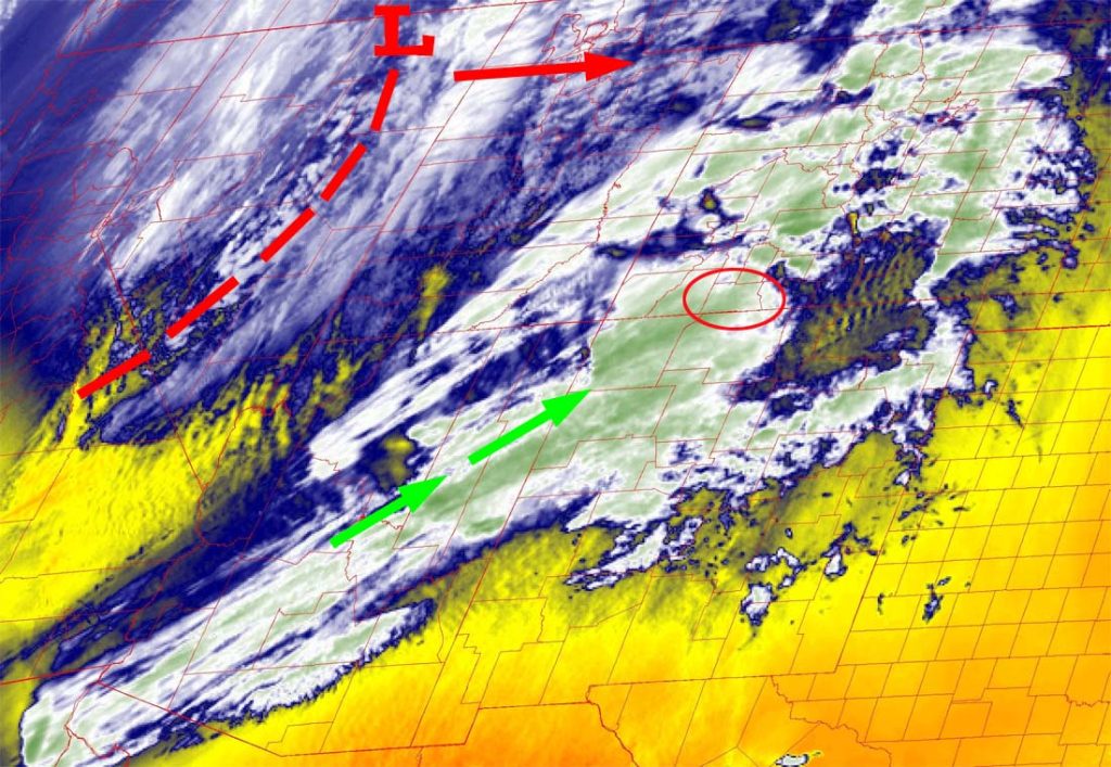

Forecast highlights…
*** Strong winds Sunday, Monday and Tuesday. ***
*** Potential for blowing dust Sunday afternoon into Sunday night. ***
*** Scattered showers and an isolated thunderstorm Sunday evening into early Monday morning. ***
*** A WINTER WEATHER ADVISORY has been issued for the eastern San Juan Mountains above 10,000ft elevation. 4-8” of snow winds gusting to 60mph are possible from 9pm Sunday evening to 6am Monday. ***
Rest of Sunday to early Monday morning… We will catch the southern end of a fairly strong spring storm as it moves quickly through the region. The best moisture and storm energy will stay to our north, so I don’t expect much precip. The easy part of the forecast is the gusty winds.
The best chance for scattered showers and an isolated thunderstorm is Sunday evening into early Monday morning.
Precip forecast…
Valley: 0.05” to 0.10”
Valley above 7,600ft: a dusting of snow is possible early Monday morning
Mountains: 2-5” of snow above 9,500ft
Winds… Late Sunday afternoon into early Monday morning gusts will be 35-45mph. Winds in the mountains will be 50-60mph.
*** Dust could get blown into our area from eastern AZ and western NM late Sunday afternoon into Sunday evening. ***
Temps… Highs Sunday will be in the high 50s to mid-60s and lows will be in the high 20s to mid-30s.


Monday, Tuesday, and Wednesday… Drier air will move in from the northwest. We’ll have partly cloudy skies and gusty afternoon winds.
Winds… Monday afternoon gusts will be 30-35mph. *** Tuesday afternoon into Tuesday evening winds will gust 40-50mph. *** Wednesday afternoon winds will gust 25-30mph.
Temps… Highs Monday will be in the low to high 50s and lows will be in the mid-20s to low 30s. Highs Tuesday and Wednesday will be in the mid-50s to low 60s and lows will be in the mid-20s to low 30s.

Thursday through Sunday… A cut-off low is expected to spin over the Great Basin region for a few days. Forecast models struggle with cut-off lows because there is very limited upper-level steering. Weather associated with cut-off lows is usually confined to a small area near the low. So if the low wobbles any direction, it impacts the forecast.
For now, I expect our weather to be unsettled with a chance for scattered afternoon showers and isolated thunderstorms through the weekend. Precip amounts will be low.
The good news is that the winds will be considerably weaker.
Winds… Afternoon gusts will be 15-20mph. Isolated stronger gusts are possible near showers and thunderstorms.
Temps… Thursday and Friday highs will be in the mid-50s to mid-60s and lows will be in the high 20s to mid-30s. Saturday and Sunday highs will be in the high 50s to high 60s and lows will be in the high 20s to high 30s.
My next forecast post will be tomorrow.
– Shawn


