

A harbinger of Spring! We have a bluebird couple that are nesting in our backyard despite the 20” of snow at 8,000 feet & that tomorrow is the first day of spring!!!
We get a break this week before weather returns this weekend.
If images fail to load in the email, please click the title of the post. Thanks!
Monday – 18 Mar 2024 – 5:30pm
The past…
At Stevens Field the high temperature this afternoon was 50 and the low this morning was 22.
The peak wind at the airfield today has been 7mph.
| Average High | Record High / Year | Average Low | Record Low / Year |
| 50 | 69 / 1907 | 16 | -17 / 1917 |
Precipitation summary… Showers yesterday remained weak and isolated with afternoon rainshowers remaining in the southern area of the county. Wolf Creek reported zero snowfall.
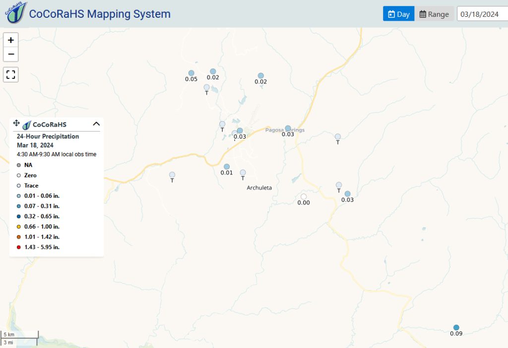
CoCoRaHS 24-hour precip reports range from a trace to .09”. Patty in Chromo was the precip winner. Only a few spots reported snow with the highest amount reported as ½” of snow in O’Neal Park.
Forecast discussion…
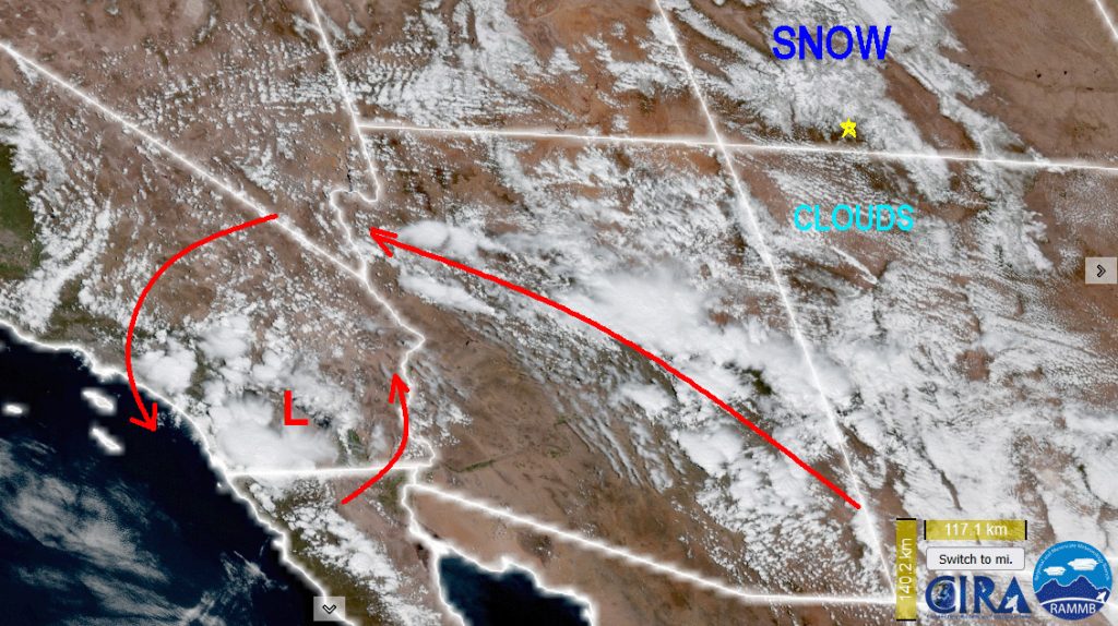
The area of low pressure has filled, weakened and retrograded into southern California. There are only fair weather cumulus clouds over the southwest. Those clouds are flattening out an indicator of high pressure and fair weather. Other white blobs on this satellite image are snow fields in the mountainous areas.
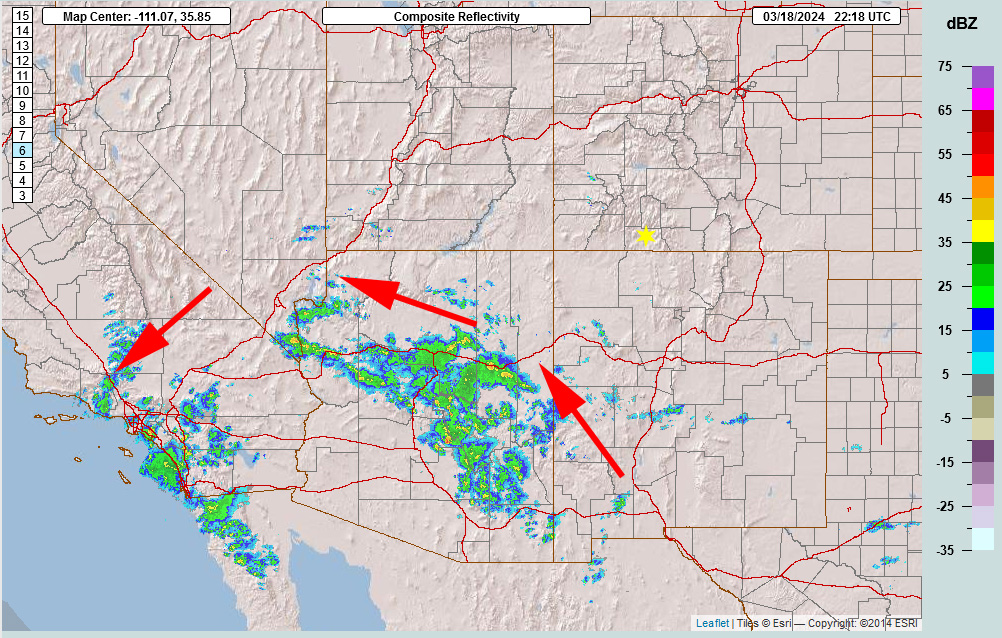
The only precipitation showing up on radar this afternoon is over the Arizona area wrapping cyclonically around the low.
Forecast highlights…
*** A cut-off low will be ejected and move to the east of us late Tuesday into Wednesday morning. ***
*** Avalanche danger in our mountains is rated “considerable”. ***
Rest of Monday: The low is wobbling in southern California and not impacting our weather this afternoon. We’ll be Partly Cloudy with fair weather cumulus and unrestricted visibility.
There will be a lot melting Monday afternoon and this will give us areas of fog overnight and Tuesday morning.
Winds… Peak winds will be 12mph this afternoon.
Temps… Highs temperatures will be mid-40s to low 50s and lows Tuesday morning will be in the high teens to mid 20s.
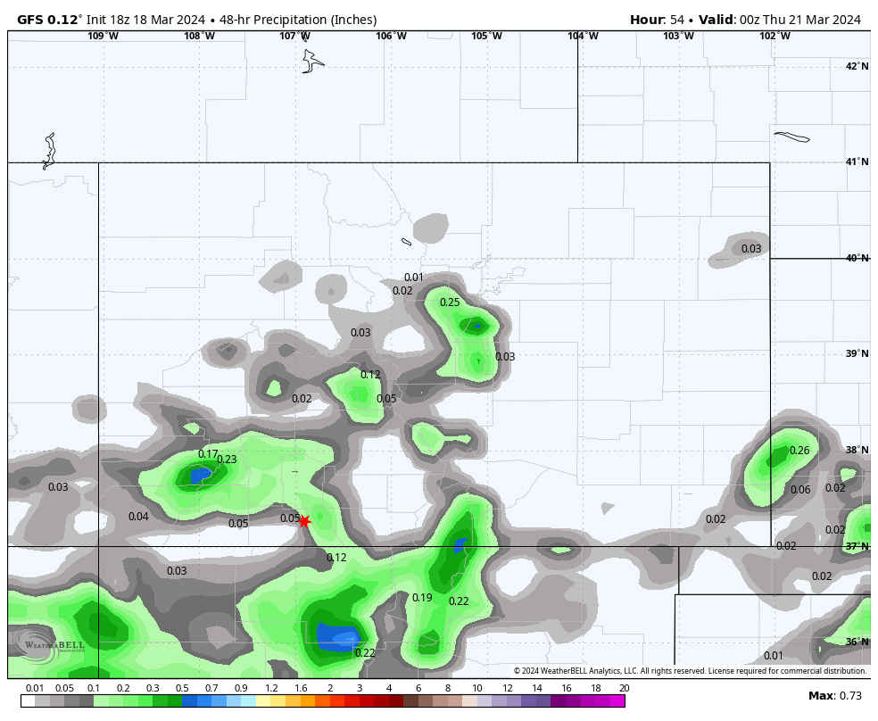
Tuesday through Wednesday… The pesky cut-off low will finally be picked up by an upper level wave and ejected from southern California into northwest New Mexico. This will give us just enough instability to kick up spotty showers throughout the area in the afternoon Tuesday into the overnight hours over the mountains and again Wednesday afternoon.
Snow levels could pop up to 8,200ft each afternoon. That means rain the afternoon for all locations less than 8,200 feet. Though, all types of precip are possible: rain, snow, graupel, and small hail. It will be all snow over the mountains.
Definition of “spotty showers”: Cover small areas, precip changes intensity quickly. Plus, they start & stop abruptly. Most of the time it will be dry with brief periods of “fun”.
Snow totals for Tuesday afternoon through Wednesday…
Valley below 8,200ft: mostly rain but up to an inch of snow in a few lucky spots
Valley above 8,200ft: up to 2” in the lucky spots
Mountains: 2-4” but it will be spotty
Winds… Gusts will be around 15mph Tuesday and Wednesday afternoons.
Temps… Tuesday, and Wednesday highs will be in the upper-40s to low-50s and lows will be in the low 20s to upper 20s.
Thursday: The big, beautiful blue skies will be out! After areas of morning fog, we’ll be mostly sunny with temperatures warming up and a lot of melting going on.
Highs Thursday will be in the low 50s to high 50s and lows will be in the mid 20s.
Thursday afternoon gusts will be 15-25mph.
Friday: After areas of morning fog and stratus, Friday will be mostly cloudy with mid and upper level clouds as moisture starts tostream in from the southwest ahead of the next system. We can also expect to see very isolated and spotty showers.
Highs Friday will be in the mid 50s to low 60s and lows will be in the mid 20s to low 30s.
Friday afternoon gusts will be 15-25mph.
Heads UP: Starting Saturday into next week looks to mostly cloudy to cloudy with some sort of precipitation each day as another slow-moving system impacts us from the southwest. The details are fuzzy at this time.

My next post will be on Wednesday. By then things should be in better focus and I can share more details with you.
Enjoy the first day of Spring tomorrow!
– Arleen


