
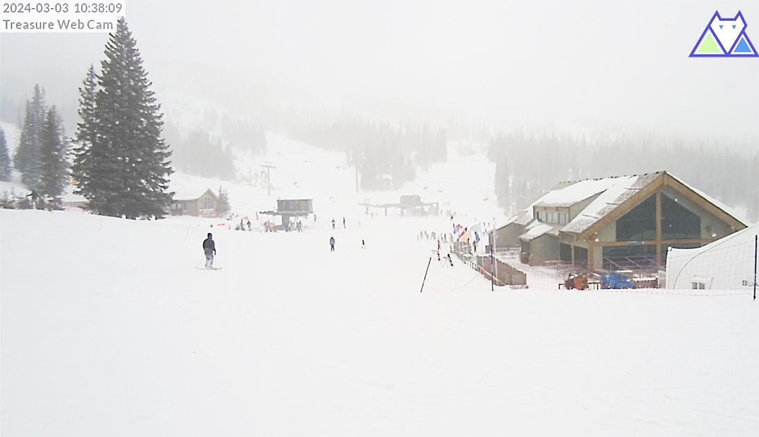
Wolf Creek Ski cam at 10:38am Sunday
If images fail to load in the email, please click the title of the post. Thanks!
Sunday – 3 Mar 2024 – 10:50am
The past…
At Stevens Field the high temperature yesterday afternoon was 51 and the low this morning was 32.
The peak wind at the airfield was 41mph at 11:15pm, 2:15am, and 2:35am.
The peak wind on Wolf Creek Pass was 86mph and the peak wind at Lobo Overlook was 74mph. Both sensors stopped reporting winds around 2am last night.
| Average High | Record High / Year | Average Low | Record Low / Year |
| 44 | 62 / 1986 | 13 | -18 / 1916 |
Precipitation summary… Precip started falling lightly up at Wolf Creek 8-9pm last night. We had a few snowflakes and graupel shortly after midnight just north of Turkey Springs. Snow was falling pretty good in parts of the county around sunrise, but only lasted an hour or so.
Wolf Creek Ski Area reported 5” of new snow this morning.
Wolf Creek Pass was closed for safety from 5am to 7:40am.

Forecast discussion…


Forecast highlights…
*** Windy into early Sunday evening. ***
*** Hit and miss snowshowers into Monday morning with minimal additional accumulations. ***
*** A WINTER WEATHER ADVISORY is out for the eastern San Juan Mountains above 10,000ft – this includes Wolf Creek Pass. Valid until 5am Monday. ***
Rest of Sunday to Monday morning… We caught the tail end of a weakening cold front Sunday morning. The bulk of the snow is done but hit and miss snowshowers will persist into Monday morning. There will be occasional patches of blue sky and sun.
Additional snow amounts…
Valley: up to 1”
Mountains: 3-6”
Winds… Gusts will be 30-40mph into Sunday afternoon and then slowly taper off after sunset. In the mountains winds will gust 60-75mph.
Temps… Highs Sunday will be in the mid-30s to low 40s and lows Sunday night will be in the mid-teens to mid-20s.


Monday afternoon through Wednesday afternoon… Upper-level flow goes zonal – flat, west to east with no significant ridge or trough. This will result in partly to mostly cloudy skies and very spotty showers, mostly over the mountains. For snow, the lucky spots in the valley could get a dusting and lucky spots in the mountains could get 1-2”.
Winds… Afternoon gusts will be 15-20mph.
Temps… Highs Monday will be in the mid-30s to mid-40s, and lows will be in the high single digits to high teens. Highs Tuesday and Wednesday will be in the low 40s to low 50s and lows will be in the low teens to low 20s.
Wednesday night through Friday… The next system will move through. It’s not organized and lacks storm energy and moisture so precip amounts will be low. We’ll see quite a few clouds and an occasional spotty shower.
Snow amounts…
Valley: 0-2”
Mountains: 2-5”
Winds… Afternoon gusts will be 15-20mph.
Temps… Lows Wednesday night will be in the high teens to mid-20s. Highs Thursday and Friday will be in the high 30s to mid-40s and lows will be in the low teens to low 20s.

My next post will be tomorrow. I also hope to get the February summary/March outlook posted tomorrow.
– Shawn


