

Tommy and I had a great day snowshoeing at Williams Creek yesterday!
If images fail to load in the email, please click the title of the post. Thanks!
A Weak Trough is Pushing Through today with Only Clouds & Winds
Wednesday – 14 Feb 2024 – 4:15pm
The past…
At Stevens Field the high temperature yesterday afternoon was 43 and this afternoon it has been 41. The low this morning was 14. The cold spots dropped to 4.
The peak wind at Stevens Field this afternoon has been gusts to 24mph.
| Average High | Record High / Year | Average Low | Record Low / Year |
| 43 | 59 / 1981 | 7 | -22 / 1948 |
Precipitation summary… There hasn’t been any sort of precipitation in the last 24 hours.
Forecast discussion…
We have a weak ridge and high pressure to our west. But it is, as we say, a dirty ridge. It is allowing moisture, clouds, and energy to spill over the top of it. When this happens, sometimes these features can pick up energy and intensify. However, even if they do and it were to result in snowshowers, they would approach us from the northwest and downslope in our area and weaken.
The polar front jet and associated frontal systems are to our north but sinking slowly towards Colorado. This is resulting in a tightening gradient and some surface winds.

Water vapor satellite this afternoon – the weak is centered from the Great Basin area into the Baja area. A lot of moisture and clouds are streaming over the ridge into Utah and Colorado. At the same time a weak stationary front is backing into northeast Colorado tightening the gradient.
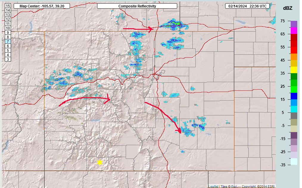
The only showers on radar today are in northern Colorado. They’ll stay there.
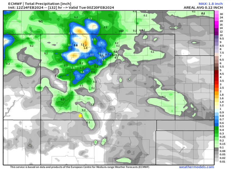
The Euro model for precip shows just weak area of precipitation in the area over the next 5 days. Wolf Creek could see .2″ precipitation or 2 to 4″ of snow.
Forecast highlights…
*** Mostly sunny with occasional clouds and near average temps the rest of the week. ***
*** More active weather pattern starting Tuesday. ***
Wednesday and Thursday: The ridge will be the dominate feature with overall high pressure with weak trofs moving though the area. Overall, Partly Cloudy but occasionally Mostly Cloudy. We could see an isolated snowshower over the mountains Wolf Creek could pick up a few inches of snow, too.
Winds… Valley areas could see gusts to 25mph today, 20mph tomorrow.
Temperatures: Highs: Low to mid- 40s. Lows: High single digits to mid-teens.
Friday and Saturday: The ridge will be the dominate feature with overall high pressure resulting in Clear to Partly Cloudy skies.
Winds… Valley areas Gusts to 15mph. Wolf Creek, Gusts to 25mph.
Temperatures: Highs: Low to upper- 40s. Lows: Low teens to Low 20s.
Sunday: The ridge will be the dominate feature with overall high pressure but a weak trof moves though the area in the afternoon. Overall, Partly Cloudy but occasionally Mostly Cloudy. We could see an isolated snowshower over the mountains and Wolf Creek could pick up a few inches of snow, too.
Temps… Highs: Low to upper- 40s. Lows: Low teens to Low 20s.
Monday and beyond… The Euro wants to move the ridge to our east on Tuesday. Models tend to move stationary ridges out of areas too quickly. But the Euro handled the last system well so that gives me more confidence. The weather pattern should get more active starting Tuesday. We’ll see how the Euro verifies with the movement on Friday. We’ll see if they arrive at the same solution.
Shawn will have the next update on Friday. In the meantime get out and play in the snow under the big beautiful blue skies!
– Arleen

Another view of William’s Creek Reservoir yesterday.


