

Frosty is up to his neck in snow. Our snow depth is 30″ just north of Turkey Springs. That could grow to 36” with tonight’s snow. – Pic taken 8 Feb 2024
If images fail to load in the email, please click the title of the post. Thanks!
Thursday – 8 Feb 2024 – 10:30am
The past…
At Stevens Field the high temperature yesterday afternoon was 33 and the low this morning was 19.
The peak wind at Stevens Field yesterday afternoon was 30mph. Our peak wind just north of Turkey Springs was 32mph.
| Average High | Record High / Year | Average Low | Record Low / Year |
| 41 | 56 / 1970 | 6 | -26 / 1989 |
Precipitation summary… Bands of snowshowers and gusty winds caused occasional white-out conditions yesterday, but the snow rarely fell long enough to pile up.
Wolf Creek reported another 16” in the last 24 hours bringing their storm total to 28”.
THANKS so much for your reports!

Forecast discussion…


Forecast highlights…
*** A WINTER STORM WARNING has been issued by the Pueblo NWS for the eastern San Juan Mountains above 10,000ft for up to 14” of snow and 50mph winds valid until 5am Friday. ***
*** An AVALANCHE WARNING has been issued for the San Juan mountains valid until 7:30am Friday. Avalanche danger is rated “high” – it’s dangerous! ***
*** Grand Junction NWS has issued a WINTER WEATHER ADVISORY for the San Juan River basin which includes the Pagosa Springs area. 3-6” of snow with locally higher amounts is expected between 3pm Thursday & 5am Friday. ***
*** A little more snow Saturday and then dry the rest of the week. ***

Thursday afternoon through Friday morning… Mostly cloudy skies and occasional snowshowers will increase as the day goes on. The next trough will move through Thursday night.
The heaviest snow will fall between 5pm Thursday and 1am Friday. Cold air will be in place, so snow levels won’t be a concern – yay.
Snow amounts…
Valley: 3-7”
Mountains: 10-15”
Winds… Gusts to 20mph are possible for a few hours starting around midnight as the trough moves through.
Temps… Highs Thursday afternoon will be around 30 to the mid-30s and lows Thursday night will be in the low teens to near 20.


Friday afternoon through Saturday… The next trough will move through from the northwest which isn’t favorable for us. Additionally, storm energy and moisture are weak, so my expectations are low.
Snow amounts…
Valley: a dusting to 2” – it will be spotty
Mountains: 3-5”
Winds… Peaks will be 10-15mph both afternoons.
Temps… Highs Friday afternoon will be in the high 20s to mid-30s and lows Friday night will be in the high single digits to high teens. Highs Saturday afternoon will be in the low to high 30s and lows Saturday night will be around zero to the low teens.
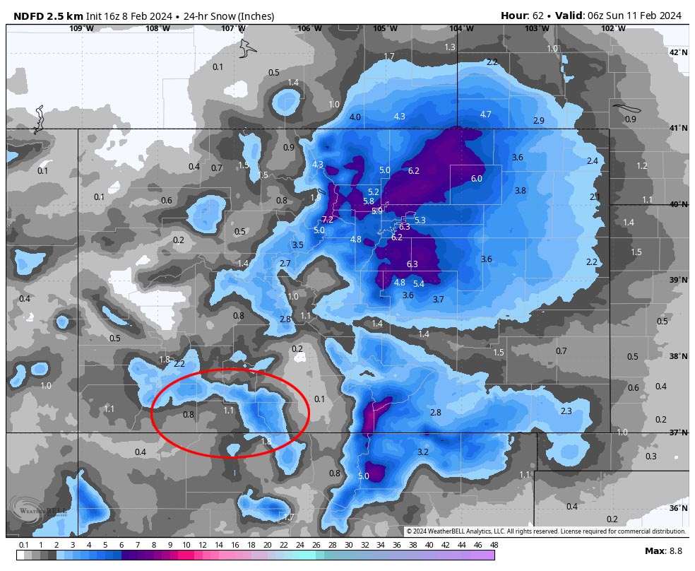
Sunday through Friday… Ridging will gradually take over. Sunday there will still be lingering clouds and a few spotty snowshowers, mostly over the mountains. The lucky spots in the mountains could get up to an inch of additional snow.
Monday through Friday there will be fewer clouds and it will remain dry.
Winds… Peaks Sunday afternoon will be 10-15mph. Peaks the rest of the period will be around 10mph.
Temps… Highs Sunday afternoon will be near 30 to the high 30s and lows Sunday night will be in the negative mid-single digits to high single digits. Highs Monday and Tuesday will be in the mid-30s to low 40s and lows will be in the mid-single digits to mid-teens. Highs Wednesday, Thursday, and Friday will be near 40 to the mid-40s and lows will be in the low teens to low 20s.
I’ll do a quick Facebook post first thing tomorrow morning and then a more thorough post in the afternoon.
– Shawn


