
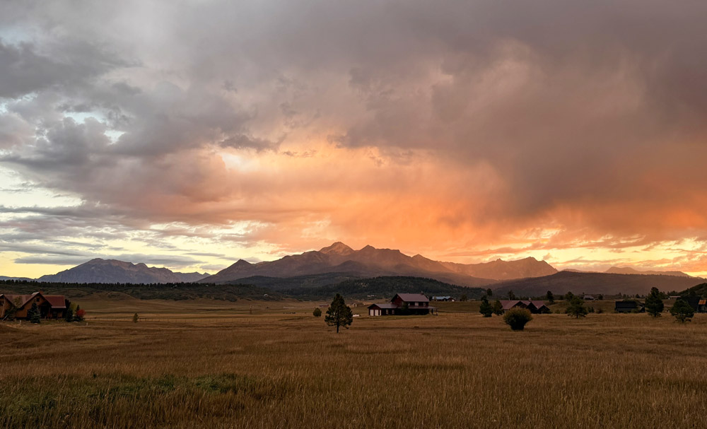
A beautiful Pagosa Country sunrise over Pagosa Peak – pics taken 9/22/2026
Tuesday – 22 Sep 2026 – 2:30pm
The past…
Stevens Field Observations
Sunday: High: 72, Low: 40, Peak wind: 28mph, Afternoon humidity: 17-22%
Monday: High: 72, Low: 35, Peak wind: 17mph, Afternoon humidity: 17-22%
| Average High | Record High / Year | Average Low | Record Low / Year |
| 71 | 85 / 1945 | 34 | 23 / 1983 |
Precipitation summary… A few lucky folks got some rain Tuesday morning, otherwise it’s been dry.
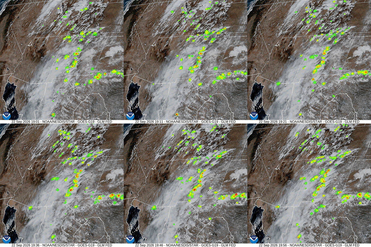
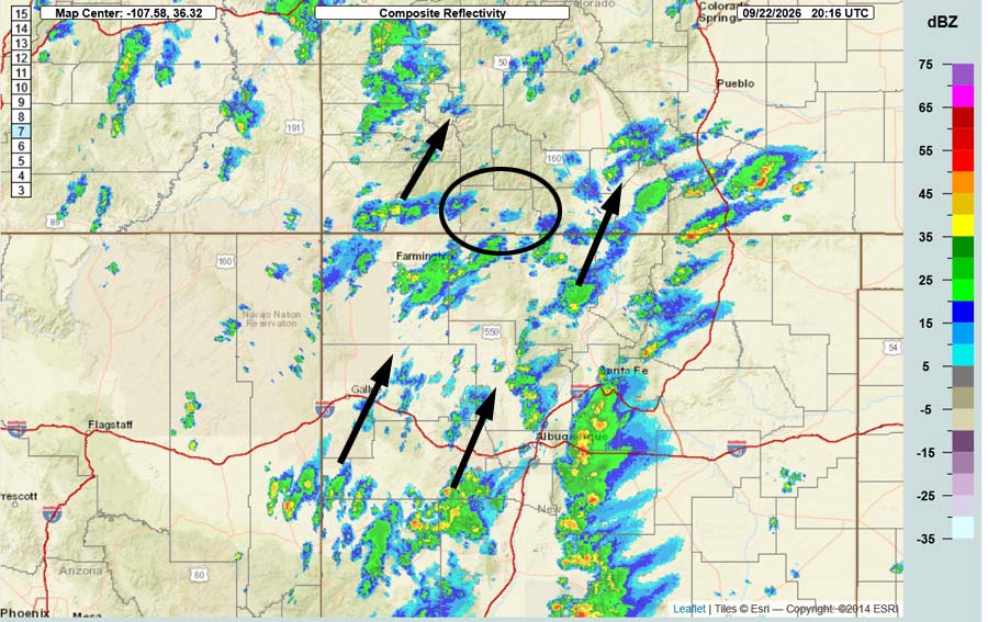
Current satellite and radar…
Forecast highlights…
*** The Swiss Roll Fire, burning about 14 miles northwest of Pagosa Springs, is 777 acres and 36% contained. ***
*** Tuesday afternoon through Friday evening will be wet with scattered showers and thunderstorms. Wednesday afternoon through Thursday evening is the best chance for a good soaking. ***
*** There is a FLOOD WATCH from Wednesday afternoon through Thursday evening. ***
*** Saturday and Sunday will be mostly dry with temps near average. ***
*** Early Monday morning into next Tuesday evening there will be another round of scattered showers and thunderstorms. ***
Rest of Tuesday through Friday… The high is expected to wobble around the TX region while a weak low moves through northeast NV and then over the Salt Lake area. Southerly flow between these two features will funnel subtropical moisture into our area.
There’s a good chance for scattered showers and thunderstorms for much of this period, but things line up best Wednesday afternoon into Thursday evening. Isolated cells will be capable of brief periods of heavy rain, small hail, gusty winds, and lightning.
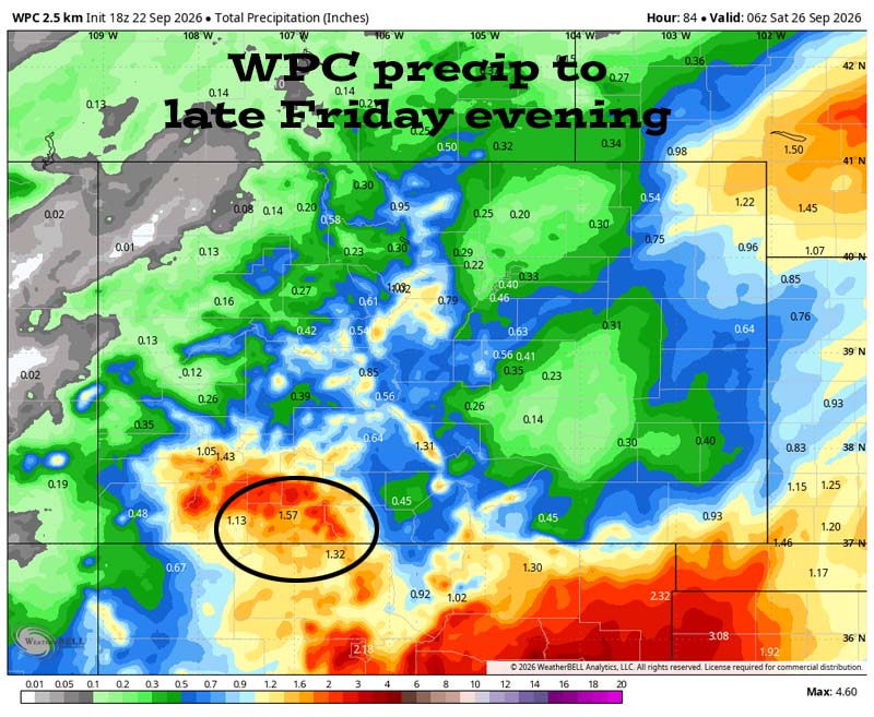
I expect much of the county to get 1” to 1.5” between Tuesday afternoon and Friday evening.
Saturday and Sunday… Flow will turn more westerly and push most of the moisture to our east. Instability will be marginal so there’s a slight chance for a spotty afternoon shower, but I think we will stay dry.
Monday and next Tuesday… A trough moving west to east across the Great Basin will bring in a little more moisture and instability and kick up scattered showers and thunderstorms. The best chance for precip is Monday afternoon through Tuesday afternoon.
The GFS expects the remnants of hurricane Polo to move through area, but the GFS is the outlier. I don’t buy it, but I’ll keep a close eye on it.
Temps…
Tuesday night lows will be in the low 40s to the low 50s.
Wednesday and Thursday highs will be in the high 50s to the mid 60s and lows will be in the mid 40s to the low 50s.
Friday highs will be in the mid 60s to the low 70s and lows will be in the high 30s to the mid 40s.
Saturday and Sunday, highs will be near 70 to the mid 70s and lows will be in the high 30s to the mid 40s.
Monday and next Tuesday highs will be in the low to high 60s and lows will be in the low to high 40s.
Winds…
Each afternoon gusts will be 15-20mph.
*** As always, isolated stronger gusts are likely near showers and thunderstorms. ***
26 Sep to 7 Oct… It’s transition season. We are gradually switching from a summer monsoon to a fall pattern. Forecast models always struggle during transitions seasons. They are widely fluctuating and unreliable.
Right now, I’m sticking with the typical seasonal shift of the summer high weakening and the jet stream slowly dipping farther south. I don’t expect much precip during this period.
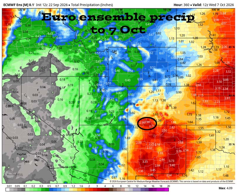
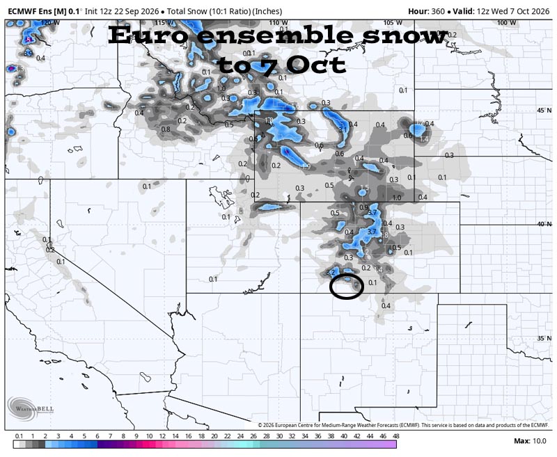
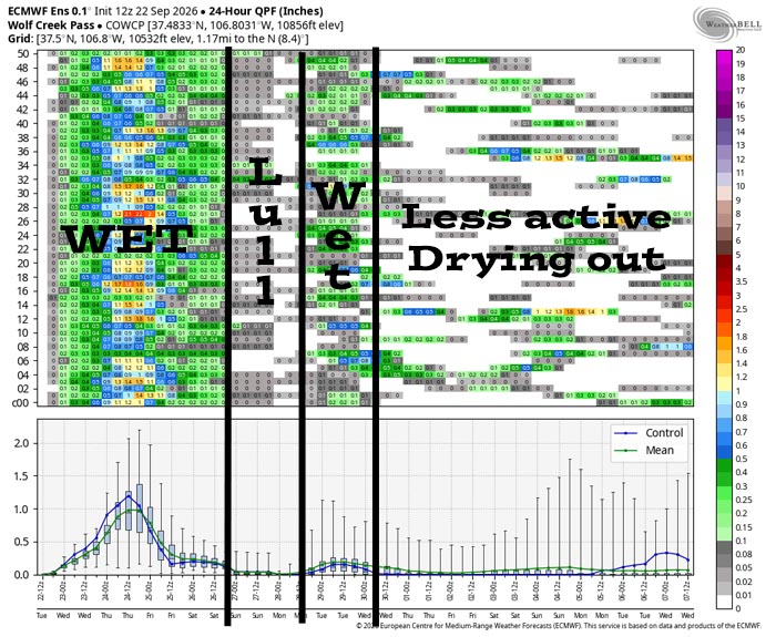
It’s wet into Friday night with precip peaking Wednesday afternoon into Wednesday night. There’s a lull over the weekend though a few light showers are possible. Another round of showers is possible Monday afternoon into Tuesday evening, and then it’s less active and drying out for the rest of the period.
The next post will be on Thursday. Keep an eye on Facebook for quick updates.
– Shawn


One Response
El ninio projection