
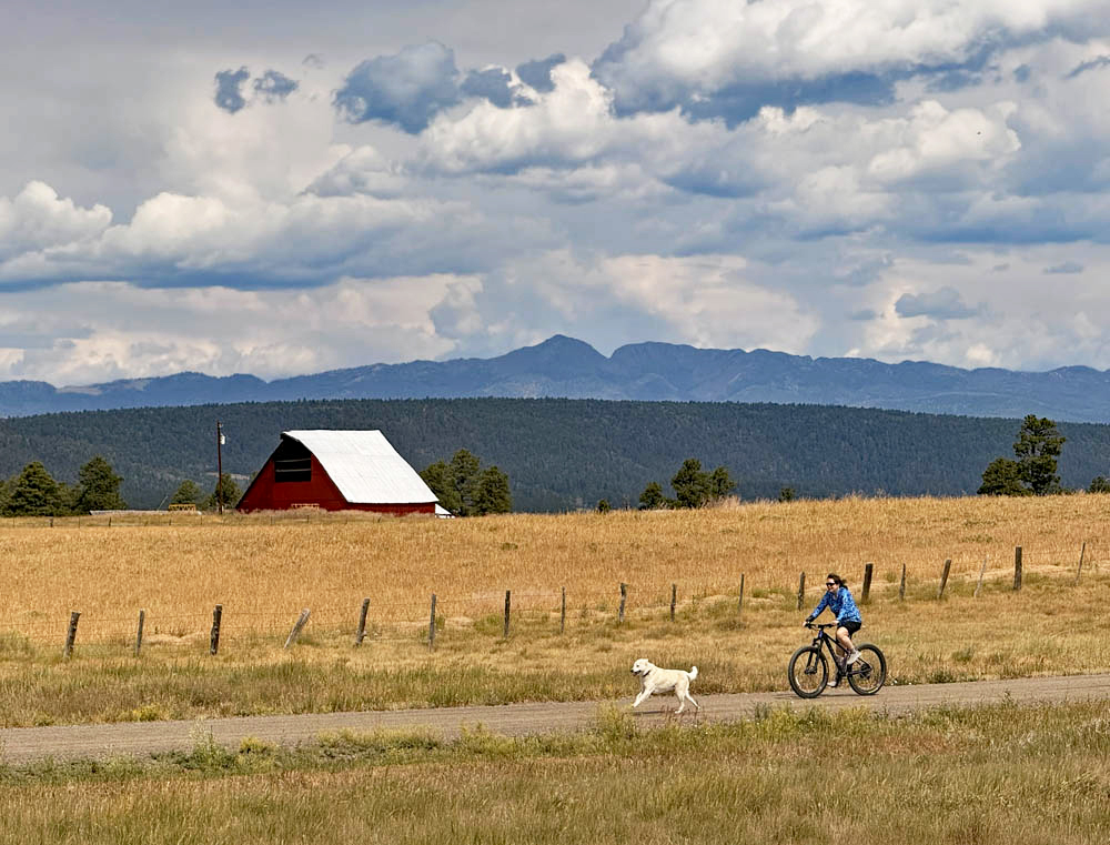
Tommy living the good life with a backdrop of Cumulus clouds! (Hit title of post to see image)
Tuesday – 14 Jul 2026 – 7:30pm
The past…
Stevens Field Observations
Sunday: High: 91, Low: 52, Peak wind: 20mph, Afternoon humidity: 9-12%
Monday: High: 85, Low: 56, Peak wind: 32mph, Afternoon humidity: 26-68%, Rain 02″
Tuesday: High: 86, Low: 55, Peak wind: 25mph, Afternoon humidity: 25-57%, Rain .17″
| Average High | Record High / Year | Average Low | Record Low / Year |
| 83 | 91 / 1972 | 45 | 30 / 1948 |
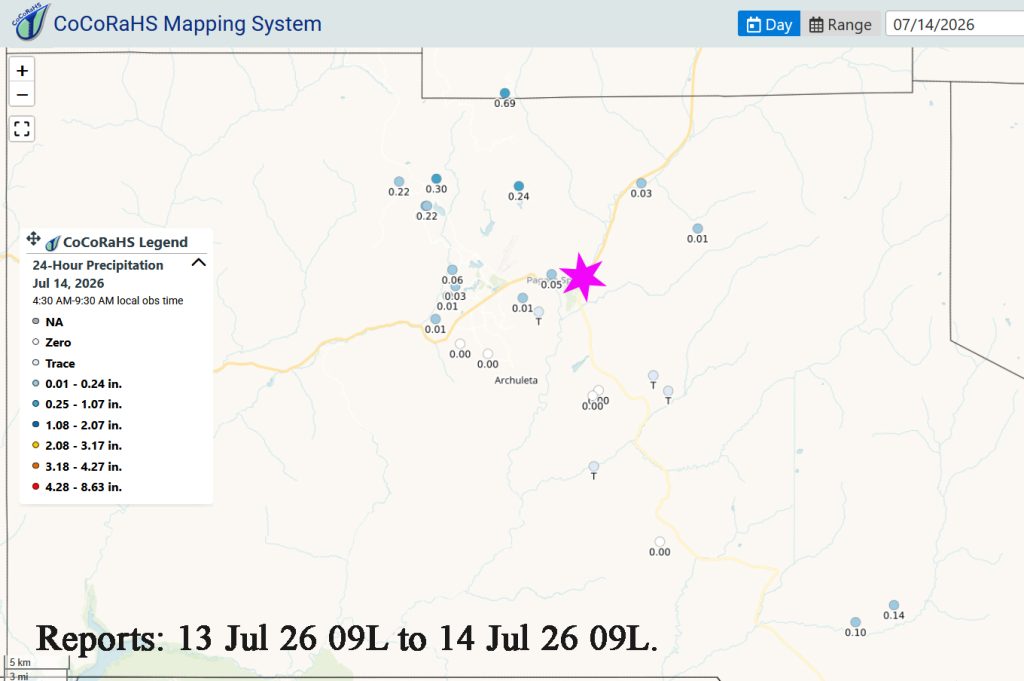
Precipitation summary…
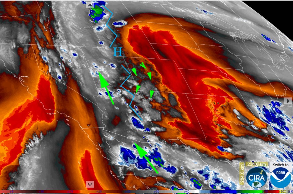
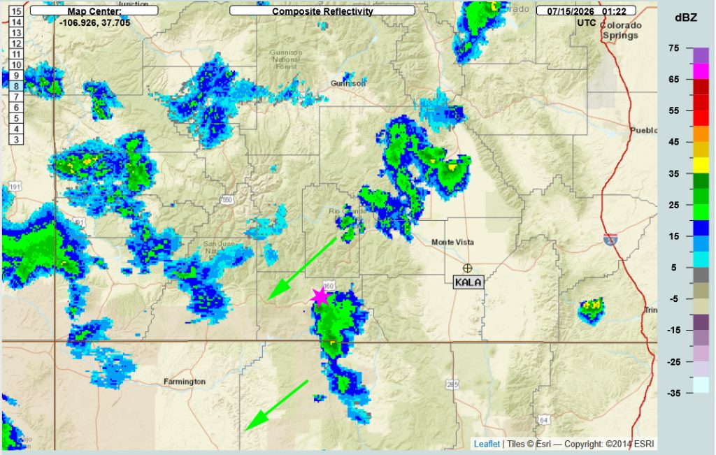
Current satellite and radar…
Forecast highlights…
*** Fire danger remains very high. The entire San Juan National Forest and Archuleta County are under stage 2 fire restrictions. ***
*** The MONSOON has arrived! Expect thunderstorms with lightning, small hail, gusty winds and drops in temperature from noon to 8pm each day.***
Tuesday through next Tuesday…
The monsoon is here! We’ll be Clear to Partly Cloudy in the mornings with clouds increasing at noon till we are Mostly Cloudy. Then clouds will clear out overnight as we cool. Expect thunderstorms with lightning, small hail, gusty winds and drops in temperature from noon to 8pm each day.
We are seeing its typical beginning phase behavior. Not everyone is going to get rain. Yesterday we had .22″ in O’Neal Park. So far today we have had ZERO! Other areas had rain today!
As we move into monsoon season, the lower atmosphere will become more saturated and the thunderstorms will have wider footprint as to where they drop rain.
This week tomorrow (Wednesday) and next Tuesday look to be the most active days with the chance of more folks seeing rain. This weekend, we will still see thunderstorms but it may be more quiet as the area of High pressure moves.
Storms will be moving from the northeast to the southwest through Friday. They will move from the east to the west over the weekend. On Monday they will move from the south to the north. Finally, on Tuesday, they will move form the southwest to the northeast as the High sinks to our southeast. This is the ideal flow for our monsoon season!
There will be rain lottery winners and losers. Do your rain dances!
Temps…
High temperatures will have a high degree of variance. They will range form mid-70s to near 90. It all depends on how warm we can get before the thunderstorms move in and collapse. They push down cold air from up at 20,000 feet so temperatures can drop 20 to 30 degrees.
Low temps have warmed with the increase in moisture. Expect mid-40 to low-50s.
Winds…
Winds will be out of the southwest at 8 to 12 mph each day. However, expect much gusts of 20-30mph associated with the collapse of thunderstorms each afternoon.
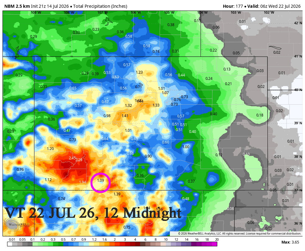
14 to 29 Jul… The subtropical high pressure will shift from the northwest of us to our southeast which is ideal. The models have been having a difficult time with placement and have not verified well. I hope the latest version sticks because it is a better solution with more rain Southwest Colorado.
Precipitable water is pretty high for much of this period, so showers will be capable of producing brief periods of heavy rain over small areas.
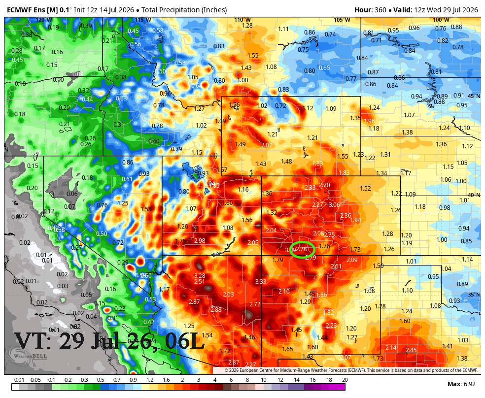
Euro ensemble precip to 29 Jul shows 2.78 ” in the Pagosa area. The GFS is indicating 2.97. Given how volatile monsoon season can be, these two models are pretty close.
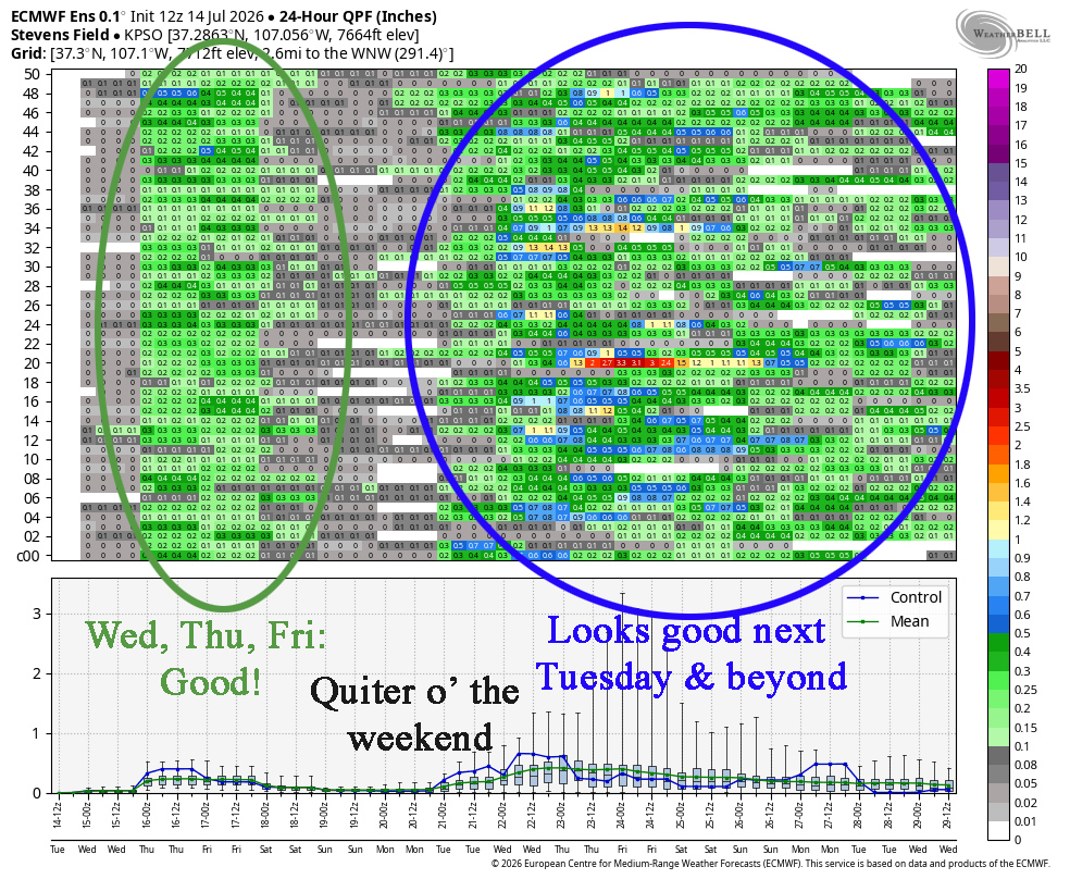
On Wednesday, Thursday and Friday there is a good chance for monsoon thunderstorms with moderate rain amounts. Over the weekend there will be isolated monsoon thunderstorms with lighter rain amounts. Starting Monday, there will be more monsoon thunderstorms with moderate to heavy rain through the week.
The next post will be Thursday afternoon.
– Arleen


One Response
Smelled rain, even felt a few sprinkles. That’s the third time in as many days that that has happened.