
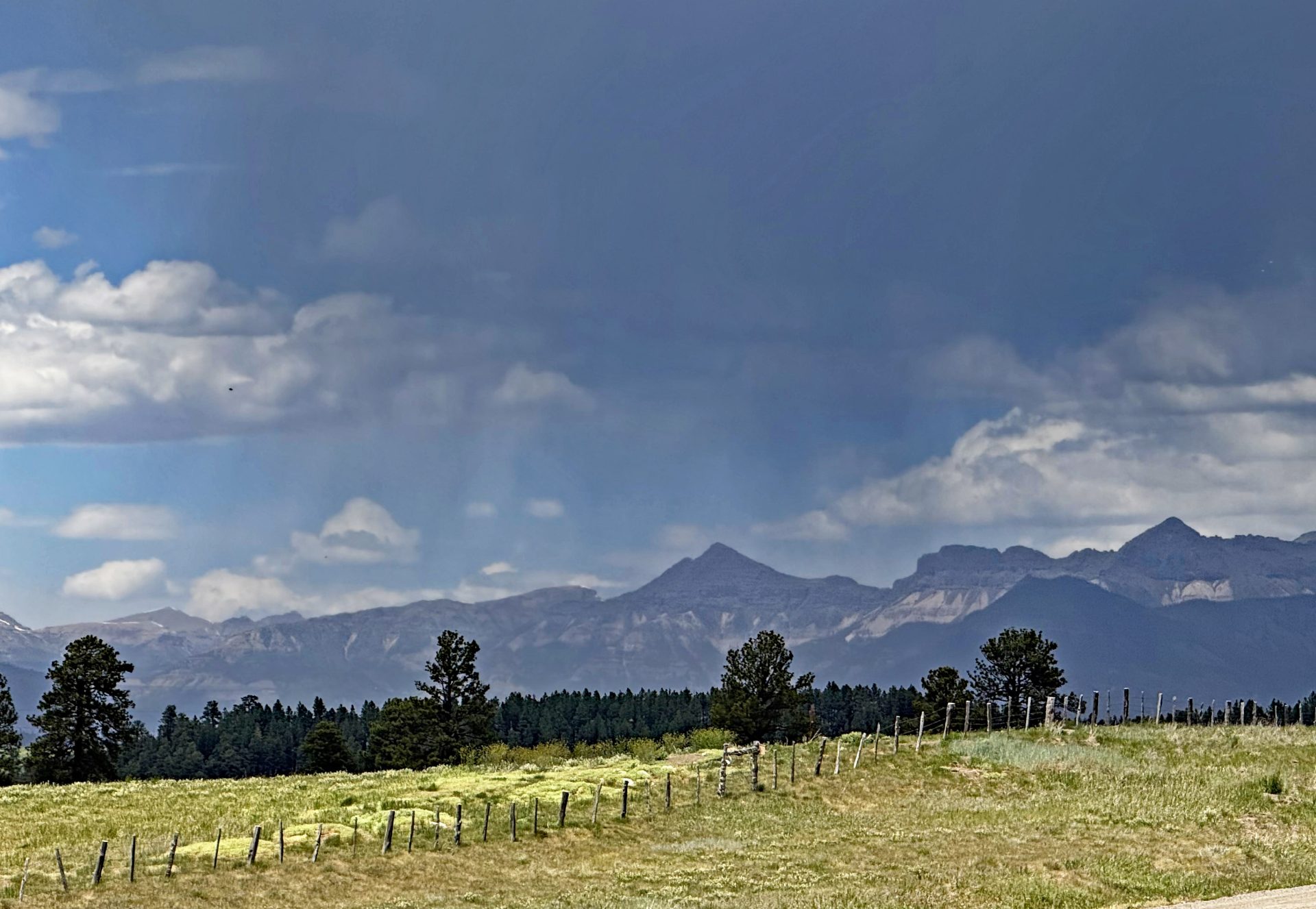
Typical storm that approaches us from the northwest – we just get scraps. Folks on North Piedra by county line recorded .03″ & .12″ of rain. – pic taken 6/03/2026
Wednesday – 03 June 2026 – 7:40pm
The past…
Stevens Field Observations
Wednesday: High: 79, Low: 44, Peak wind: 35mph
Tuesday: High: 80, Low: 39, Peak wind: 29mph
Monday: High: 79, Low: 35, Peak wind: 24mph
Sunday: High: 72, Low: 32, Peak wind: 20mph
| Average High | Record High / Year | Average Low | Record Low / Year |
| 74 | 86 / 1946 | 34 | 20 / 1951 |
Precipitation summary… There was no recorded precipitation on Monday or Tuesday. This afternoon from 1pm to 3pm, a thunderstorm moved across the area dropping .03″ & .12″ of rain on North Piedra by county line. Then is calmed itself till it got farther from the mountains and the lee side affect and reformed. Steven Field reported light rain from 1:15pmto 2:35pm and a few gusts to 35mph associated with the outflow from the cell.
Current satellite and radar…


Forecast highlights…
*** San Juan National Forest fire danger is “VERY HIGH”. ***
*** Stage 1 Fire Restrictions are in effect. ***
*** Today through Saturday and next Tuesday spotty afternoon showers and thunderstorms. Precip amounts will be light. ***
*** Chance for “dry lightning” this week. Keep an eye out for new fires. ***
Forecast details…
Today through Saturday… A “monsoon-like” pattern will try to set up. We’ll be Partly Cloudy to Mostly Cloudy.
An area of low pressure in the Baja area is moving moisture into the southwest. With a minor ridge over our area, the resultant flow is northwest so conditions are marginal with just a few spotty afternoon showers and thunderstorms each day. Precip amounts will be light and spotty.
We could see “dry lightning” and need to keep an eye out for new fires.
Winds: Afternoon gusts will be 15-20mph. Expect isolated gusts to 35mph associated with the thunderstorm cells.
Temps… mid 70s to the low 80s. However, Saturday will be warmest days with highs pushing into mid 80s. Lows will be near 40 to the mid 40s.
Sunday and Monday… Drier, more stable air will move into the area from the southwest. We’ll be Partly Cloudy.
Winds: Afternoon winds will increase as a low spins over the Great Basin. Afternoon gusts will be 30mph. Mountain winds gusting to 35 mph.
Temps… mid 70s to the low 80s and lows will be low 40 to the mid 40s.
Tuesday… Isolated spotty afternoon showers and thunderstorms return. Flow will be from the southwest so they may be better organized. We’ll be Partly Cloudy to Mostly Cloudy.
Winds: Afternoon gusts will be 20-30mph. Expect isolated gusts to 40mph associated with thunderstorm cells. Mountain winds gusting to 40mph.
Temps… mid 70s to the low 80s and lows will be near 40 to the mid 40s.
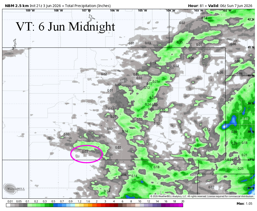
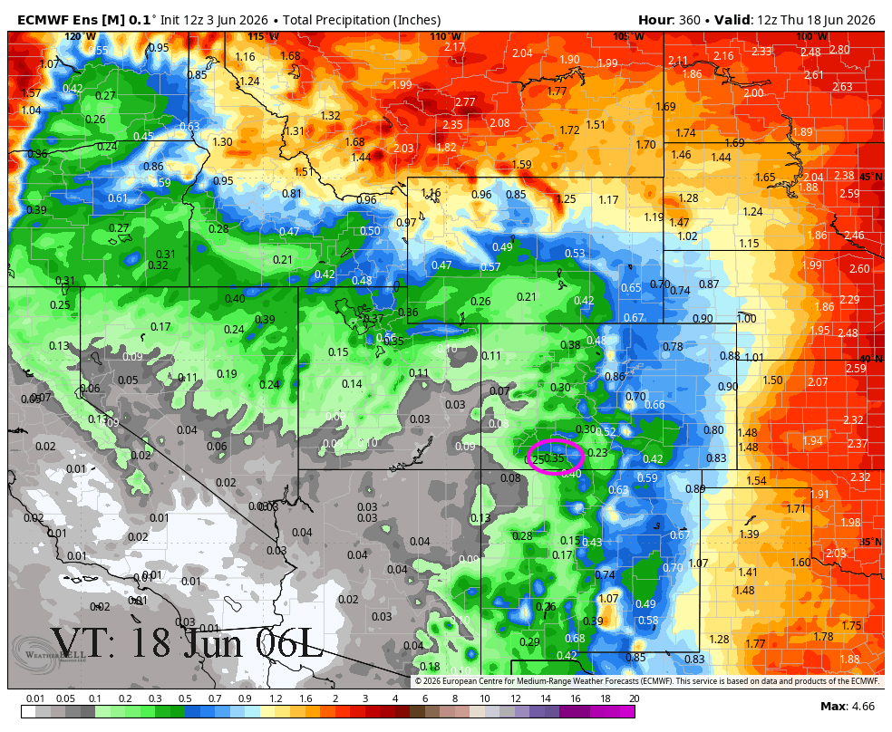
3 Jun to 18 Jun… It looks more likely that the ridge will set up to our west and cut off our moisture feed and instability. I think we will be mostly dry and warm with highs in the high 70s to high 80s. Euro looks for .35″ and the GFS is looking for .64″ in that time. I think both models are overestimating the precip amounts. I am not seeing anything that will bring us other than light precipitation.

The next post will be Friday afternoon.
– Arleen


