

Standing lenticular clouds over the Sangre de Cristos – pic taken 6/2/2026
Friday – 5 Jun 2026 – 2:30pm
The past…
Stevens Field Observations
Wednesday: High: 80, Low: 44, Peak wind: 35mph
Thursday: High: 77, Low: 41, Peak wind: 29mph
| Average High | Record High / Year | Average Low | Record Low / Year |
| 75 | 93 / 1946 | 34 | 20 / 1908 |
Precipitation summary… A few lucky spots got 0.02” of rain, but most of the county stayed dry.
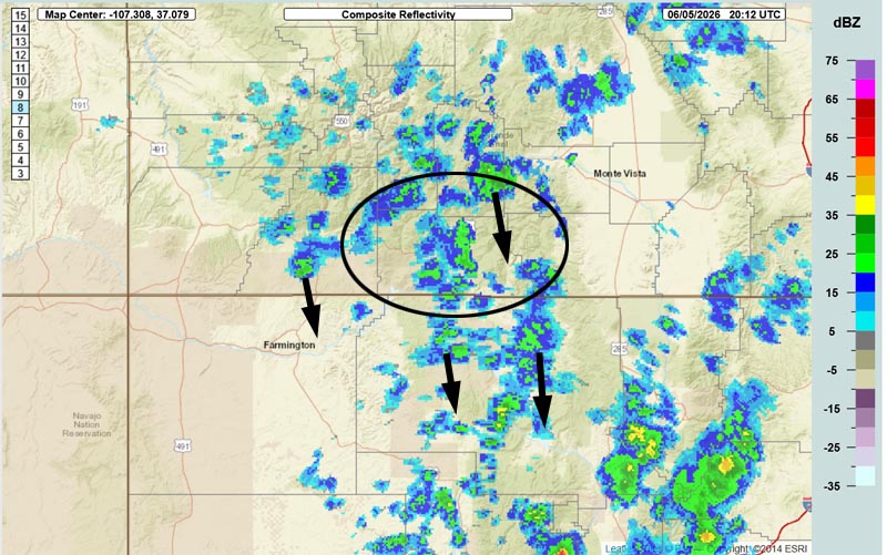
Current satellite and radar…

Forecast highlights…
*** San Juan National Forest fire danger is “VERY HIGH”. ***
*** Friday and Saturday there will be spotty afternoon showers and thunderstorms. Storms will produce more wind than rain. ***
*** Windy, dry, and INCREASED FIRE DANGER Sunday through next Friday. ***
Forecast details…
Rest of Friday and Saturday… A weak ridge is over our heads with marginal moisture and marginal instability. A few spotty afternoon showers and thunderstorms are likely, mostly over the mountains. Consider yourself lucky if you get a few raindrops.
Keep an eye out for smoke from potential lightning fires.
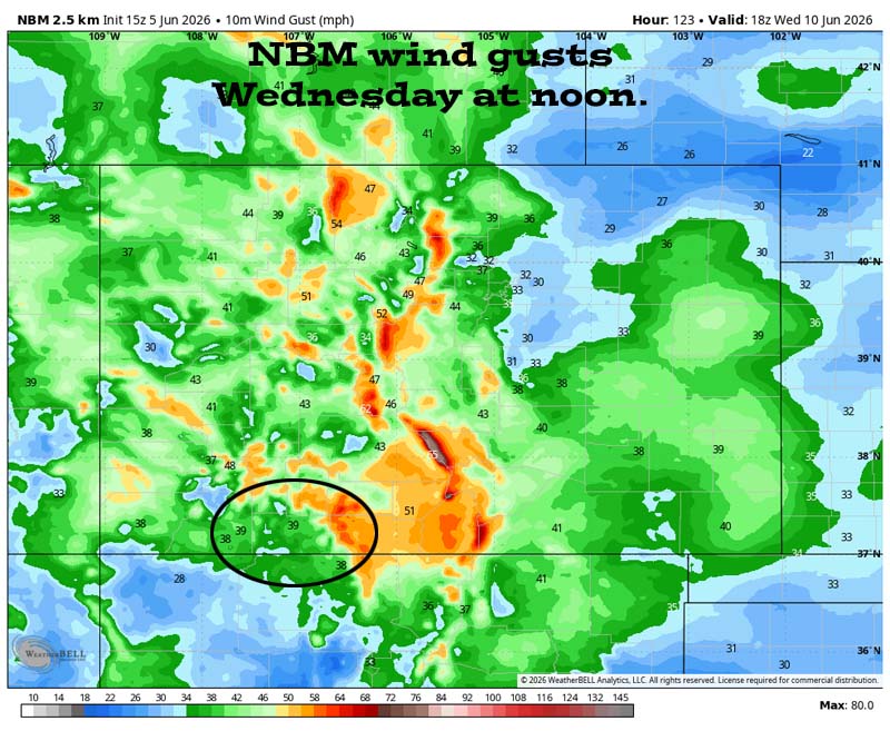
Sunday through next Friday… The ridge will move to our east while a trough skirts to our north. The jet stream will sink south and help tighten our gradient. This means gusty winds each afternoon.
It will also be dry for most of this period. Tuesday is the exception when the trough will be closest and bring us a little more moisture and instability leading to a chance for a few isolated showers and thunderstorms. Precip amounts will be low and spotty.
*** Low humidity, warm temps, and gusty winds will boost our fire danger. ***
Temps…
Friday night lows will be in the high 30s to the mid 40s.
Saturday through Wednesday highs will be in the mid 70s to the low 80s and lows will be in the high 30s to the mid 40s.
Thursday and next Friday highs will be in the high 70s to the mid 80s and lows will be near 40 to the high 40s.
Winds…
Friday and Saturday, each afternoon gusts will be 15-20mph. Isolated higher gusts are likely near showers and thunderstorms.
Sunday and Monday, each afternoon gusts will be around 30mph.
Tuesday and Wednesday, each afternoon gusts will be 35-40mph.
Thursday afternoon gusts will be 30-35mph.
Next Friday afternoon gusts will be around 30mph.
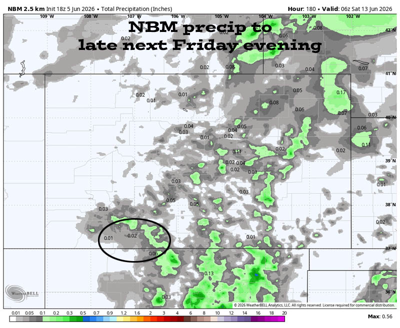
12 Jun to 20 Jun… There is a lot of uncertainty for the this period, but I think we will be mostly dry and warm with highs in the high 70s to high 80s.
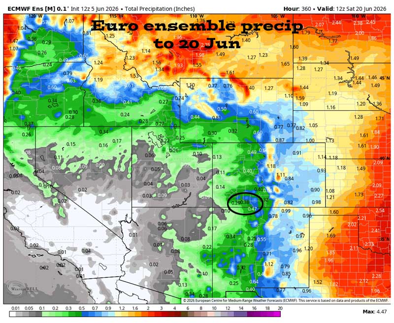

It shows light precip amounts today with spotty showers and a lower chance for showers tomorrow. Its’s dry Sunday and Monday. Tuesday afternoon and evening there’s a chance for scattered showers with light precip amounts. Then it’s mostly dry 11-15 Jun. The models are all over the place the last few days, but still lean towards mostly dry.
The next post will be Sunday afternoon.
– Shawn


