

The “official” NWS snow forecast shows 5-8” in the Pagosa area and 12-18” in the Wolf Creek area. Let it snow!
Thursday – 22 Jan 2026 – 4:10pm
The past…
Stevens Field Observations
Wednesday: High: 45, Low: 10, Peak Wind: 8mph
| Average High | Record High / Year | Average Low | Record Low / Year |
| 37 | 57 / 1981 | 1 | -31 / 1955 |
Precipitation summary… There has been no recent measurable precip.
Current satellite and radar…
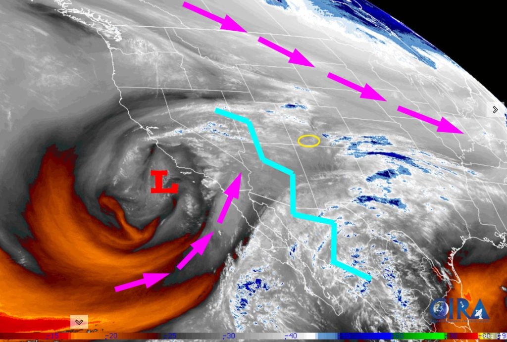
There is nothing on radar in our area Thursday afternoon.
Forecast highlights…
*** Clouds will gradually increase through Friday morning. ***
*** A WINTER WEATHER ADVISORY has been issued for the PAGOSA SPRINGS area. 4-8” of snow is expected 5pm Friday to 5am Sunday. ***
*** A WINTER WEATHER WARNING has been issued for the eastern San Juan Mountains above 10,000ft. This includes WOLF CREEK PASS. 10-18” of snow and winds gusting to 35mph are expected 11am Friday to 5 am Sunday. ***
*** Expect winter driving conditions Friday evening into Sunday morning. ***

*** Most of Sunday and through next week will be dry. ***
Forecast details…
Thursday night through Friday morning… Clouds will gradually increase as the ridge weakens and moves to our east.
Friday afternoon into early Sunday morning… The storm looks more favorable for us! The ingredients are lining up for a decent winter storm.
Timing… The first few scattered snowshowers will start over the mountains around noon on Friday and then gradually increase through Friday afternoon. *** The best chance for snow and most of the accumulation will occur Friday evening into Saturday afternoon. *** Saturday evening into early Sunday morning snowshowers will become more spotty and gradually come to an end.
Snow amounts…
Wolf Creek area: 12-18”
Pagosa area: 4-8”
Sunday and the rest of next week… A ridge will build over the region and dry us out.
Temps…
Thursday night lows will be in the high teens to mid-20s.
Friday highs will be in the mid-30s to low 40s and lows will be in the low to high 20s.
Saturday highs will be in the mid-30s to high 30s and lows will be in the mid-single digits to mid-teens.
Sunday highs will be in the high 20s to mid-30s and lows will be -10 to 5.
Monday highs will be in the low to high 30s and lows will be -5 to 10.
Tuesday highs will be in the mid-30s to low 40s and lows will be in the low single digits to the mid-teens.
Wednesday and next Thursday highs will be near 40 to the high 40s and lows will be in the high single digits to high teens.
Winds…
Friday afternoon gusts will be around 15mph in the Pagosa area and 30-35mph in the high country.
Saturday afternoon gusts will be 15-20 in the Pagosa area and 30-35mph in the high country.
Sunday afternoon gusts will be around 15mph in the Pagosa area and 25-30mph in the high country.
Monday through next Thursday, each afternoon peak winds will be around 10mph in the Pagosa area and around 20mph in the high country.

29 Jan to 6 Feb… It looks dry through the 1st or 2nd and then more active.
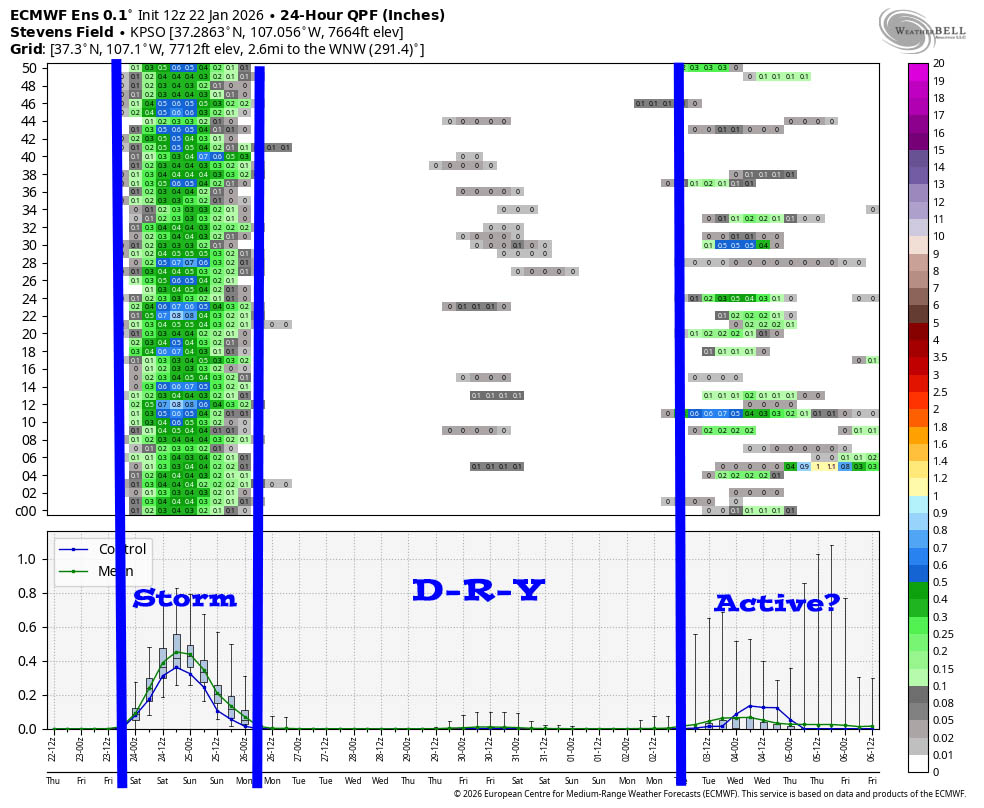
It clearly shows our Friday/Saturday storm, and then dry through the 1st or 2nd, and then potentially active at the end of the period.
I’ll try to do a weather post each day to Sunday. Keep an eye out for quick posts on Facebook Friday and Saturday.
– Shawn


