
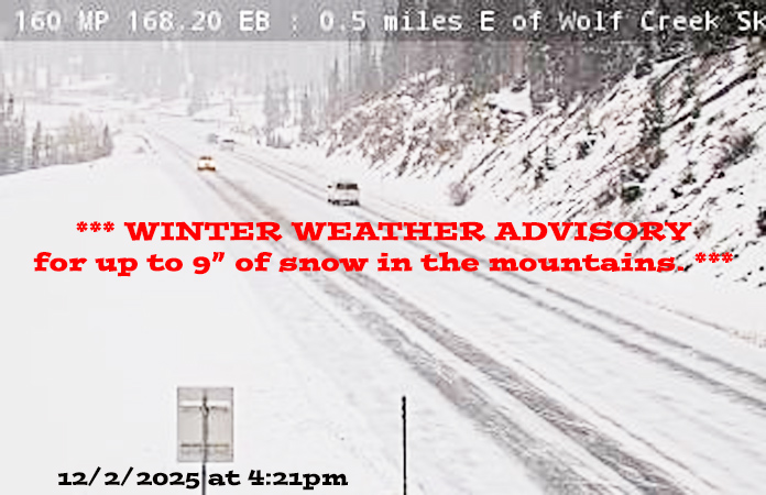
CDOT webcam from Wolf Creek Pass on 2 Dec at 4:21pm
Tuesday – 2 Dec 2025 – 4:45pm
The past…
Stevens Field Observations
Sunday: High: 35, Low: 21, Peak Wind: 8mph
Monday: High: 33, Low: 19, Peak Wind: 20mph
| Average High | Record High / Year | Average Low | Record Low / Year |
| 44 | 63 / 1906 | 10 | -10 / 1913 |
Precipitation summary… Light snow fell in the Pagosa Springs area early Sunday afternoon into Sunday night.
Wolf Creek reported 10” of snow from the last storm.
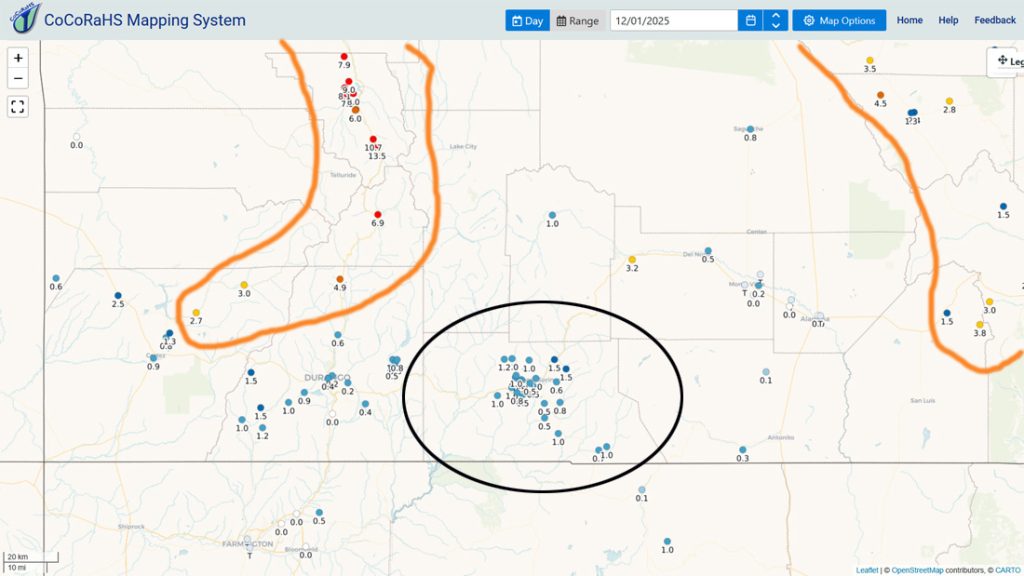
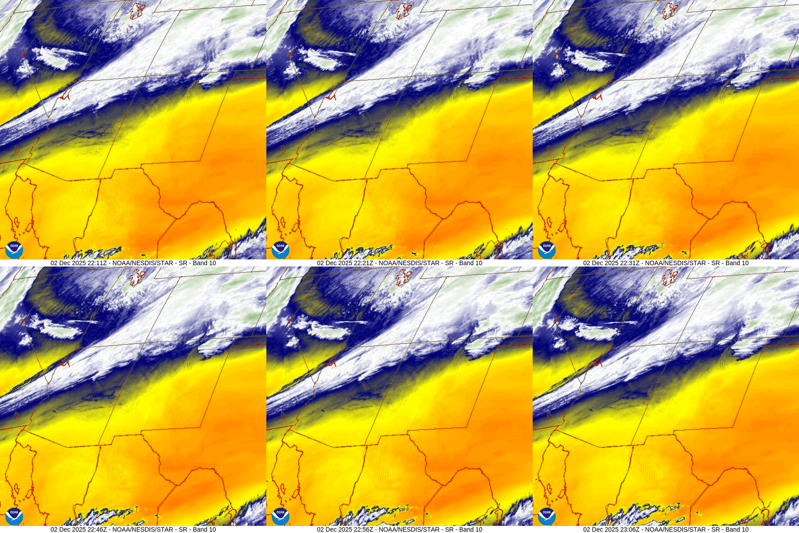
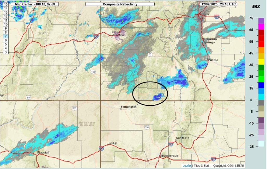
Current satellite and radar…
Forecast highlights…
*** There is a WINTER WEATHER ADVISORY for the eastern San Juan Mountains above 10,000ft. This includes Wolf Creek Pass. Up to 9” of snow is expected by 2am Thursday. ***
*** Light snow is falling across much of the area Tuesday afternoon. Roads could get slick shortly after the sun sets this evening. ***
*** Winter driving conditions will be the worst late Wednesday morning through Wednesday evening. Expect slick roads into Thursday morning. ***
*** It looks like dry weather roughly 5-13 Dec and then the pattern could get more active. ***
Forecast details…
Rest of Tuesday… A prefrontal trough will move through southwest Colorado 7-8pm this evening. Light snow snowshowers will end 7-8pm and then hit and miss snow showers are possible through the night, especially over the mountains.
Snow amounts to sunrise Wednesday…
Mountains: 1-2”
Pagosa area: a dusting to 1”
Wednesday through Thursday morning… Another fast-moving trough will move through the area from the northwest.
Timing… Snowshowers will ramp up mid-morning on Wednesday. The best chance for snow is late Wednesday morning into Wednesday evening. Hit and miss showers will persist into early Thursday morning, mostly over the mountains.
Snow amounts…
Mountains: 6-10”
Pagosa area: 1-3”
Thursday afternoon through next Wednesday… A Rex block will set up off the southern West Coast and keep the dreaded, dry flow out of the northwest over us. Temps will slowly warm towards average.
Temps…
Wednesday and Thursday highs will be near 30 to the high 30s. Wednesday night lows will be in the low teens to low 20s. Thursday night lows will be in the mid-single digits to the mid-teens.
Friday and Saturday highs will be in the mid-30s to low 40s and lows will be near 10 to the low 20s.
Sunday, Monday, and Tuesday highs will be in the low to high 40s and lows will be in the low teens to low 20s.
Next Wednesday highs will be in the mid-40s to the low 50s and lows will be in the
Winds…
Afternoon gusts will be 10-15mph each day.
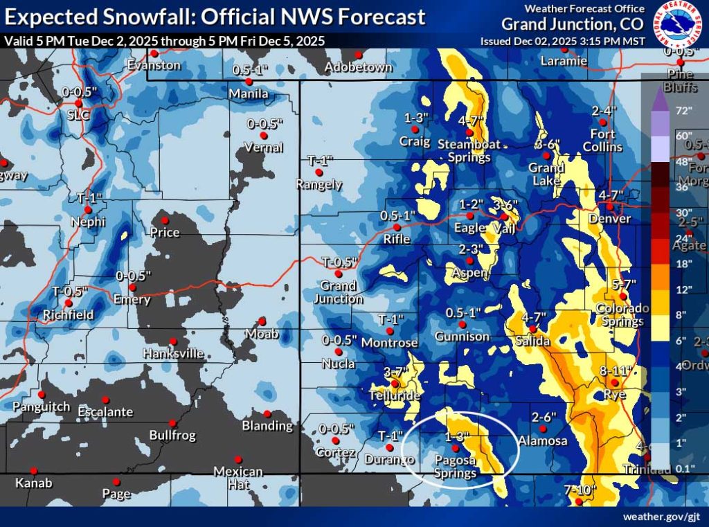
Note the Sangre De Cristos, La Veta Pass, and the I-25 corridor are expected to get decent snow. Keep an eye on COTrip for travel conditions.
The 8-14 day period… Upper level flow will remain in a La Nina-like pattern. The storm track over our region will be out of the northwest which means northern CO is favored and we get a few scraps. There are signs that the pattern could more active towards the end of this period.
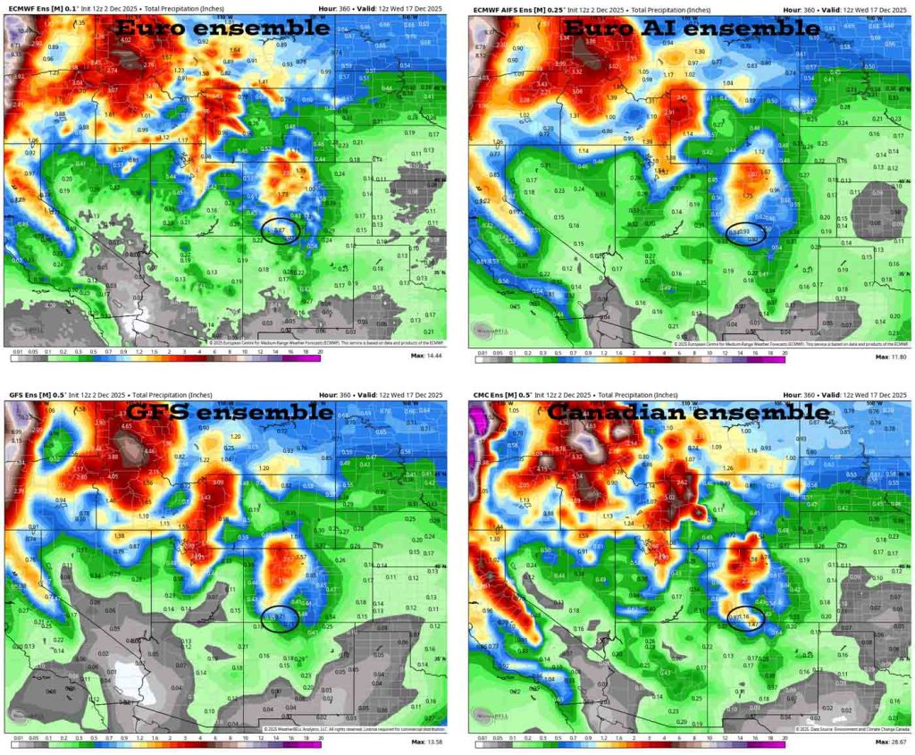
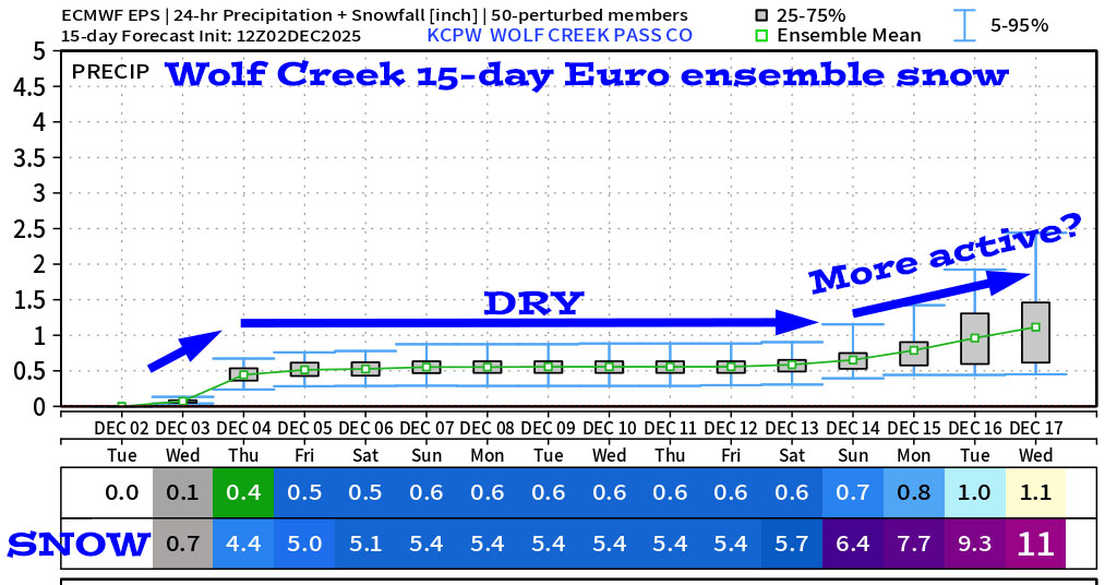
It looks pretty dry roughly 5-13 Dec and then might get more active.
Keep an eye on Facebook for quick weather posts. The next thorough post will be on Thursday.
– Shawn


