

Golden aspens and a dusting of snow on Pagosa Peak – pic taken 10/4/2025
Saturday – 4 Oct 2025 – 2:30pm
The past…
Stevens Field Observations
Thursday: High: 74, Low: 34, Minimum relative humidity: 16%, Peak Wind: 18mph
Friday: High: 72, Low: 38, Minimum relative humidity: 27%, Peak Wind: 25mph
| Average High | Record High / Year | Average Low | Record Low / Year |
| 67 | 79 / 1987 | 31 | 20 / 1959 |
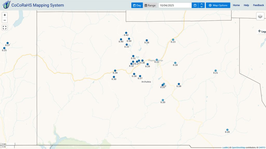
Precipitation summary… There was no measurable precip reported Friday morning.
Friday evening through Friday night scattered showers and thunderstorms moved through. Our mountains got a dusting of snow above timberline.
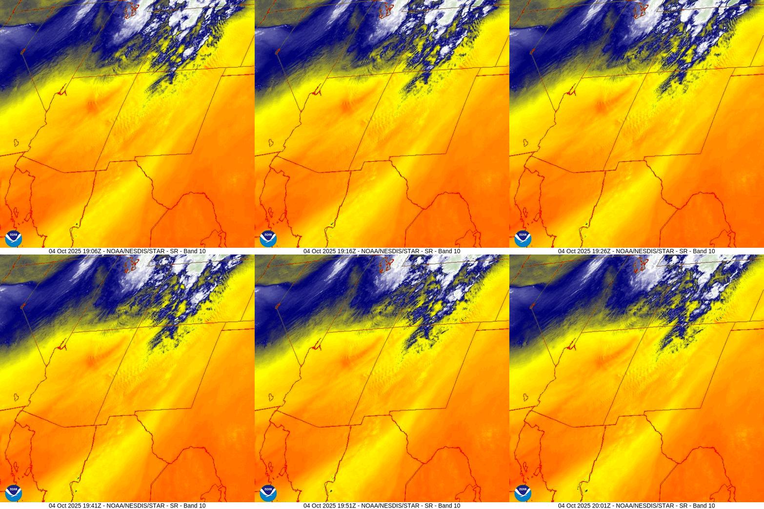
Current satellite and radar…

Forecast highlights…
*** Saturday afternoon there will be a few scattered showers, thunderstorms, and gusty winds. ***
*** HARD FREEZE Saturday night with temps down to the mid-20s. ***
*** Sunday and Monday will be nice with scattered clouds. ***
*** Tuesday and Wednesday will be mostly dry with just a few spotty afternoon showers and thunderstorms. ***
*** Thursday through next weekend will be more unsettled with occasional showers and thunderstorms, mostly in the afternoons. Priscilla might visit. Forecast confidence in the details is still low. ***
Forecast details…
Rest of Saturday… The trough will move through this afternoon. There will be a few fast moving storms with brief periods of rain and small hail. Winds will also be gusty. We could be treated to a pretty sunset!
Snow levels at noon on Saturday are around 11,600ft and will drop to around 10,600ft later Saturday afternoon. As snow levels drop, clouds and showers will taper off. Our mountains above 11,000ft could get an inch or two of snow. It will be spotty.
Saturday night through Monday… We will be between systems as the ridge holds to our east, and an upper-level trough stalls along the West Coast.
Tuesday and Wednesday… The upper-level ridge will be near us. We’ll have marginal stability and marginal moisture. There will be a few spotty afternoon storms, but most of us will be dry.
Thursday through next weekend… I’m still not sure about this period.
Priscilla might visit. She is expected to get organized off the Mexican Pacific Coast tonight. Some models expect her remnants to soak us later this week, some think it will hold off until early next week, and other models don’t think it will impact us at all.
The other question is where the mid and upper-level ridge will set up. If it’s to our east, we’ll see more storm activity. If it’s overhead or to our west, it will be quieter.
As of today, this is what I expect…
Thursday through next weekend will be more active with scattered showers and thunderstorms. Storms this weekend could produce brief periods of heavy rain, small hail, lightning, and gusty winds.
Snow… A subtropical feed means relatively warm air and mostly rain. Snow levels will start around 12,000ft Tuesday and then rise to around 13,000ft by next Saturday. Temps will hover around freezing so snow will struggle to accumulate. I expect the mountains above 12,000ft to get 1-3” of snow over the entire period.
*** My forecast confidence in the details is low. I’ll adjust timing, precip amounts, and mountain snow as the data gets better. ***
Temps…
Saturday highs will be in the near 60 to the mid-60s and lows will be in the *** mid-20s to low 30s ***.
Sunday through Wednesday highs will be in the low to high 60s and lows will be in the *** LOW to high 30s ***.
Thursday and Friday highs will be in the mid-60s to low 70s and lows will be in the mid-30s to low 40s.
Next Saturday highs will be in the low to high 60s and lows will be in the low to high 30s.
Winds…
Saturday afternoon gusts will be 30-35mph.
Sunday and Monday afternoons gusts will be 20-25mph.
Tuesday and through next weekend, each afternoon gusts will be around 20mph.
As always, stronger isolated gusts are likely near a shower or thunderstorm.

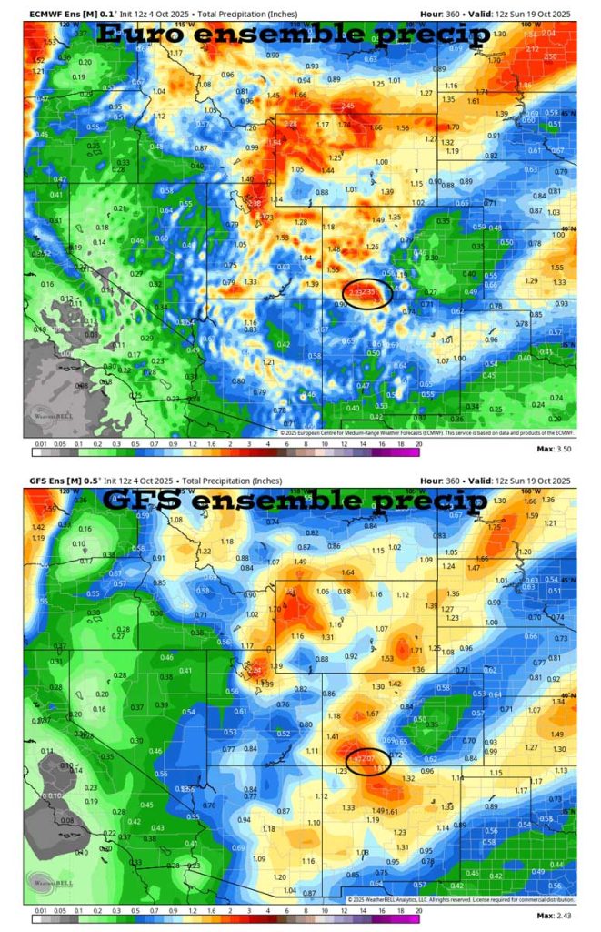
Most of the models have dropped precip amounts considerably. When the models vary like this, I don’t trust them.
The 8-14 day period… The models continue to flip-flop wildly for the 8-14 day period. One model run will show multiple low-pressure systems impacting us and then the next model run shows them missing us.
The good news is that the jet stream has slipped south and is active. It looks like the first half of October will be wet.

Unless something interesting pops up, the next post will be on Monday.
– Shawn


One Response
That was a great report
Shawn. We are in Texas for a bit and it is really nice to keep up with our weather in Colo.