
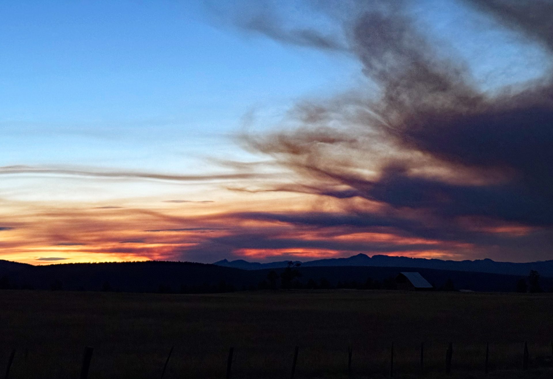
Smoke from the Stoner Mesa Fire made for an eerie sunset last night. – Pic taken 8/5/2025
Wednesday – 6 Aug 2025 – 6:00pm
Two more dry days and then a chance again starting on Saturday.
The past…
At Stevens Field the high temperature on Monday, Tuesday and so far today has been 86. The low this morning was 47. On Tuesday morning it was 41. But the cold spots were in the mid 30s!
The minimum relative humidity Saturday afternoon was 14% with a dew-point of 32. Tuesday afternoon it was only 8% RH with a dew-point of 19. This indicates a little moisture advection but we want to see dew-points in upper 40s for good monsoon showers.
The peak wind at Stevens Field on Tuesday was 29mph and today (Wednesday) has been 30mph.
| Average High | Record High / Year | Average Low | Record Low / Year |
| 83 | 91 / 1981 | 46 | 32 / 1976 |
Precipitation summary… There were not any reports of precipitation on Monday or Tuesday afternoon or overnight.
Fire and smoke…
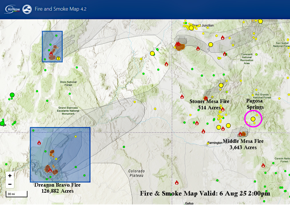
Pagosa Springs has moderate air quality. Sensitive people should consider making outdoor activities light and short.
As of Wednesday, the Elkhorn Fire north of Durango is 298 acres and is 87% contained. Unless something changes, this is the last time we will mention this fire.
The Middle Mesa Fire burning east of Navajo Lake just south of the CO/NM border is 3,643 acres and 0% contained.
The Stoner Mesa Fire west of Rico in Dolores county is up to 514 acres this afternoon and 0% contained. This fire blew up yesterday and was responsible for a lot of the smoke we saw at sunset.
There is a quite a bit more smoke in our area and air quality is now moderate across Archuleta County.
*** Between the Middle Mesa Fire east of Navajo Lake and the large Dragon Bravo Fire near the North Rim of the Grand Canyon, smoke continues to move into our area. It will be worse overnight and in the mornings. ***
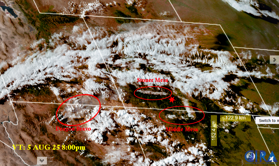
Fire and smoke map on Tuesday evening – Dragon Bravo Fire continues to produce smoke across the area. If winds are out of the south we see smoke from the Middle Mesa. If they switch out of the west as they did last night, we will see smoke from the Stone Mesa Fire.
Forecast discussion…
Satellite
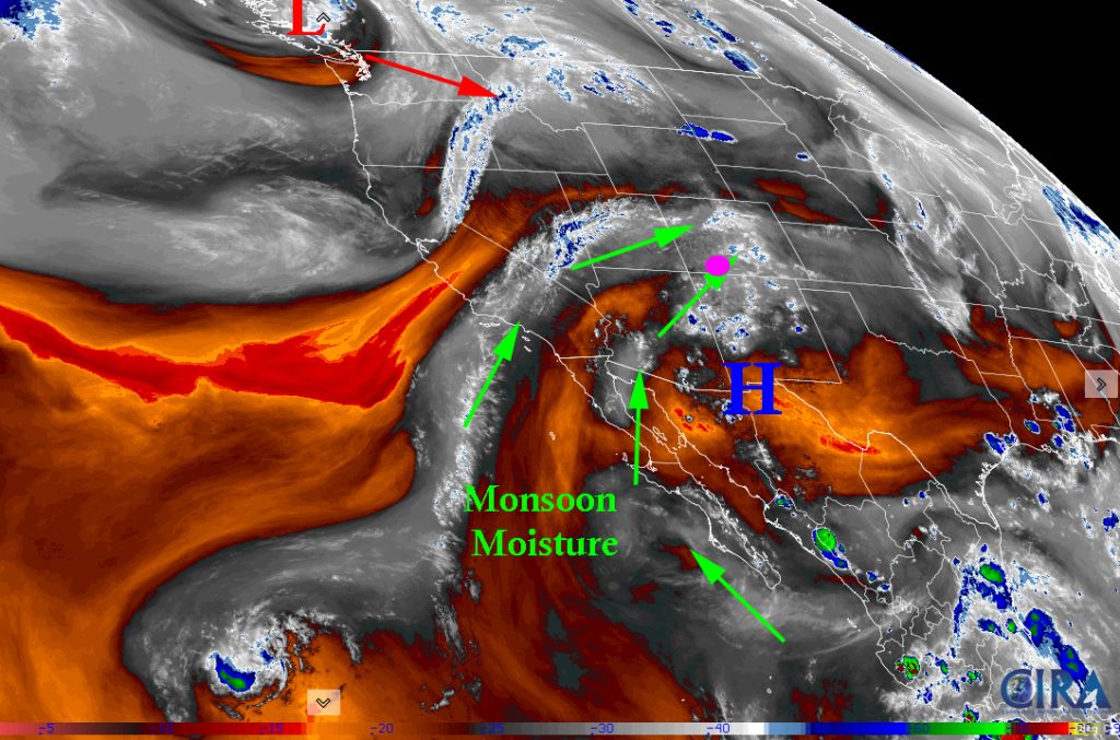
The subtropical ridge has finally rebuilt and is at a good strength! Monsoonal moisture is streaming into the area. Unfortunately, there is an area of low pressure riding on the active polar front jet that will push into Washington/Idaho/Montana tomorrow and that will knock down and weaken our subtropical ridge again and cutoff the monsoonal moisture.
Radar
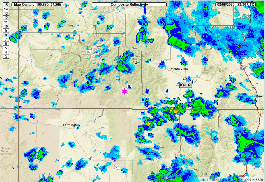
Forecast highlights…
*** Stage 1 Fire Restrictions are in effect for the entire San Juan National Forest and Archuleta County.***
*** Concerned about fire danger through the week with lots of sun, warm, dry, and gusty afternoon winds. ***
*** If you spot smoke, call Archuleta County dispatch at 970-731-2160. ***
Wednesday… Subtropical Ridge is overhead. Monsoonal moisture is streaming in. However, we are in sputter phase. Lower atmosphere is very dry. Most rain will fall as virga and add to our winds. Remember the winds will continue till the moisture increases in the lower atmosphere.
Isolated thunderstorms with very light precip amounts in the valley area. Expect a trace to a few hundredths with potential for weak measurable precip over the mountain areas. Note: Thunderstorms mean lightning strikes and potential for more wildfires.
Temps… Highs will be in the mid-80s to upper-80s and lows will be in the low 40s to mid-40s.
Winds… afternoon gusts will be around 30mph. As always, stronger isolated gusts are likely near a shower or thunderstorm.
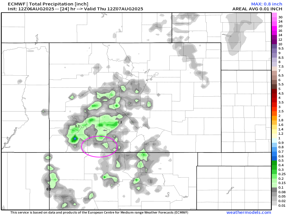
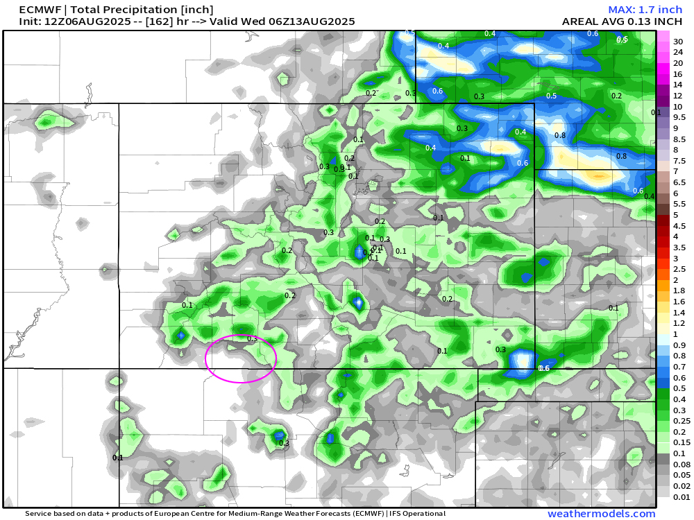
Euro precip till Thursday morning at 6am.
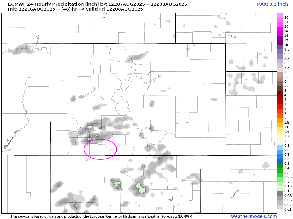
Thursday and Friday
Unfortunately, there is an area of low pressure riding on the active polar front jet that will push into Washington/Idaho/Montana early Thursday and that will knock down and weaken our subtropical ridge again and cutoff the monsoonal moisture.
Expect to see only weak thunderstorms and rainshowers over the mountains. Again, there is the potential for lightning strikes and wild fires.
Temps: Highs will be in the mid-80s to low-90s. Lows will be mid-40s to low-50s.
Winds: Wednesday through Sunday afternoon gusts will be around 25mph. As always, stronger isolated gusts are likely near a shower or thunderstorm.
Saturday through Tuesday
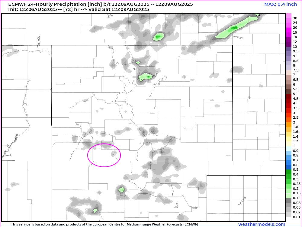
The ridge will try to rebuild. Moisture will slowly advect into area with chance of precip increasing each day and chance of gusty winds decreasing.
There is a slight chance on for an isolated shower or thunderstorm every day. Consider yourself lucky if you get enough rain to wet the ground. Unfortunately, it means lightning without higher relative humidities and rain. So the chances of wildfire outbreaks increases.
Temps: Highs will be in the low-80s to upper-80s. Lows will be mid-40s.
Winds: Saturday will be the breeziest day with gusts to 25mph. Sunday gusts to 20mph. Monday gusts to 18mph. Tuesday afternoon gusts to only 15mph. As always, stronger isolated gusts are likely near a shower or thunderstorm.
The 8-14 day period… A weak monsoon pattern with weak moisture and weak instability will persist. Expect isolated showers and thunderstorms most afternoons. Precip amounts will vary considerably. There is the potential for an uptick after the 18th.
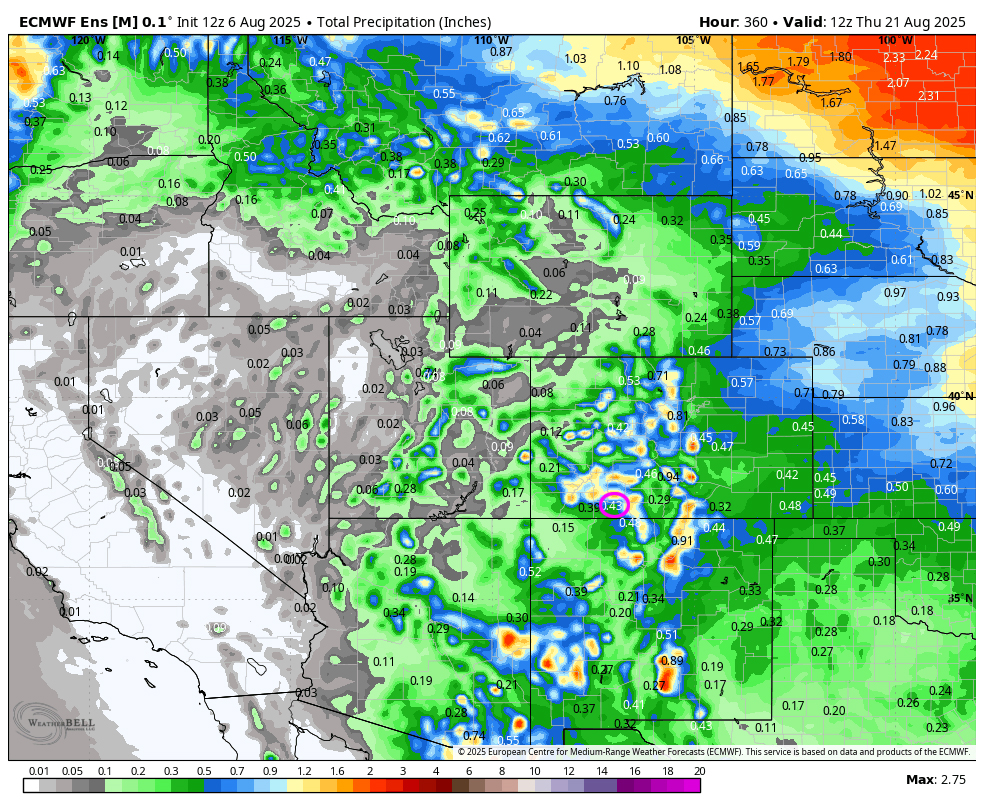
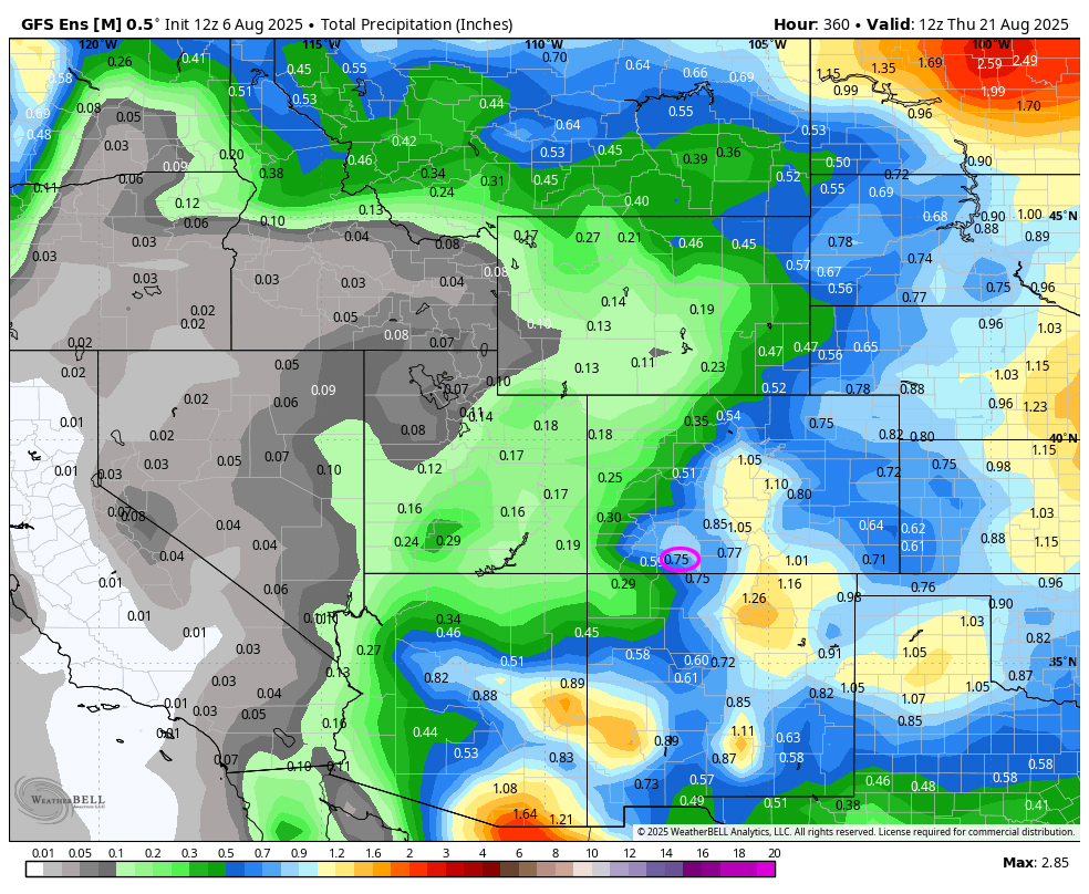
We need a good, deep tropical moisture storm to give the southwest and the firefighters some relief.
Unless something interesting pops up, my next post will be on Friday.
– Arleen


